Brooke Range @en
now browsing by tag
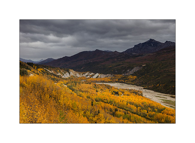
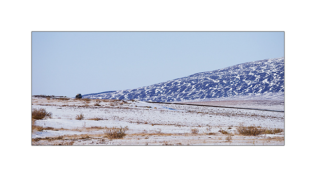
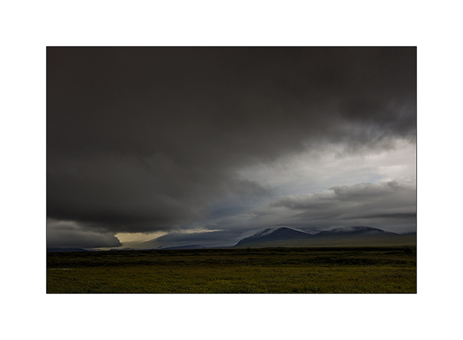
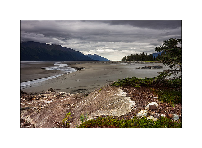
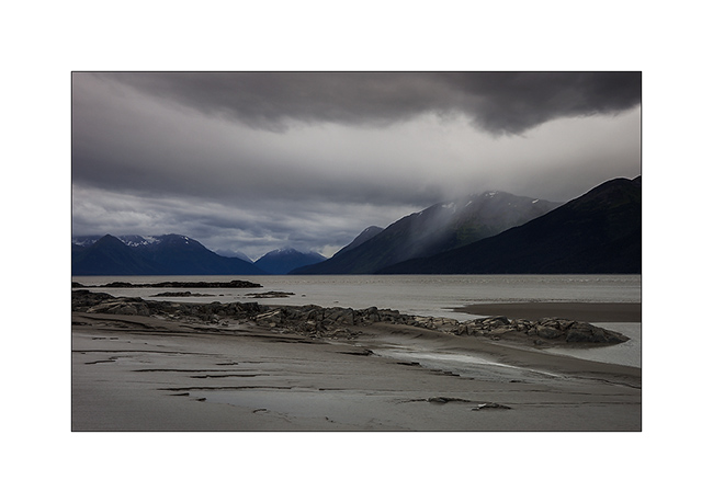
Going back South of Alaska
Before quietly thinking about joining back Anchorage where Mino will take his plane, we still made two beautiful hikes.
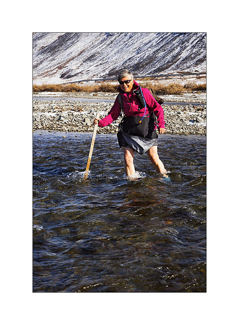
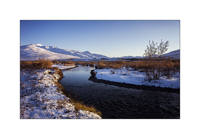
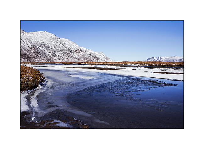
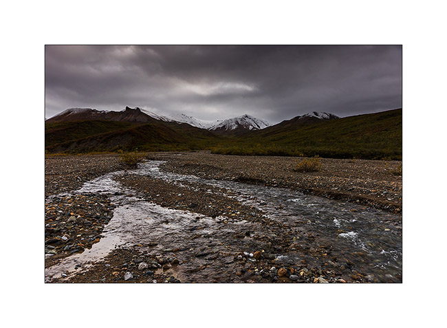
1. I initiate Mino to river crossings! This one was only about 32°F.
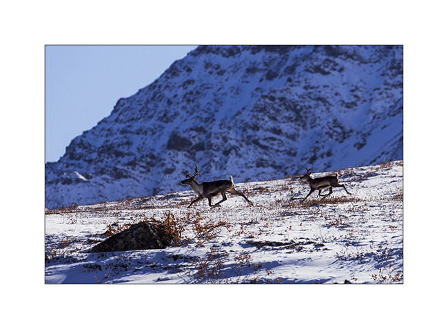
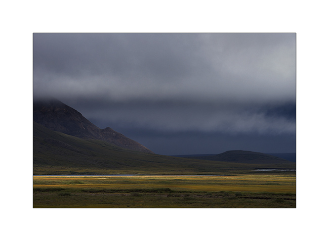
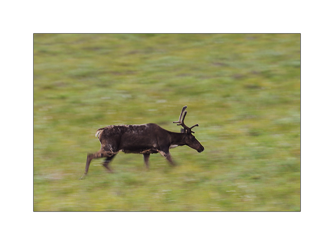
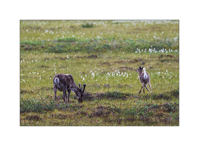
2. Caribou migration southward began, we see several made fearful by the hinting season opened since almost two months.
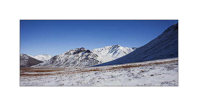
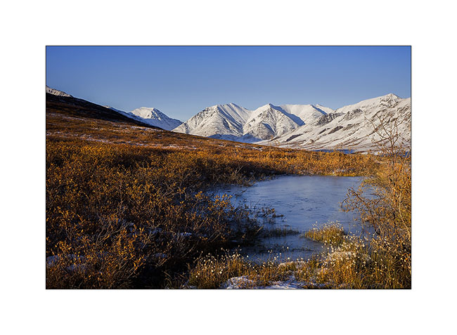
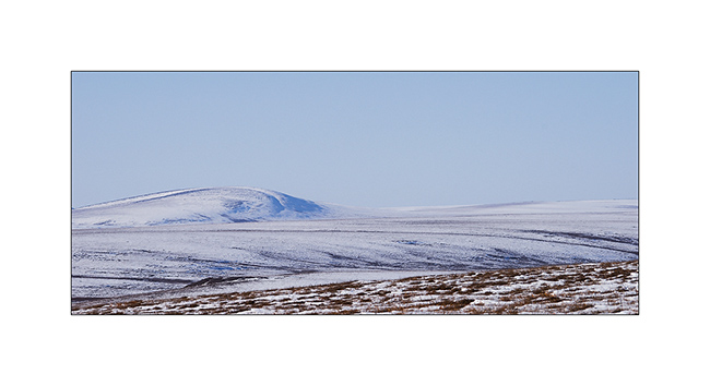
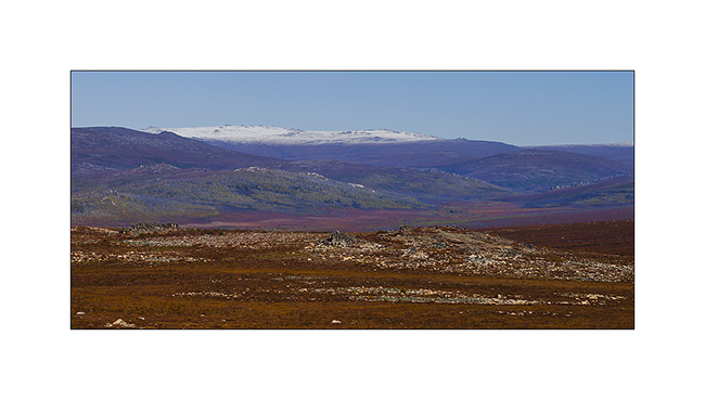
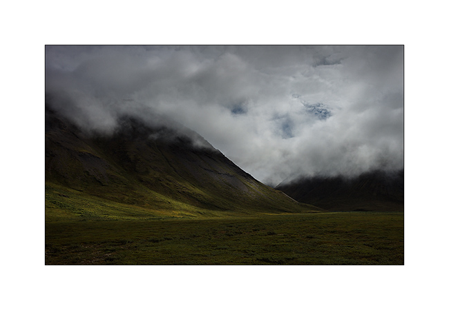
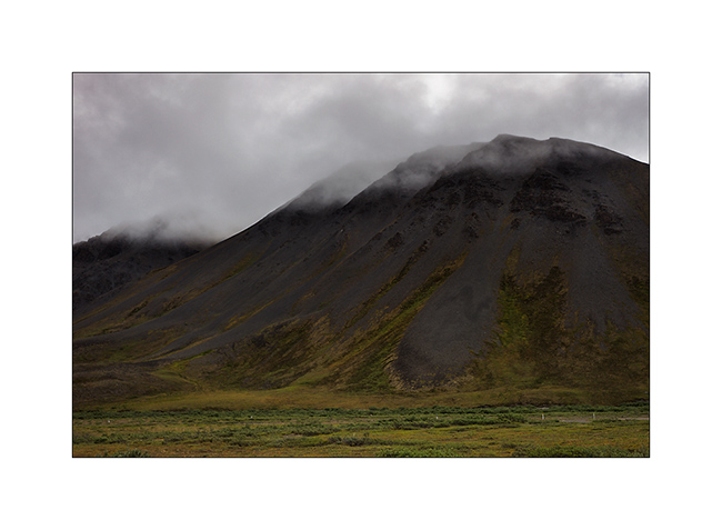
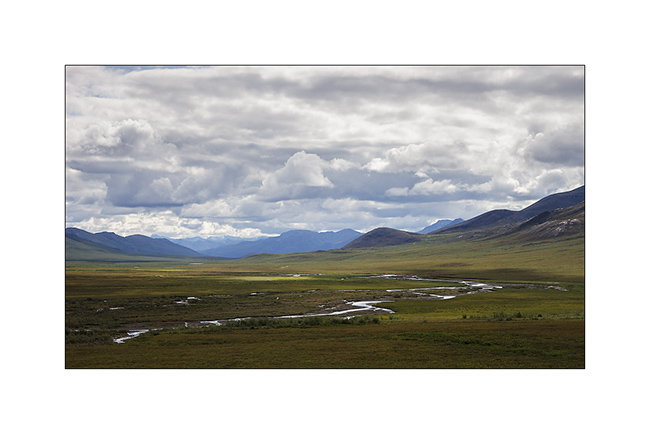
3. I never tire of these landscapes…
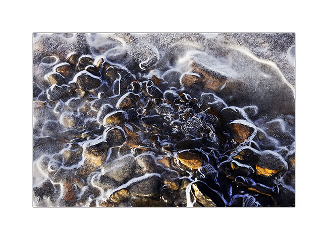
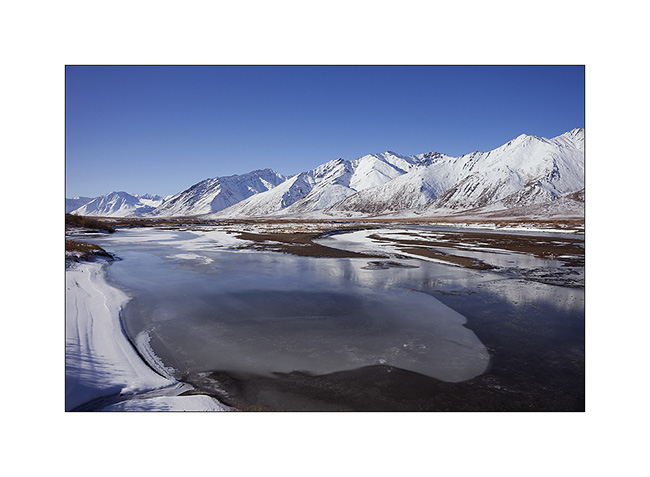
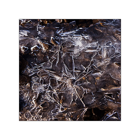
4. I find other paintings of ice…
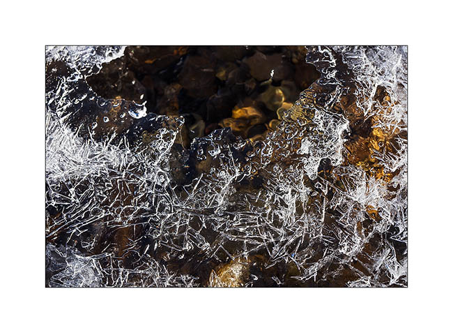
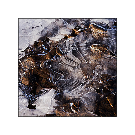
5. … that trap pebbles.
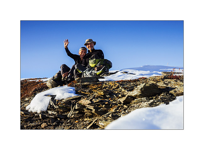
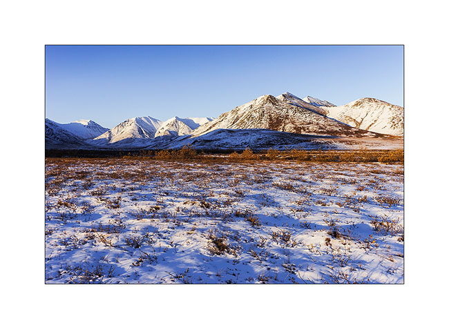
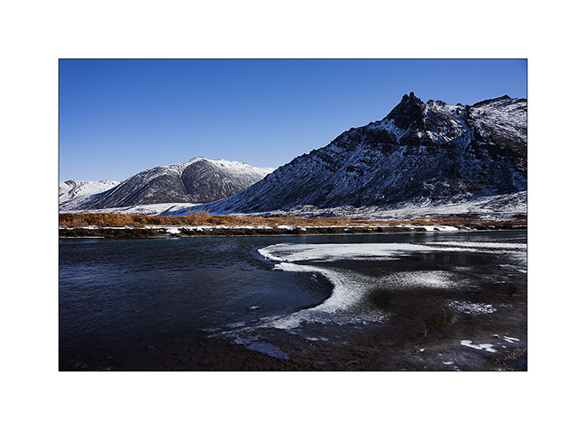
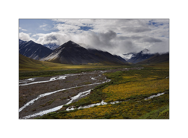
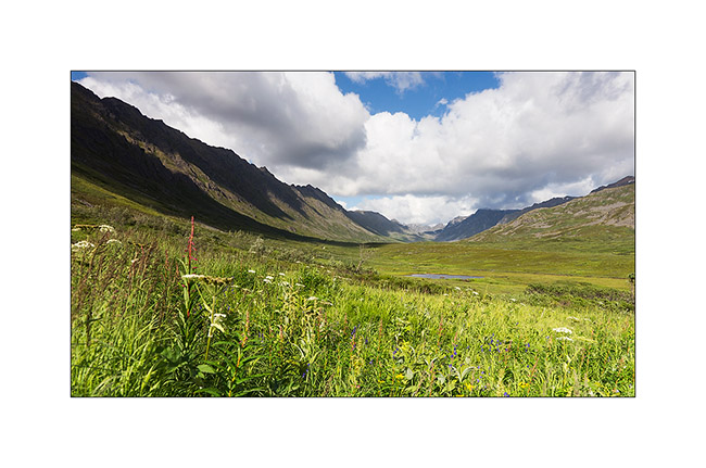
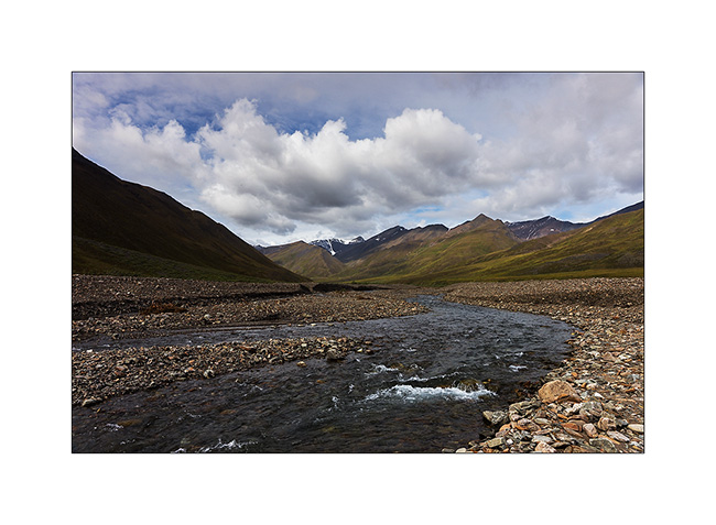
6. The next day, we explored a valley north of Antigun Pass to climb a nearby summit.
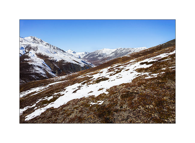
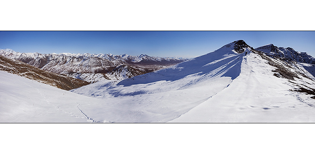
7. We stop at a pass after a hard climb. The view is gorgious.
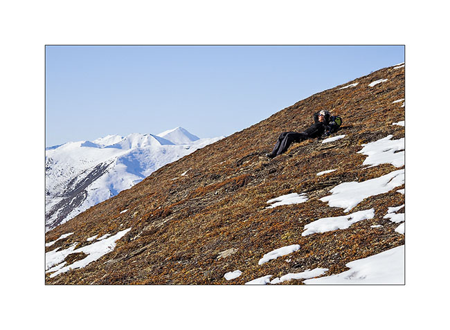
8. Mino rests admiring the scenery.
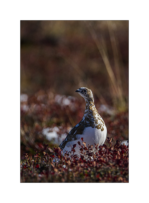
9. Going down, I manage to approach ptarmigans in moult.
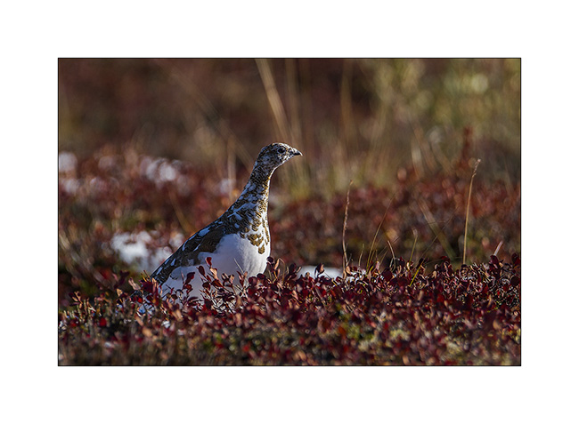
10. This one is already quite white…
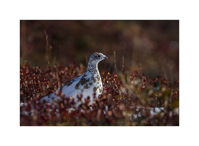
11. … while the neck of that one just starts to lose its summer color.
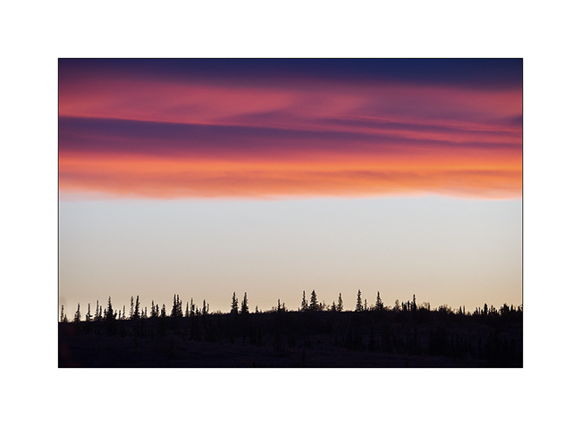
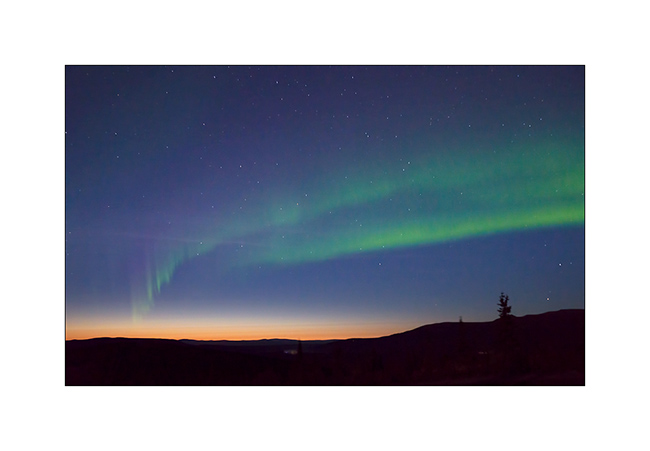
12. This end of day still reserve us a beautiful light.
13. VivaLaVida along beautiful granite peaks…
14. … and goes down a large valley.
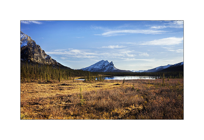
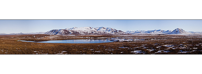
15. A pond that reflects Chugapak Mountain.
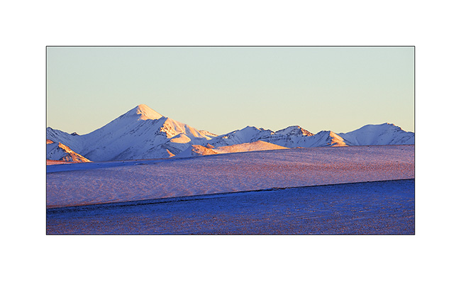
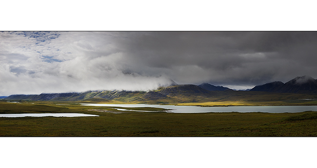
16. Crossing the Brooke Range is really beautiful.
This concludes the report of our visit to the Dalton Highway. We continued towards the Denali where we spent the two last days before Mino’s departure.
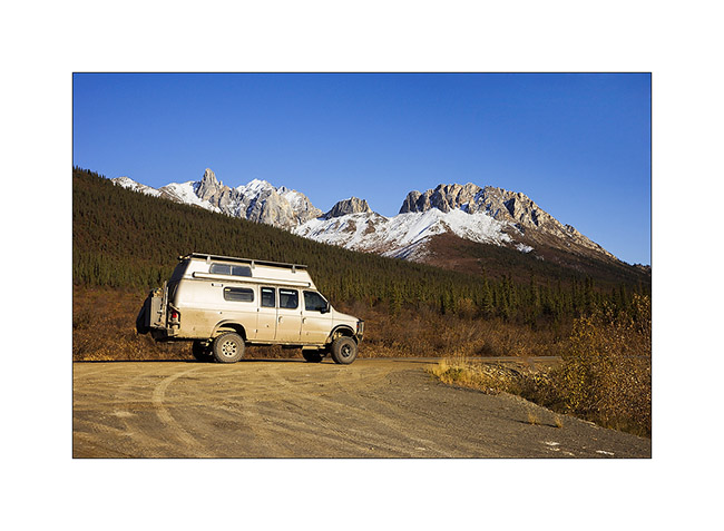
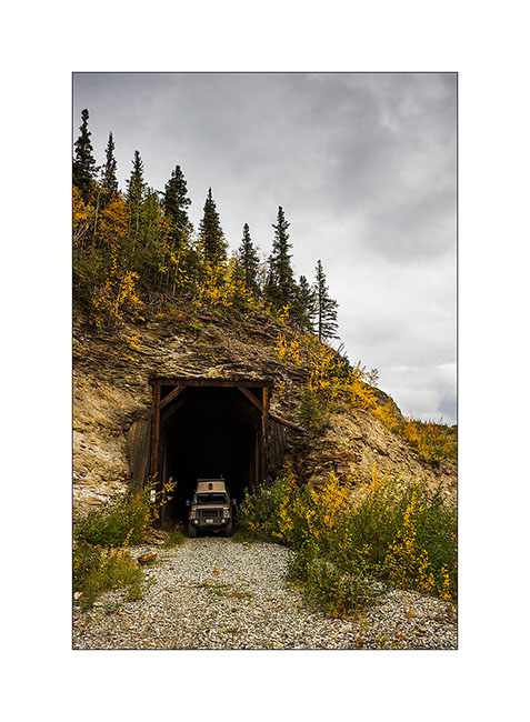
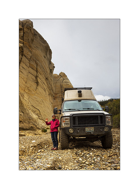
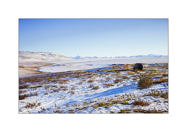
17. VLV strikes a pose in an old railway tunnel.
18. Quick “wild” visit (because unauthorized) of a still active coal mine.
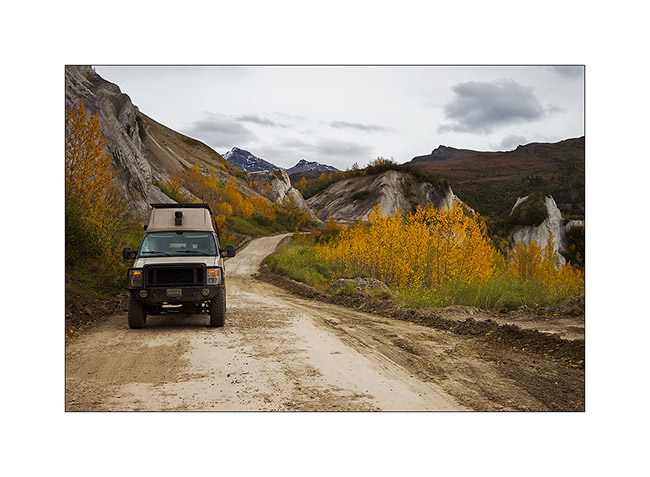
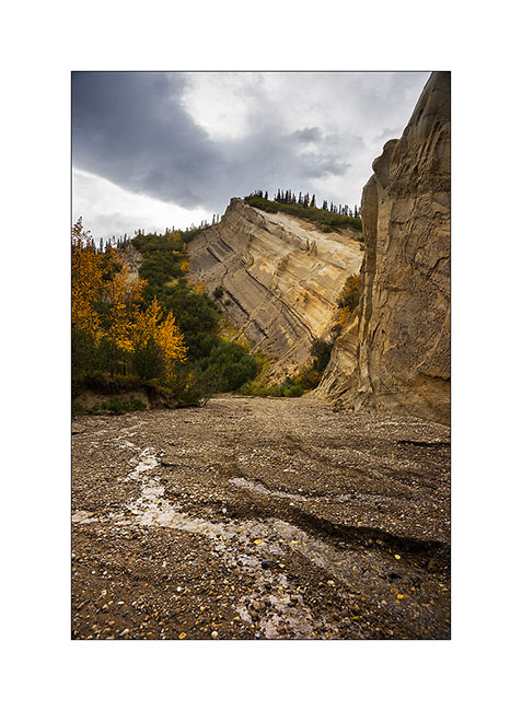
19. In a rather aesthetic side canyon.
20. VLV has managed to go up the riverbed to pose in front of the cliffs sculpted by wind and rain.
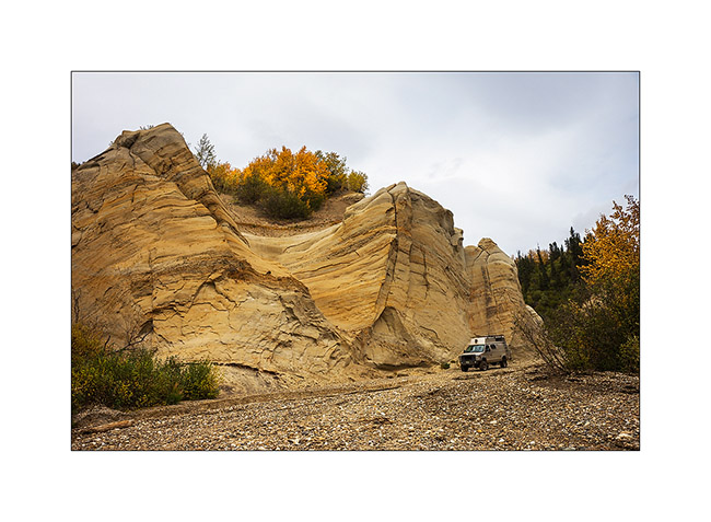
21. Since it is difficult to realize the size of VivaLaVida on pictures – when seeing for the first time, Mino exclaimed “Oh what a monster!” – I took advantage of her presence to give you the scale. She stands under the mirror..! 😀
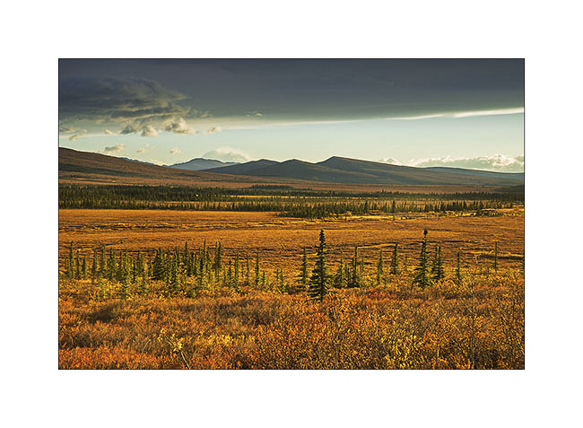
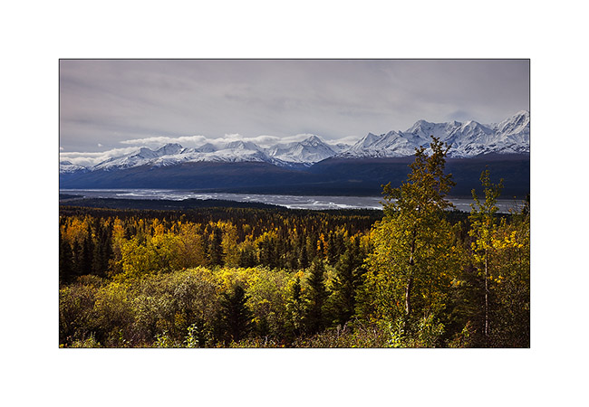
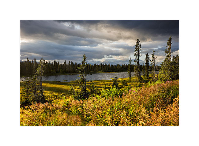
22. We are approaching a small lake that will give us a nice camp for the night.
23. The south wind blows in gusts but offers me some sunrays.
24. We sleep on the windy shore…
25. The next day, we explore the mine from the top, after a track more than 35% steep !

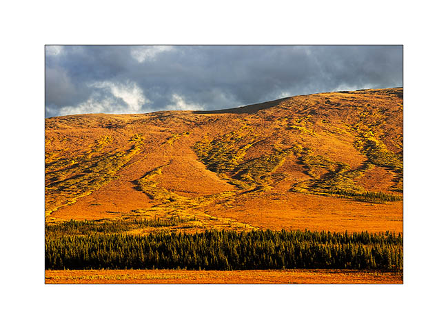
26. The fall colors have invaded the forest…
27. … and the tundra.
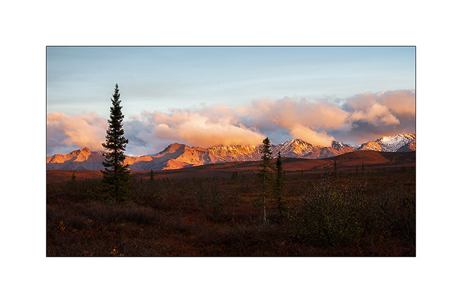
28. The sky clears as the sun sets down…
29. … coloring the nearby mountains of the last boondocking for Mino.
30. Last colors on the taïga.
That ended the few weeks when Mino traveled in VivaLaVida. She walk the over 180 miles I hiked during these almost six weeks and has cooked me some really good dinners! Thanks to her. 😀
At the time of this writing, I do not know what will be the road ahead yet; so you will discover it in a future update. 😉
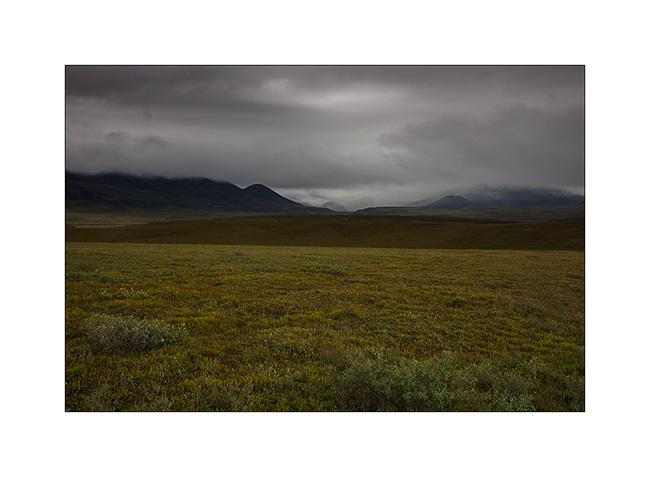
Brooke Range and arctic tundra
We continue farer northward…
1. Nolan valley, a side valley accessible by a really muddy small mining road .
2. At this altitude, the marshes are still not frozen.
3. I found the Brooke Range that bars northern Alaska back.
4. We stop a few dozen miles after Coldfoot to go climbing one of the mountains beside the road.
5. While VivaLaVida begins to climb Antigun Pass, the atmosphere becomes wintry.
6. All is already frozen here…
7. … and it is already well below freezing in late afternoon.
8. As it’s already late, we find a nice boondocking site before Antigun Pass, approx. 4,000 feet elevation on the banks of a small river.
9. Despite the cold, I’m going to make some pictures while Mino is preparing the aperitif!
Temp will almost reach 10°F that night and VLV’s heater resume service after resting for a few months…
The next morning we cross the Antigun Pass and stop thirty miles down it to go hiking along a beautiful river.
10. The blizzard that blew here two days previously installed winter before autumn has arrived…
11. Despite a significant current, the banks of the river are well frozen. It was about -5F° in previous days…
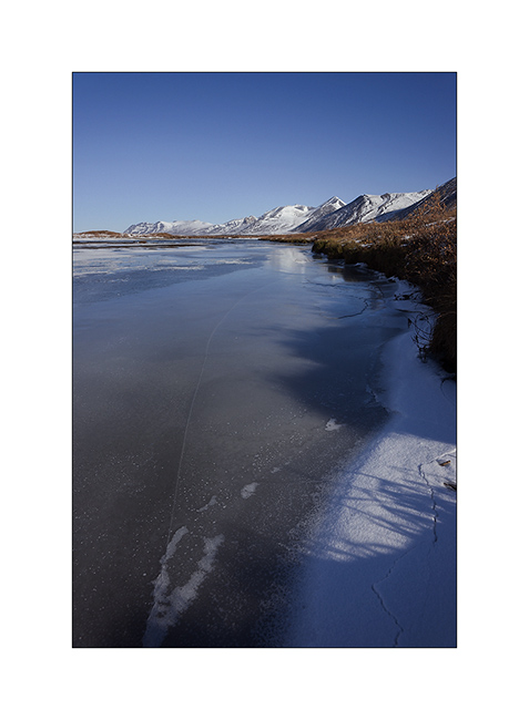
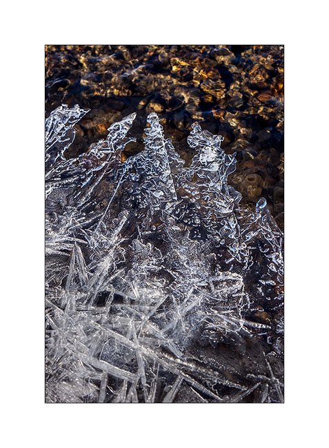
12. I enjoy the clear light to play with ice concretions…
13. … sometimes contrasting and twisted…
14. … sometimes carved by running water below.
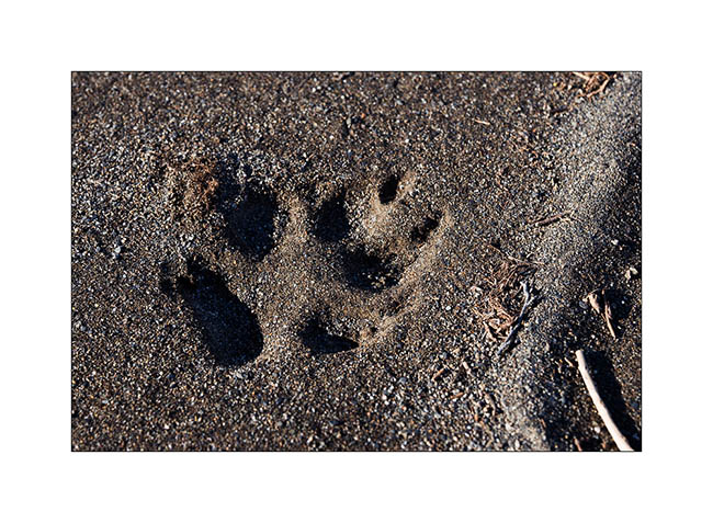
15. On a bank, we find wolf tracks. It happened here less than two days ago, the snow testifies it.
16. The show is sparkling as the river is freezing and carries plates of ice that break in crystal clear sound…
17. … and our eyes feast.
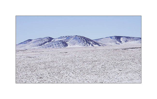
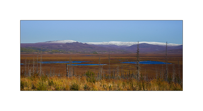
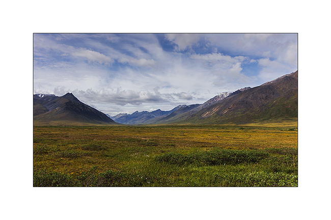
18. Continuing towards the far north, the landscape becomes truly arctic.

19. Blizzard designed the reliefs.
20. Not sure that the truck drivers who supply Deadhorse and Prudhoe Bay are all aware of this beauty…
21. We leave VivaLaVida to walk on a side track…
22. Perfect lines of the wintry tundra…
23. We will not go to Deadhorse, the last part of the track is less interesting. We stop at the last foothills of the Norths Brooke Range…
24. … and even find a camp on the tundra. What a fantastic place to camp, isn’t it? 😀
25. The Sunset is beautiful again…
26. … the last rays coloring the hills…
27. … before a magic full moonrise.
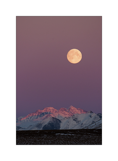
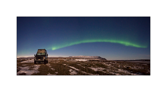
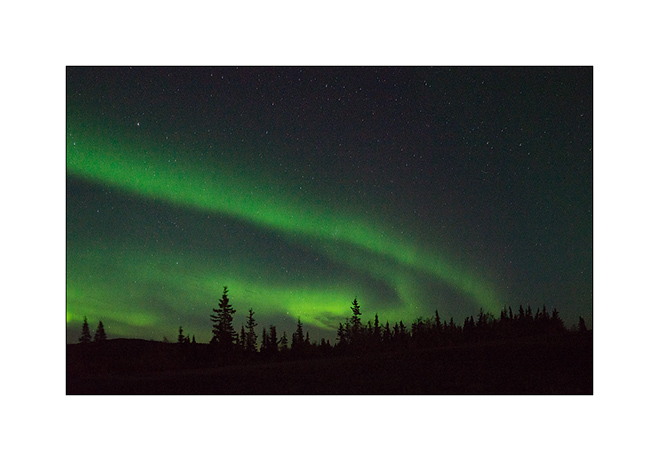
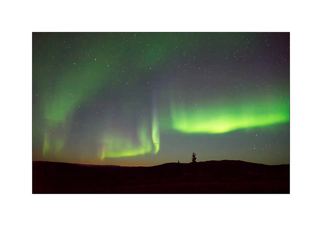
28. And to complete this grandiose day, a northern light came to wish good night to VivaLaVida while the full moon was lighting up the tundra!
We began our descent back to the South the next day. To discover in the next update… 😉
Thanks again for your loyalty!
Richardson & Dalton Highways
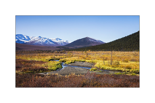
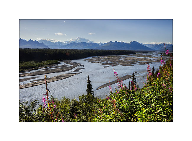
Continuing our journey northward, we cross the Alaska Range covered with fresh snow.
1. Exploring a side valley, not far from our camp.
2. The Richardson Highway passes through high mountains with difficult access.
3. Scree dusted with snow…
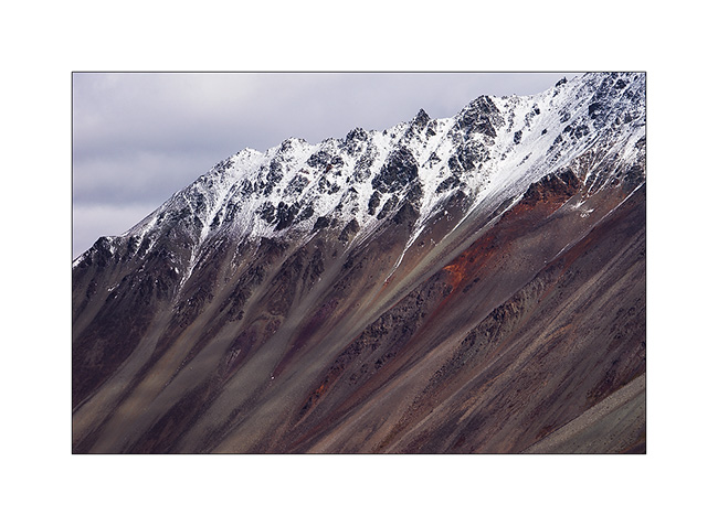
4. North slope of Alaska Range.
5. In the kitchen, we don’t let go: wild salmon with dill on a bed of spinach, all cooked over our campfire, hummm… 😉

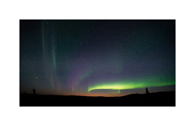
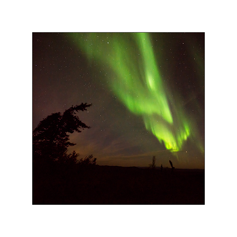
6. After the show of the previous day, we watch the sky and a new northern light appears with the last light of the Sunset still pointing north…
7. We spend almost three hours outside despite a tempestuous wind and biting cold!
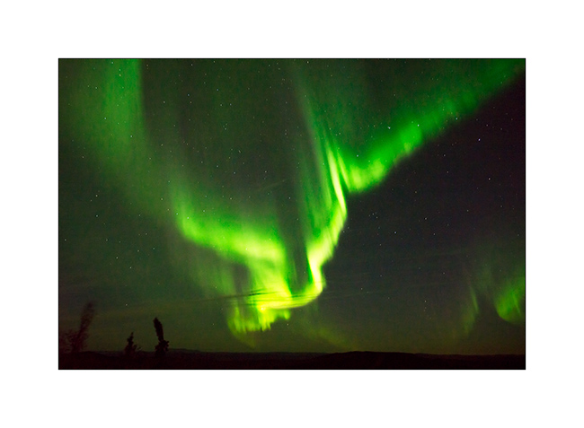
8. Paintings are constantly changing…
9. … sometimes very soft…
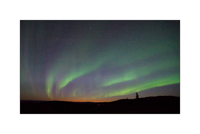
10. … sometimes very intense.
11. Sometimes the aurora crosses the sky with a truly amazing intensity, almost comparable to that of the moon.
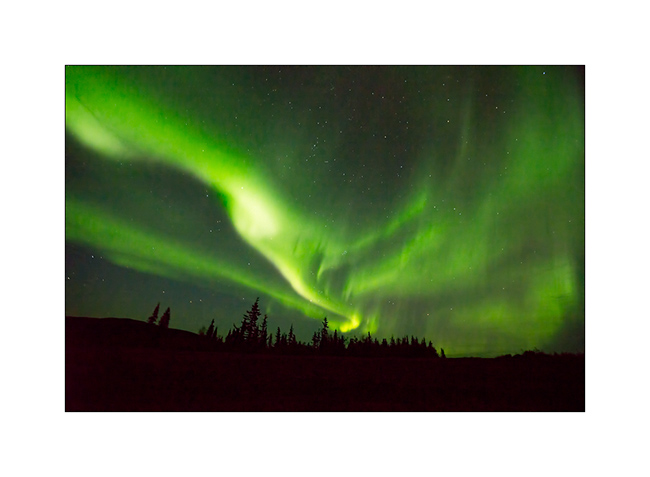
12. We are almost hypnotized by the show…
13. … and the grandiose beauty.
14. After going late to bed, we entered the Dalton Highway the next day. The atmosphere was completely different than during my first visit, I feel like discovering other landscapes…
15. Here too the recent snow still covers the hills.
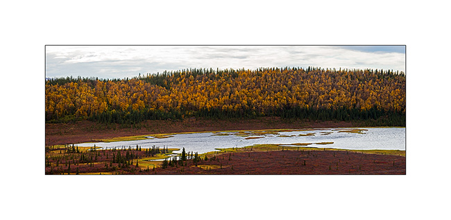
16. Taiga has completely changed color with warm tones adorning.
17. A picture of Grayling Lake I made during my first visit. If you want, you can compare: it’s the image # 17 ! 😉
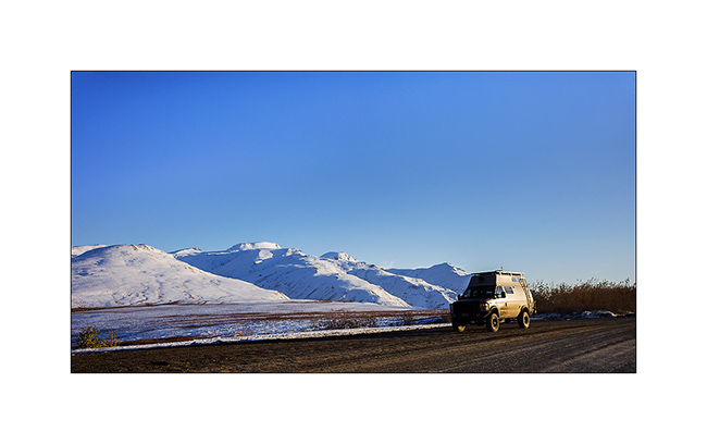
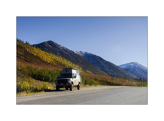
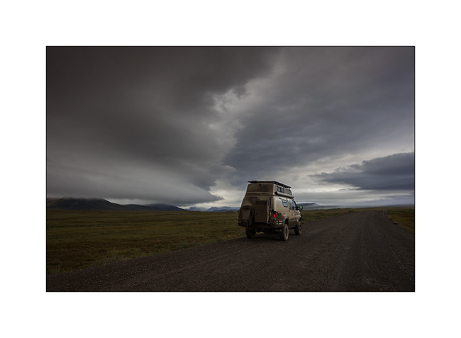
18. VivaLaVida on the Dalton Highway.
19. Between the orange-red willows and bright yellow aspen and birch, the colors are incredibly saturated…
20. … and snow further strengthens those.
To be followed soon…
Dalton Highway (3) & Hatcher Pass
I let you at the botom of the Brooke Range heading back South.
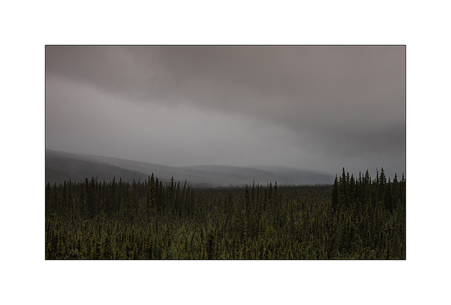
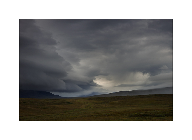
1. I’m half mesmerized by the scenes that follow one to the other…
2. … sometimes low “heavy” skies…
3. … sometimes cottony openings…

4. … or larger…
5. … but which close again almost immediately…
6. Where slopes are to steep, there are only screes…
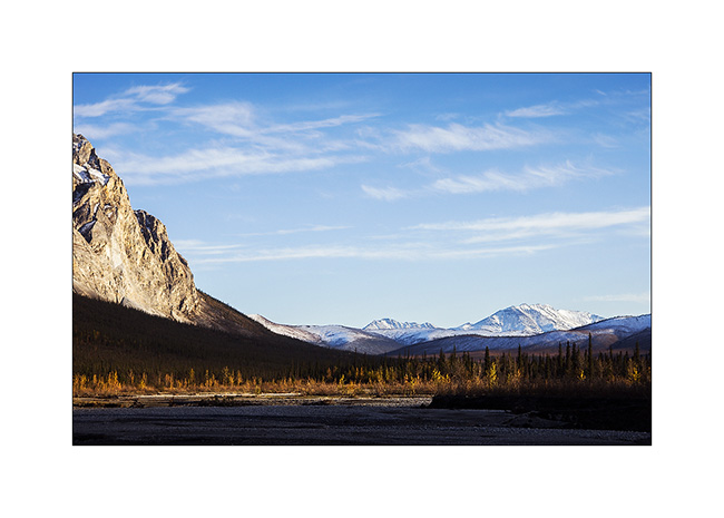
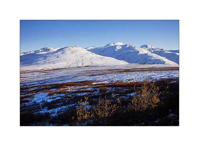
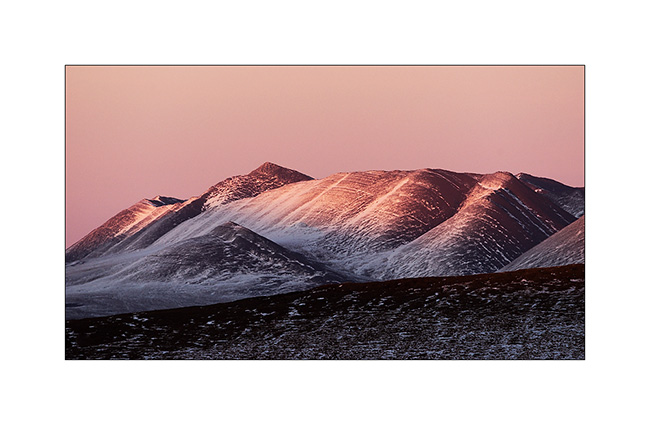
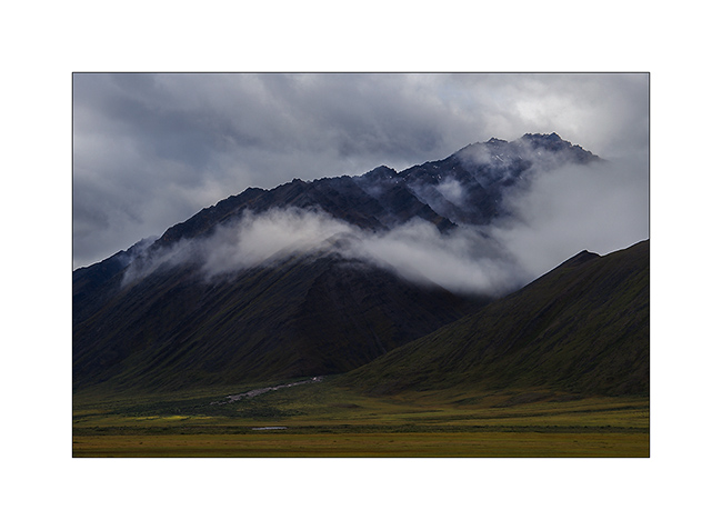
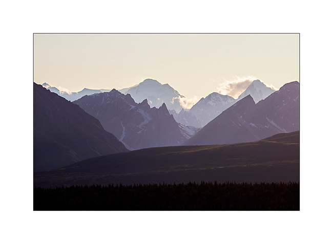
7. High plateau of the Brooke Range, just north of Antigun Pass.
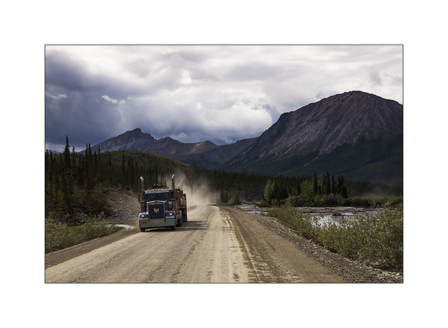
8. Going down the Brooke Range to the south, trucks roll again. They were stoped during the rain, too slippery for them. It must be said that here, hills have impressive percentages! Some also have evocative names: Beaver Slide for example, a 22% slope. VLV drove it down with 4WD 4×4 and not faster than 10 mph in the rain, in six inches of mud… Trucks then stop to wait for the road to dry.
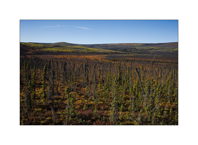
9. The trees gradually reappear on the south side of the Brooke Range…
10. … However, not many yet.
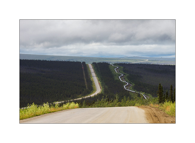
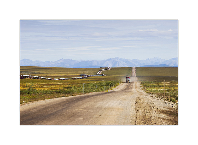
11. The pipeline sometimes accompanies me.
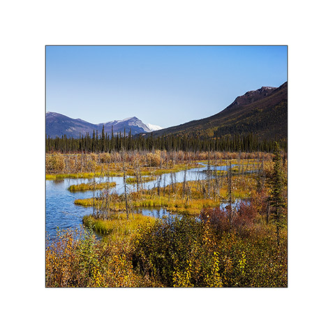
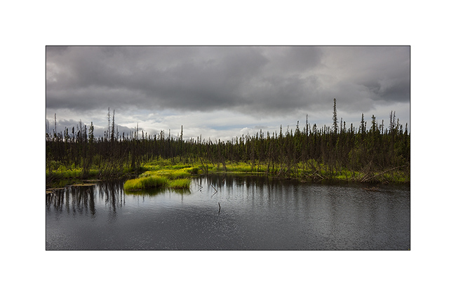
12. Marsh in the taiga.
13. A beautiful rainbow welcomes Vivalavida! 😀
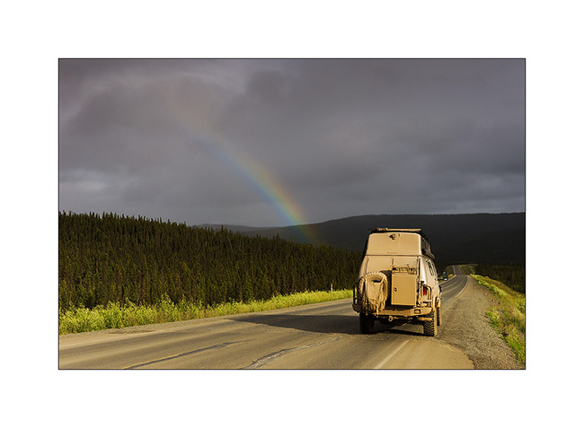
14. But the rain starts soon again.
that’s it for my fast south-north-south through Alaska via the Dalton. A barely arrived that I already want to go back..! 😉 I hope I managed to transcribe some scenes of these beautiful northern landscapes that fascinate me…
15. On the road to Anchorage, I made a detour to the beautiful Hatcher Pass.
16. Late afternoon from my bivouac.
Starting next update, Mino will keep me company… Updates will be more spaced again further apat, my delay is now caught! 😀
One more time, thank you for your loyalty to read this little blog. 😉
Dalton Highway (2)
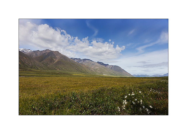
One continued ascent of Vivalavida to “far North” … The Brooke Range crossed, there is only a great plain that slopes gently toward the north to the Beaufort Sea. The more I go North and the more I can feel that winter isn’t gone since long ago…
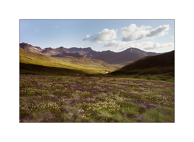
1. Tundra flowers…
2. … out of sight…
3. Although it doesn’t look on the picture, the road is really rough. Despite its large Wheel traval, VLV didn’t drove a high speed average.
4. I meet from time to time a truck. The windshield ofVLV remembers it with a new large stone impact. It’s gonna be time to replace it once back from Alaska…
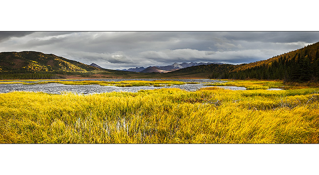
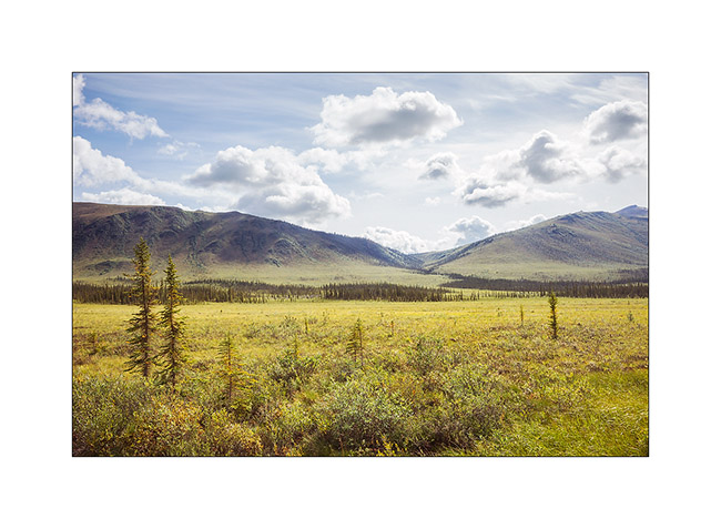
5. Colors of the tundra are constantly changing.
6. Water is everywhere, everything is marsh … I imagine how difficult it was for explorers of these regions to progress on such land.
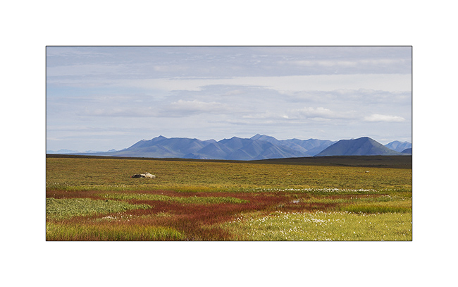
7. This tundra is summer areas for caribous that migrate South during the winter, looking for less snowed areas to find lichens which are their menu.
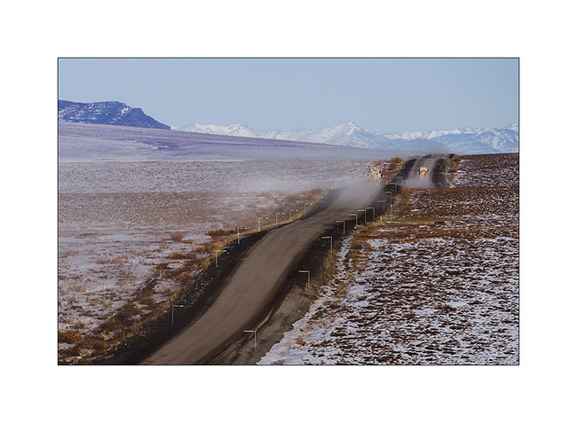
8. A long time before seeing it, the dust announces the arrival of a vehicle!

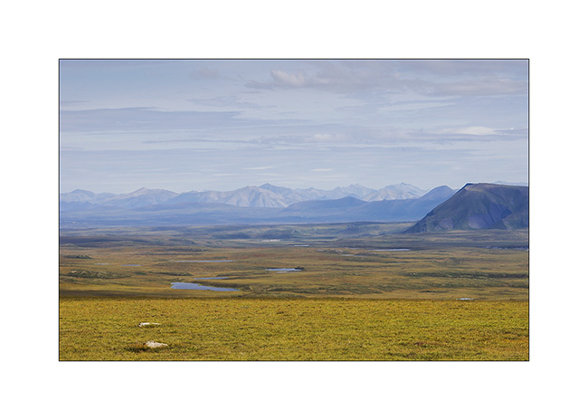
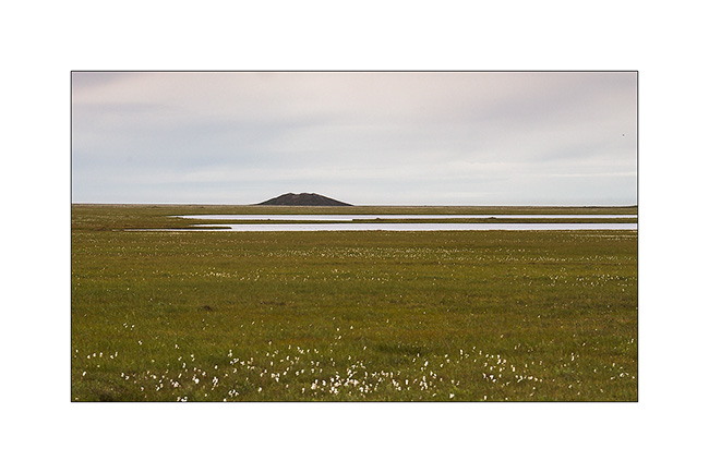
9. Far North, a pingo. This hill is created by a “ice bubble” that has developed in the tundra, pushing it upwards.
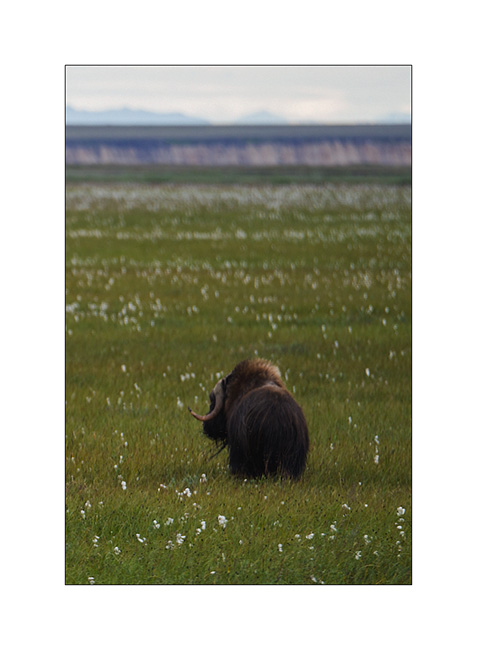
10. I have the chance to see the biggest herbivore of the tundra: a group of muskoxen.
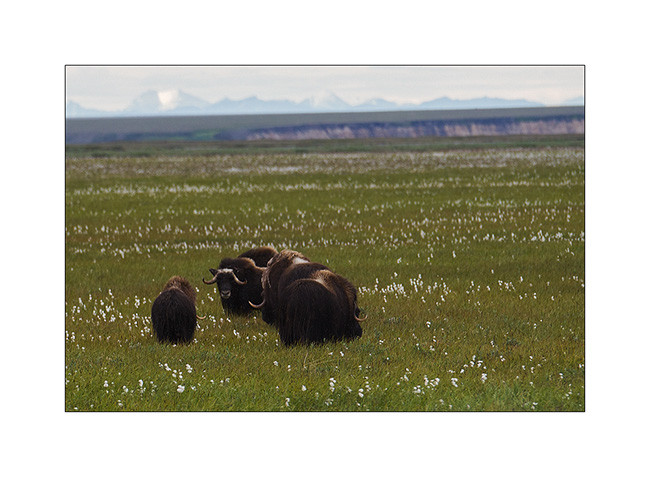
11. What a big animal! I’m not going to scratch his ear… 😉
12. A caribou mother and is calf of the year.
Quizz : que veut dire faire la cleupette ? Indice : ça vient du Jura neuchâtelois… Et Pum-Tac, t’as pas le droit de jouer !! 😀
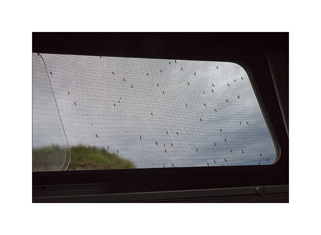
13. My bivouac announces the return of the rain. To try to show you the invasion of mosquitoes in this area: I opened this window for less than 15 seconds! Here, there are five species of these bloodsuckers, with the big tiger mosquito…
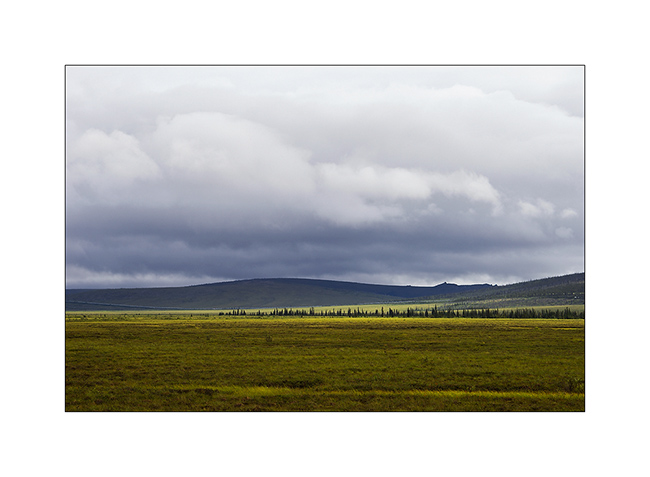
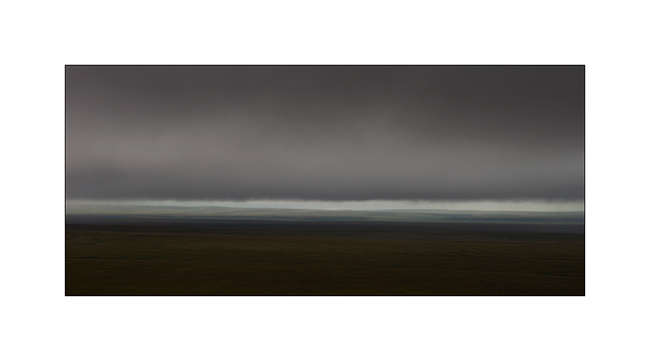
14. Low clouds in the morning, in the rain.
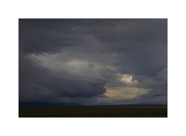
15. While VLV took the road heading South again, clouds are gorgious and impressive.
16. What an ambiance!
17. I think I’m in love with this tundra! 😀
18. VLV is already quite muddy!
19. Rain starts again…
20. Higher in the Brooke Range, the sun makes short appearances.
21. Difficult to show you how VLV was dirty!
To be continued soon… 😉
Fjords, McKinley & Dalton Highway 1…
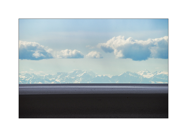
Pending favorable weather conditions to head to the far north, I took advantage of a brief lull to explore a fjord South of Anchorage. Large glacier valley, it was filled with sediment by the surrounding glaciers to the sea level or nearly. At low tide only remains a narrow channel of water in the middle. Each tide begins with a tidal wave. Not very spectacular the day I was there because the moon was in first quarter…
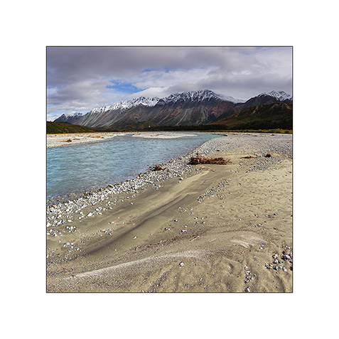
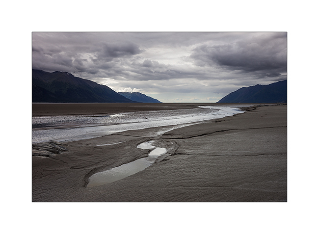
1. Turnagain fjord at almost low tide.
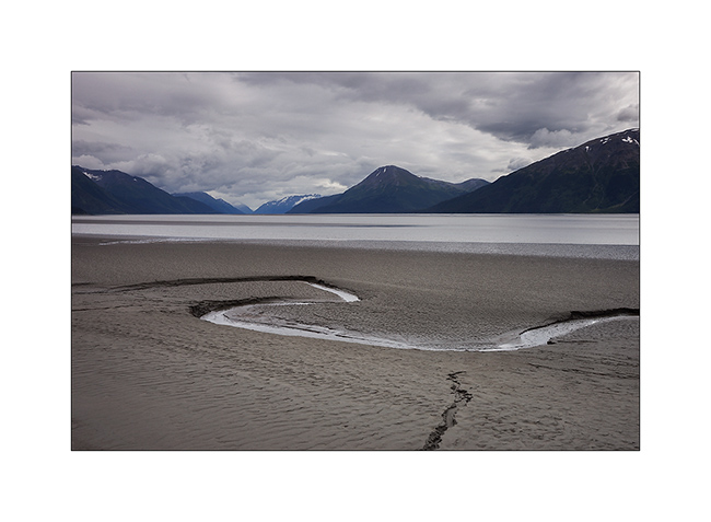
2. The channel that remains at low tide.
3. More than 150 miles away, the mountains of Kodiak.
4. After crossing swamps to seek a new composition… 😉
5. A non-edible touch of color in the undergrowth.
6. The lull was short-term…
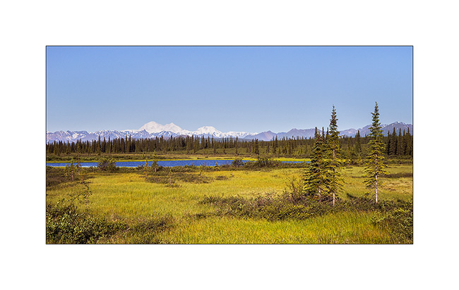
And finally, after more than three weeks of waiting, thinnings were announced on the far north. Vivalavida hit the road for a 1,800 miles way before the arrival of my friend Mino.
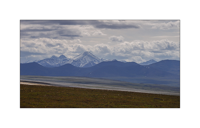
An unexpected opportunity: the beautiful weather allows me to see Mount McKinley, a rare opportunity as it is hidden in the clouds more than 80% of the year. It is the highest peak in North America, more than 20,000 feet elevation. A real giant!
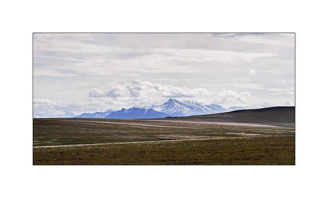
7. I’m unable to transmit how big it is through my pictures but I was there still more than 120 miles away…
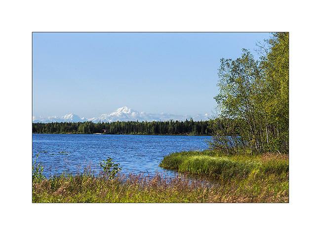
8. Here, still more than 50 miles away…
9. End of day on the surrounding mountains…
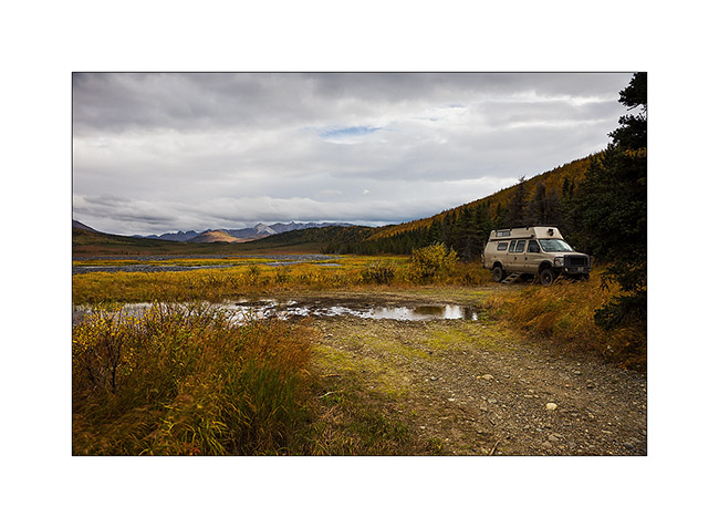
10. Camp next to a small lake.
11. The next morning, the giant is still visible while I’m more than 70 miles North!
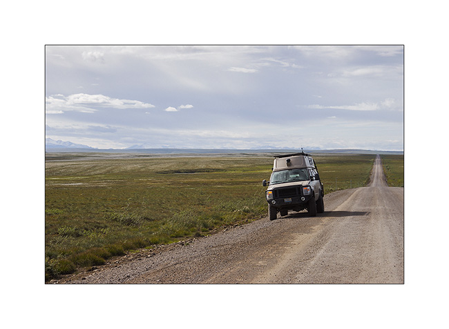
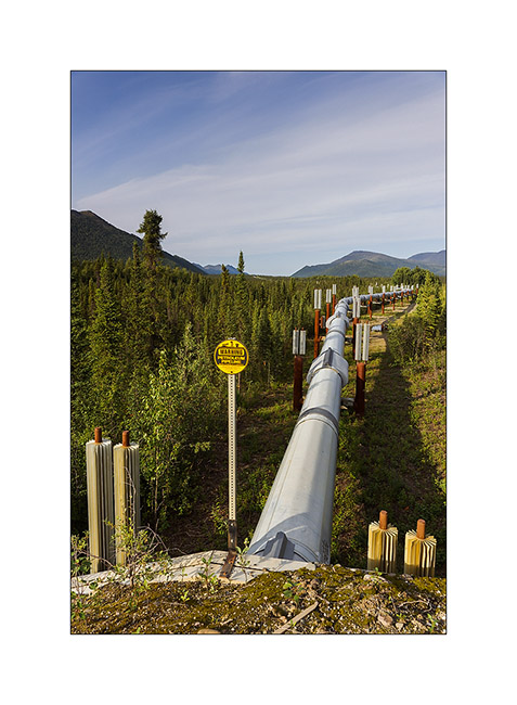
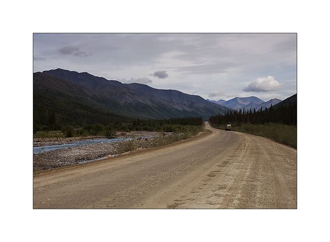
To go to the far north, there is only one path: the Dalton Highway, a 500 miles long road serving Prudhoe Bay and its oil fields. It was built along the Alaskan Pipeline and along almost its entire length. It took only five months and a half in 1976 to 15 teams working in parallel to build it, a performance driven by the short northern summer. It’s a road really committed, thin strip of dirt that goes up and down every hill in impressive percentages, then through the Brooke Range with a top at Antigun Pass, at about 3,400 feet. Only one service at mile 249, about midway. Traveled almost exclusively by large trucks that supply the oil workers, it turns into a quagmire when it rains; Vivalavida will find it out… It stays open all year round since the build of the bridge over the Yukon River.
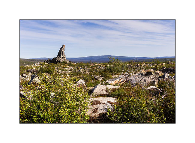
12. at mile 96, “Finger Mountain” points to the sky in the middle of the tundra.
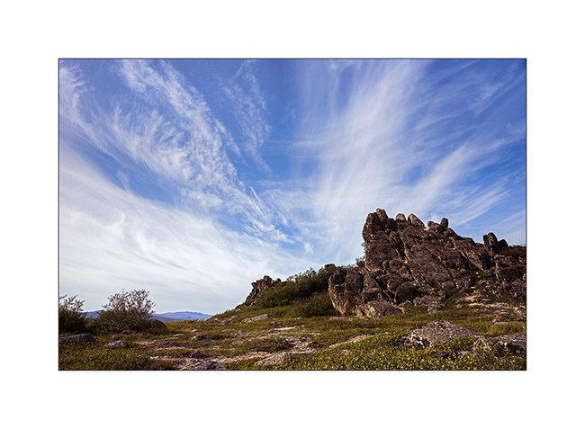
13. The sky is beautiful but cirrus clouds are already announcing the arrival of the next perturbation.
14. The Alaskan Pipeline, also completed in 1976. This is a strategic corridor for the exploitation of northern Alaska oil resources.
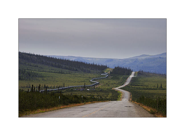
15. Its build shows great ingenuity. Each pillar is “free”, only laying on bidirectional Teflon pads. To overcome the expansion created by the magnitude of extreme temperature between winter (-60°F are common and every winter the temperature drops below that!) and summer, each tube is “sleeved free” to the next. Estimation of total theoretical expansion over the entire length would be more than 8 miles from Prudhoe Bay to Valdez terminal, 800 miles south..!
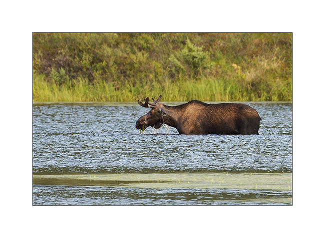
16. An moose grazing aquatic weeds that grow at the bottom of this small lake. They love it!
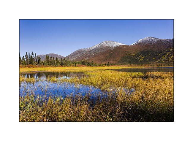
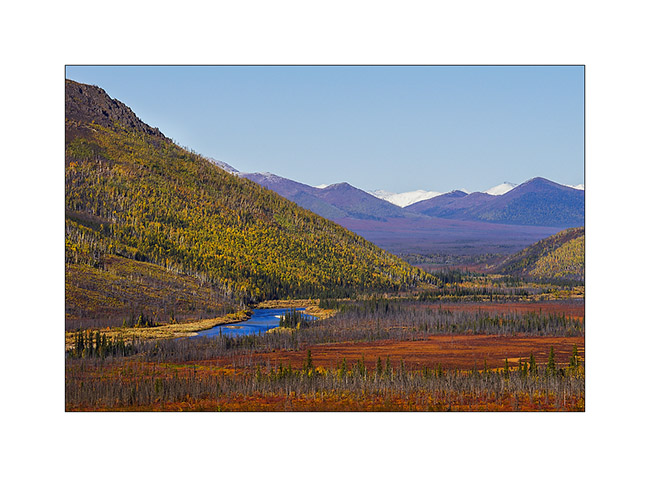
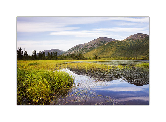
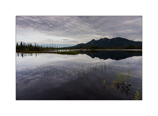
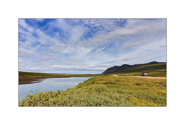
17. Small lake besides really aesthetic…
18. Everything passes through the Dalton; here, an about 25 feet wide house on this oversize convoy..!
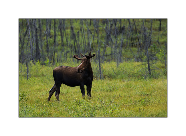
19. Another moose seen from my camp in the morning.
20. Mirror…
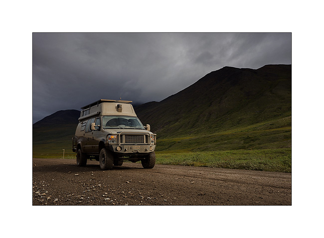
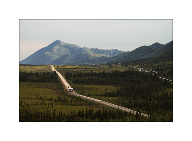
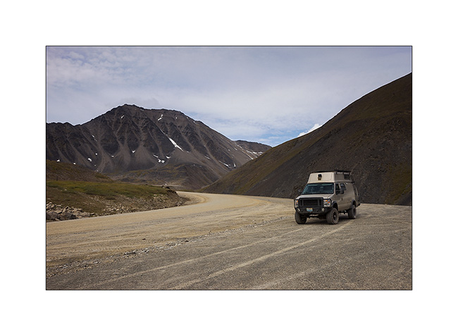
21. VivaLaVida on the northern foothills of the Brooke Range.
22. Antigun Pass.
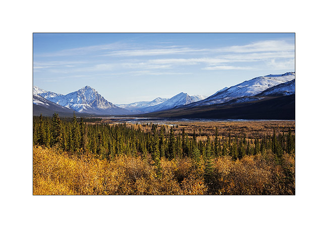
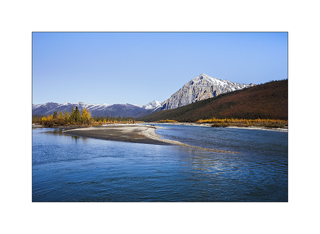
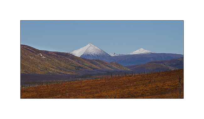
23. The Brooke Range is superb, with beautiful streams that dig valleys.
24. No more tree since mile 215. It’s to far North, the climate is too harsh. Only the tundra remains.
25. I take the opportunity of this thinning to “strafe” these moorland landscapes that are probably the ones that attract me the most…
26. VLV looks really small in these landscapes…
27. … dotted with small lakes.

Following of the thinning and return of bad weather in the next update… 😀
 D5 Creation