Lake Jocassee area…
This update is a special dedicace to Janet & Jonathan who adviced me to go discover this area during a great diner together at their house. Remember, it’s the couple I met some weeks ago at North Mills River and who are real friends now, with who I had a great mountain bike ride.
The second very technical track that I mentioned in the previous update was heading to discover the Mill Creek Falls that Janet & Jonathan – I will call them J&J now 😉 – had told me about. Since the season of the canoe rental company was done now, I had to get there by land. By studying the detailed forest service maps, I discovered what appeared to be a dirt road. In fact, it is probably an abandoned forest road, a good ten miles long, climbing steep hillsides to go down on the other side just as steep!
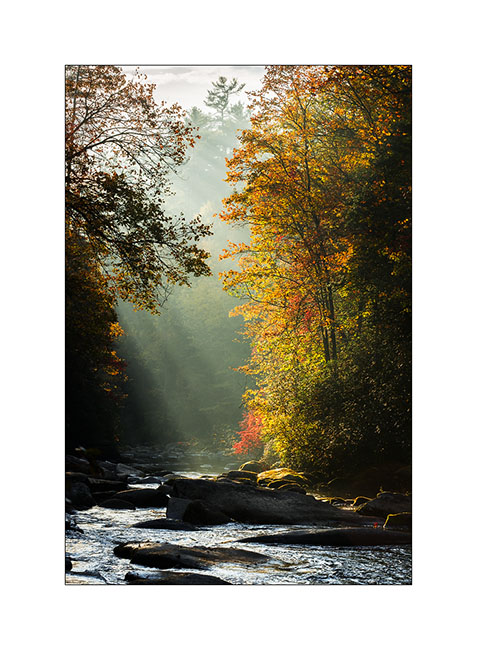
0) Morning light on Horsepasture River
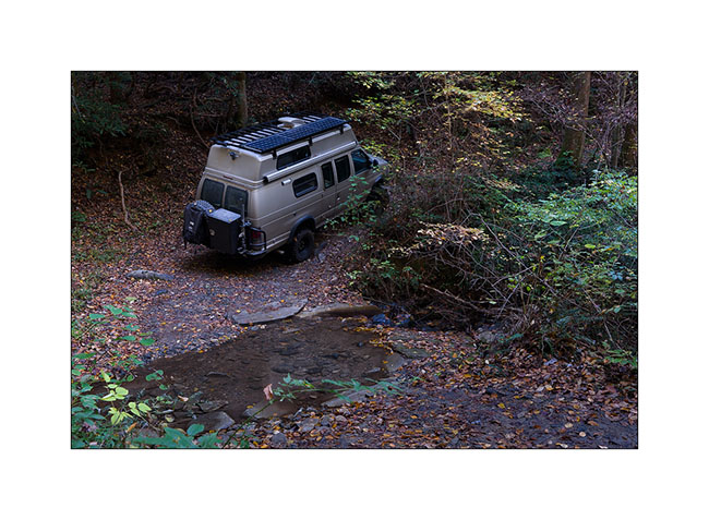
1) Small creek crossing…
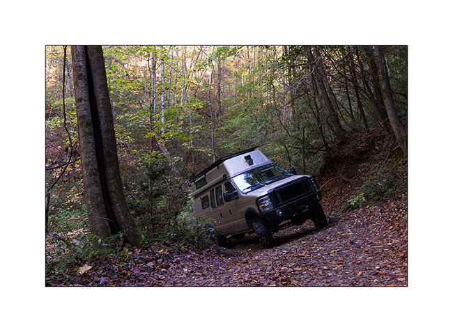
2) Banked turn…
It took me almost three hours to go 7 miles – crossing South Carolina border – before being stopped by a large fallen tree in the way that I couldn’t cut with my handsaw. So I took the bike to continue but after 2 miles pushing and carrying more than riding it, I left it to continue on foot. The last 2.5 miles held more rainforest than anything else as the vegetation was so dense. Without machete, I took almost two hours to finally arrive to the lake, without open area to photograph the waterfall falling in the lake. So I took off my hiking shoes and got wet feet for taking what is really not my best picture! But I post it anyway for Janet & Jonathan… 😉
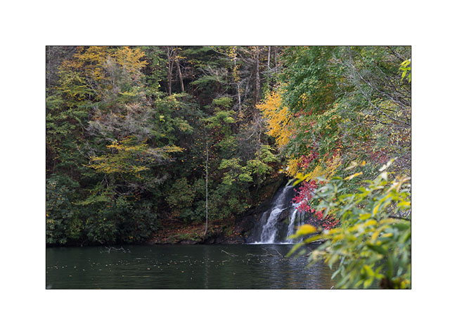
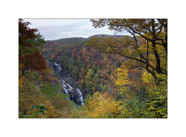
3) Mill Creek Falls
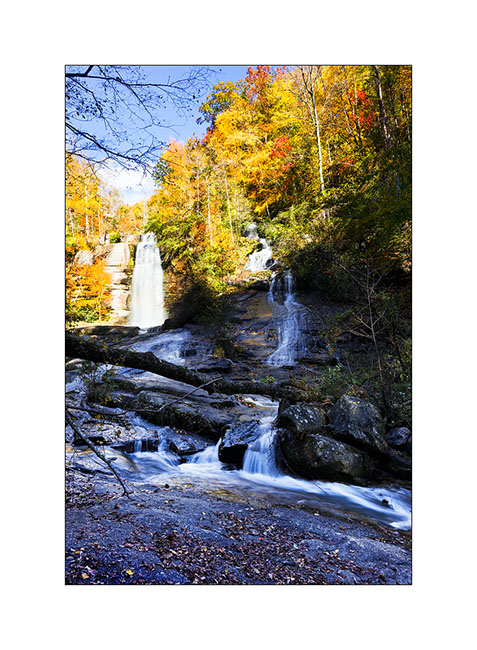
The way back was just as long and I was out of the forest late afternoon. I still did a short stop beautiful Whitwater Upper Falls, with the advantage that Sunday evening, I was almost alone there…
4) Upper Whitewater Falls
The next day I continued exploring the surroundings of this beautiful lake. First by visiting the pretty nice Twin Falls…
5) Twin Falls
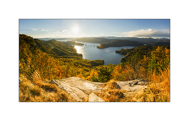
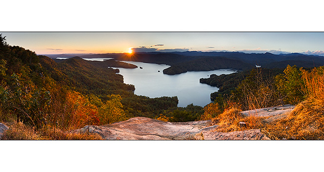
Then taking a new forest road way more accessible than the previous one, reaching one of the only open promontory of the area as the forest is everywhere, named Jumping-Off Rock. The sighting of the Lake Jocassee is just gorgious and I pulled the pan head to show it to you in two panoramas taken about fifteen minutes apart…
6) & 7) Lake Jocasse from Jumping-Off Rock
Having slept close, I went back there the next morning and it was freezing…
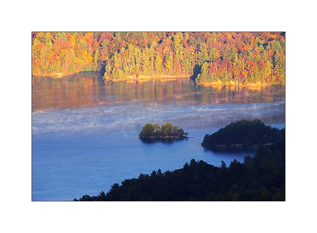
8) Lake Jocasse
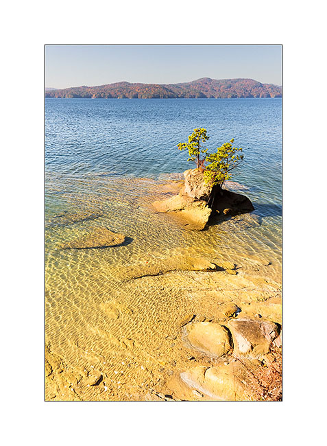
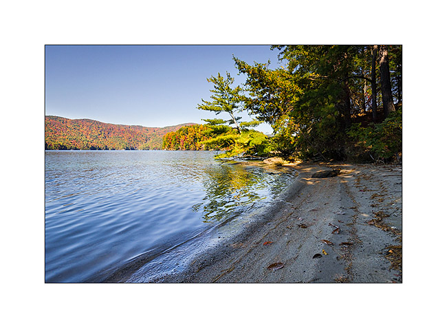
Still thanks to the USFS maps downloaded on my iPad, I spotted a trail down to the lake, at the end of a peninsula. I discovered a small very nice beach here…
9) Last land of the peninsula!
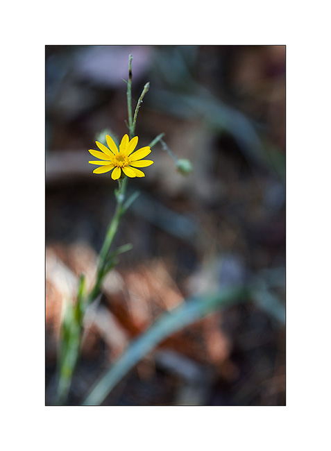
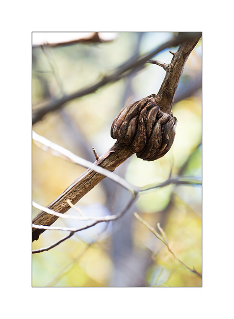
10) & 11) Vegetal…
12) Small hidden beach…
That’s it for my small Jocasse trip. I will show you other waterfalls in my next update… 😀
Thanks to all who follow that blog – and for the comments you write; I really enjoy to read them after each update… 😉
See you soon
PS : I almost forgot: Janet makes the best brownies I’ve ever eaten! Yes, you can be jealous… 😉
 D5 Creation
Comments are Closed