February, 2015
now browsing by month
Minerality…
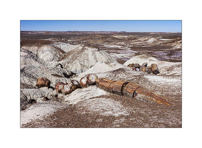
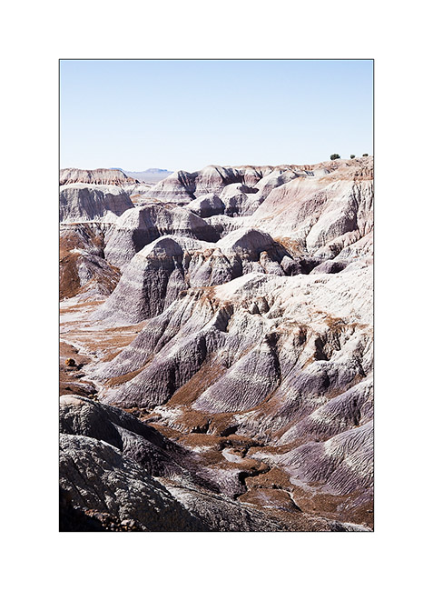
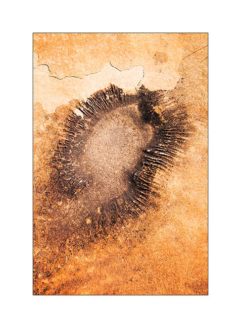
Still in Arizona, I made a short stop at Petrified Forest National Park. 225 million years ago, the current Arizona was nearly 3,500 miles South of his actual location, in a tropical climate and thus covered with tropical forests. During large floods on clay areas, trees fell and were buried in the clay that protected them from putrefaction. Over hundreds of thousands years that followed, the clay was covered with new sediment layers totaling till 1.5 miles thickness. The pressure thus exerted generated petrification of wood. Then the continental drift has gradually dried up the soil of Arizona allowing wind and rain to erode the upper sediments and leaving the petrified trunk now appear in the bentonite layers.
In places, the amount of petrified wood is staggering.
1. Bentonite which erosion reveals petrified trunks.
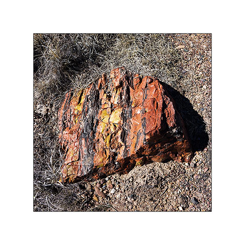
2. The colors are amazing! The density of this stone is such that it takes 4 times longer to a silica carbide saw to cut the same thickness as in granite.
3. Most of the time, erosion causes trunks to break. On some, the petrified bark is still present.
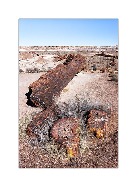
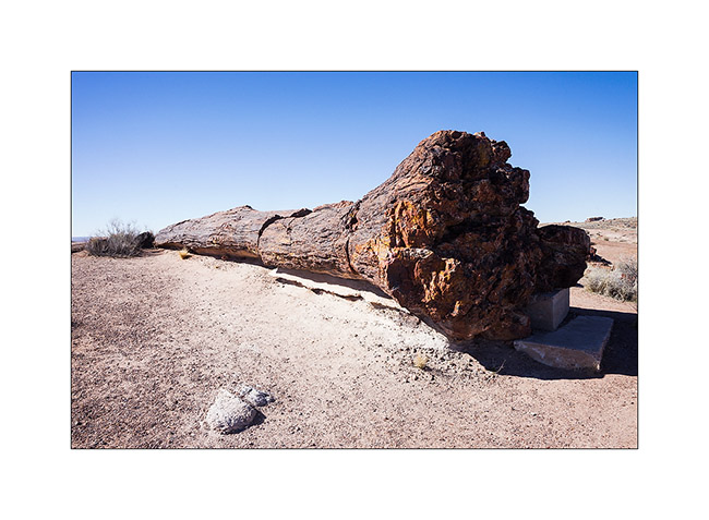
4. A giant! His strain is over 8 feet high.
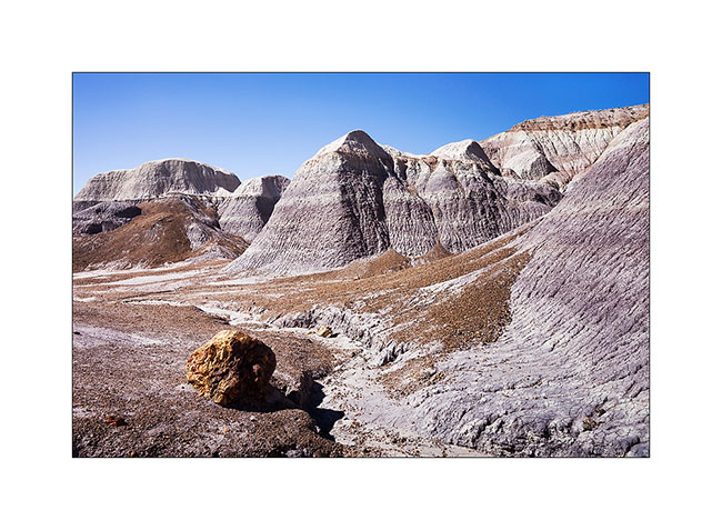
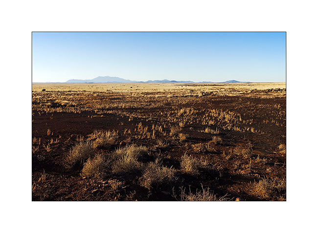
5. The desert surrounding area is varied.
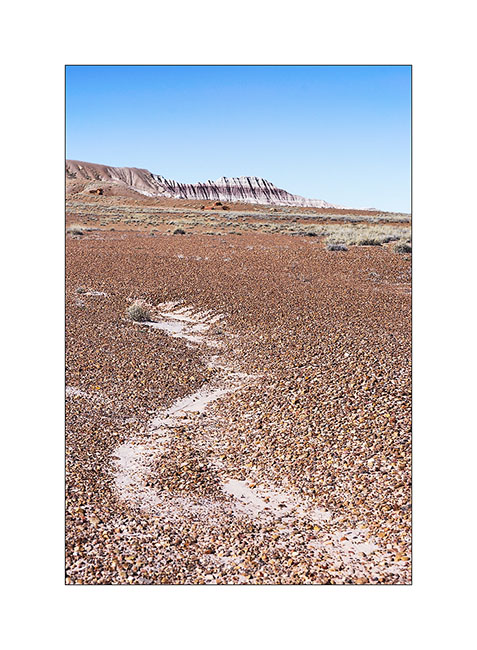
6. Undulation…
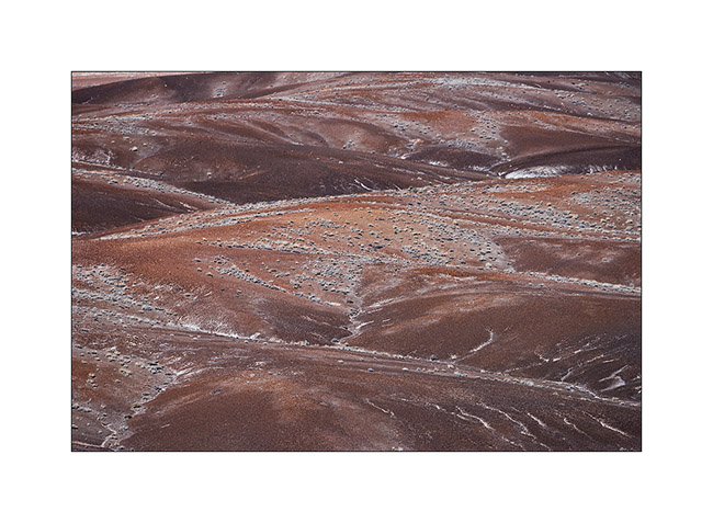
7. Mixes…
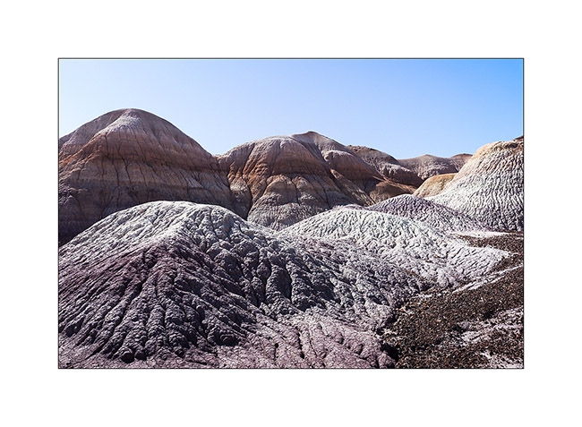
8. Amazing colors and shapes.
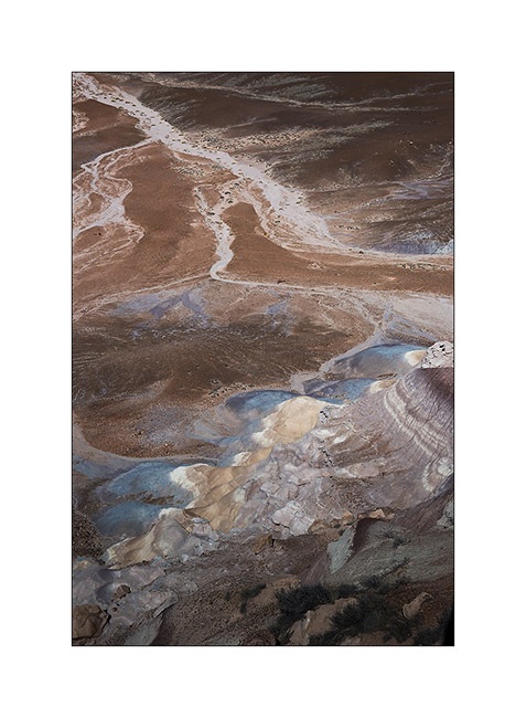
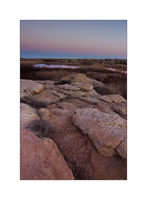
9. Edge of a bentonite mesa taht erosion carves.
10. This bentonite is less colorful than in other places but the presence of petrified trunks contrasts with the soft shapes of clay.
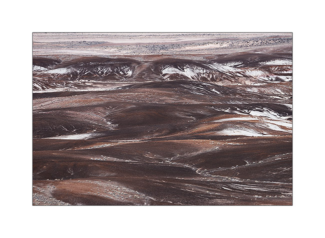
11. The eroded texture reminds me of some corals…
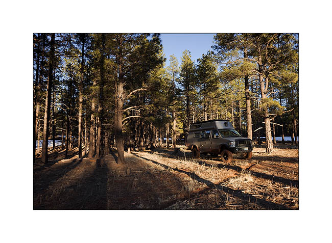
12. Vivalavida then moved to New Mexico, spending a first night at over 7,000 feet above sea level in the forests of the Zuni Mountains.
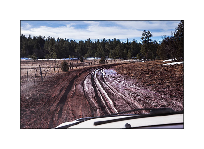
13. The next morning we crossed the Zuni Mountains with sometimes quite rutted and muddy roads…
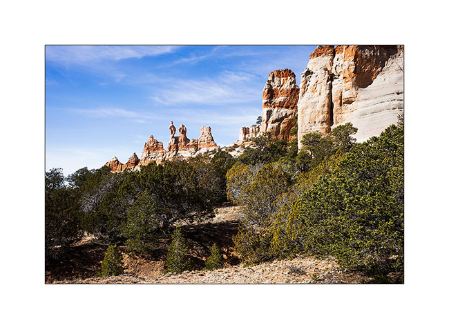
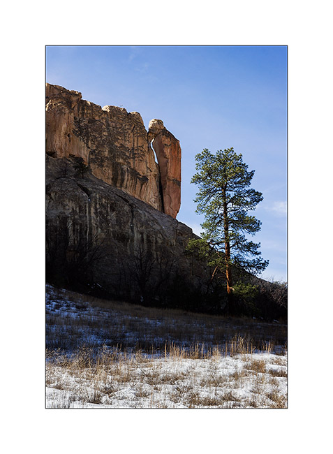
14. Discovery of the pinnacles of Los Gigantes by chance…
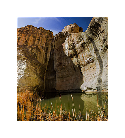
15. A guelta sheltered against a cliff of El Morro.
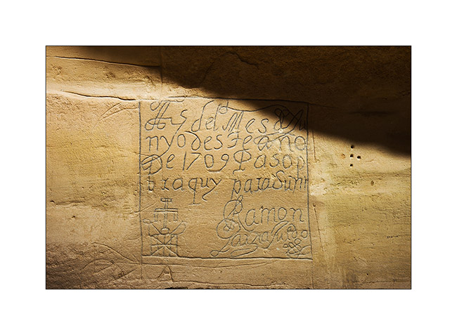
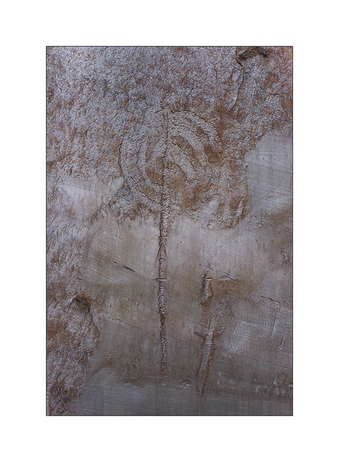
16. Etching in sandstone describing the passage of some Spanish in 1706.
17. Petroglyph much older, probably around the year 1200.
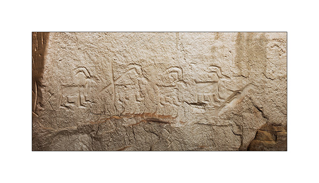
18. Another petroglyph estimated at 1,400 years BC.
19. “Woodpecker” natural arch.
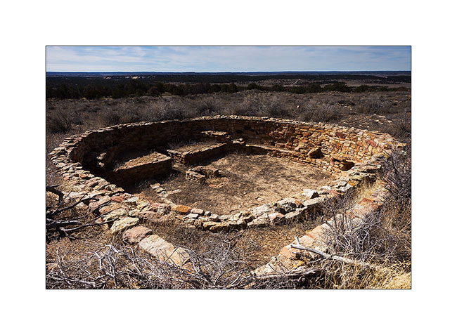
20. Pueblo ruins in El Morro National Monument.
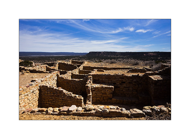
21. Another ruin of the same area.
Further discoveries along the East crossing of VivaLaVida to come soon… 😉
Craters and ruins…
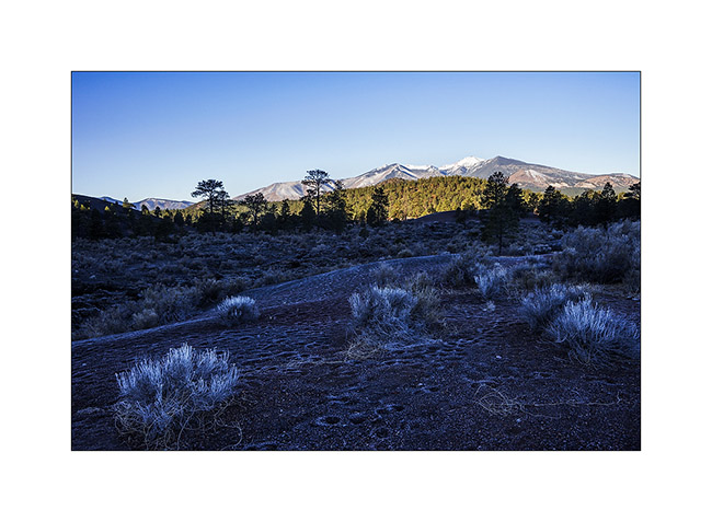
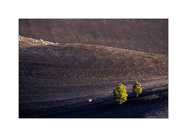
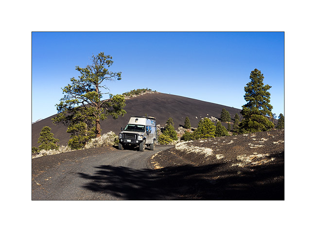
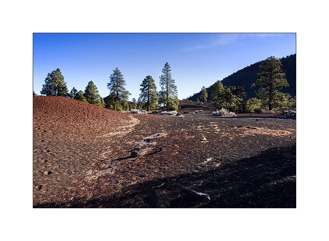
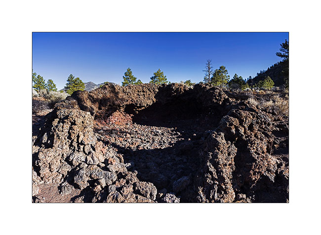
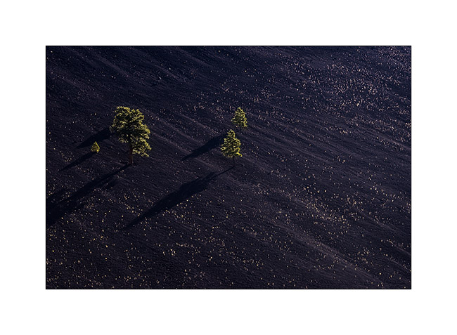
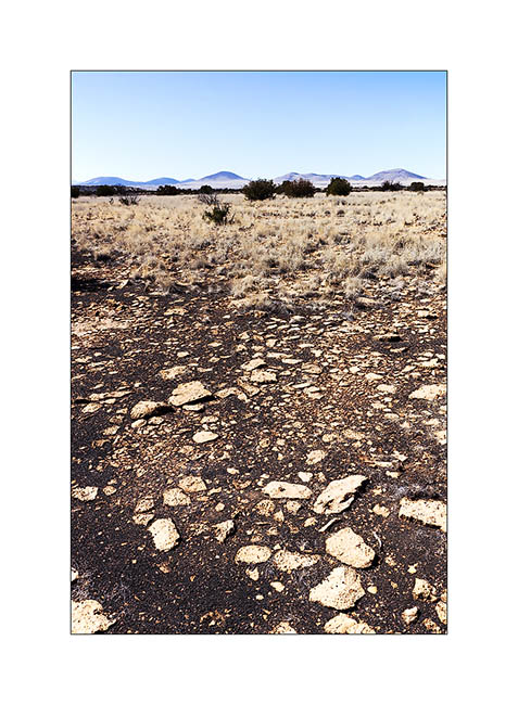
On the road to the east, VivaLaVida made some detours, the first close to Flagstaff to discover scoria cones. They appeared very recently, about in year 1080.
1. Mount San Fransisco in a freezing morning, a snowy volcano close to Flagstaff.
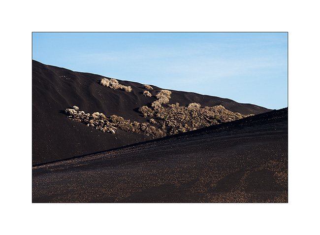
2. Cinder cones around Sunset Crater…
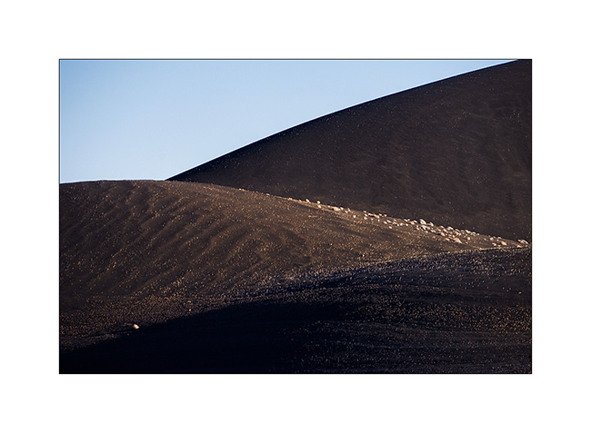
3. The vegetation is sparse and scattered.
4. First collons… 😉
5. Riding the volcano… 😉
6. Some areas are rich in ferrous minerals.
7. A lava bubble (hornito) whose roof collapsed.
8. Diagonals…
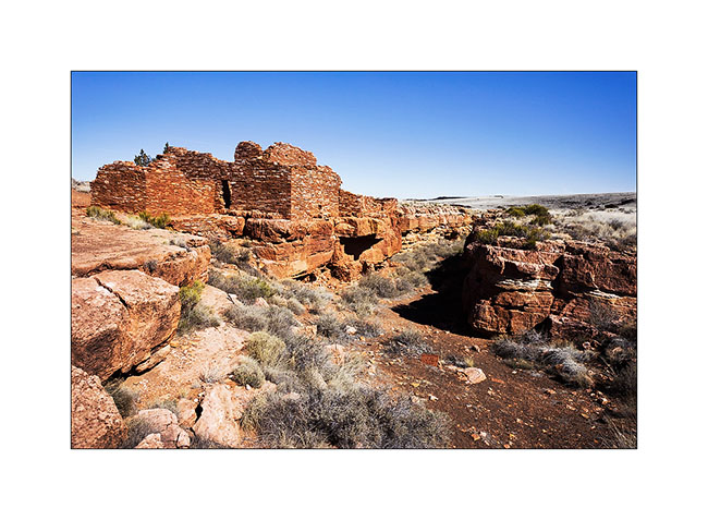
I then went to explore various ruins of Wupatki National Monument, at the limit of the Painted Desert. Several pueblos are grouped within a radius of ten miles.
9. Arrival in Pueblo Wukoki looking like a castle on a cliff.
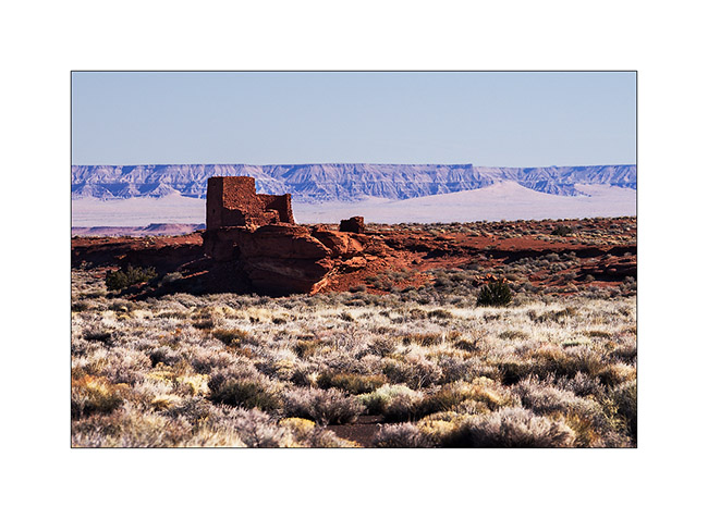
10. Yet this was the home of two or three families.
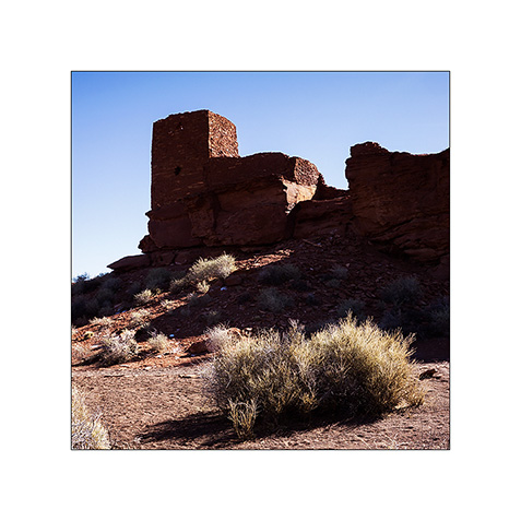
11. These ruins were built by the Indians who left the Sunset Crater region, about 25 miles away and were inhabited from approx. 1080 to 1200.
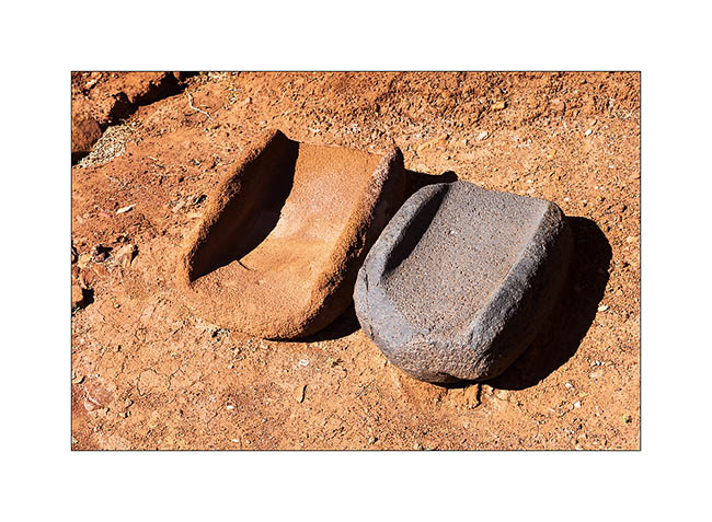
12. Stones to grind seeds.
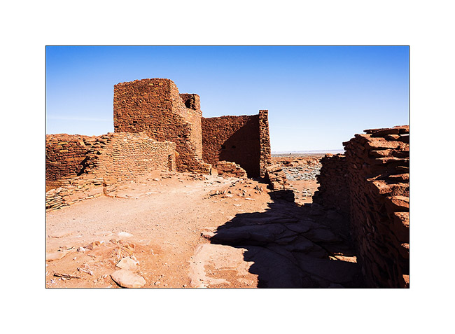
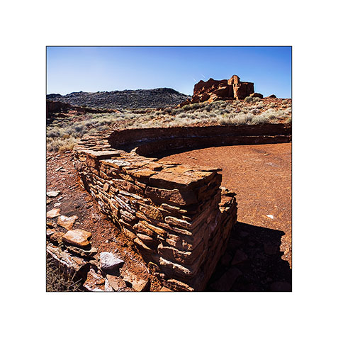
13. Another very impressive pueblo: Wupatki. The circular part of the foreground was a place of council and ceremonies.
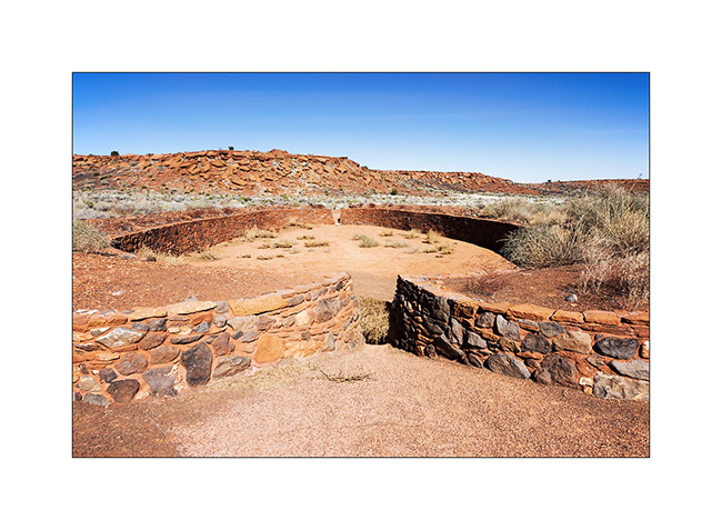
14. Here is a Ballcourt, a kind of arena in which games and trainings were organized. Ballcourts are frequent in southern Arizona and New Mexico but it is the only on known in Northern Arizona; thus assumes that Hoppi Indians who built these pueblos had contact with Southern tribes…
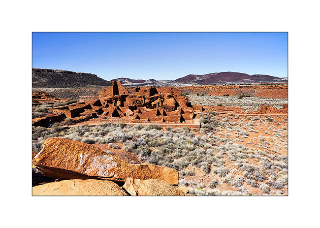
15. An overview of Wupatki Pueblo who had a hundred various rooms.
16. A pothole in the sandstone, a kinf of bowl eroded by water…
17. Other destruction the Lomaki Pueblo. The canyon on whose banks it was built is not due to erosion; it’s an earth crack created by the seismic activity.
18. Cinder cones dot the landscape; There are nearly 600 registered in the area.
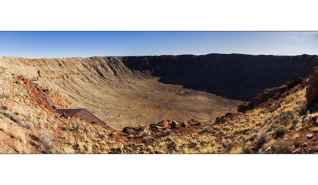
19. Here is a crater but it is a very different origin: it was created by the impact of a meteorite estimated at 140 feet in diameter 50,000 years ago! It hit the desert to the incredible speed of 11 miles/second, creating a shockwave of an equivalent power than a 20-megaton nuclear bomb. The crater is about one mile in diameter and 500 feet deep.
20. In the distance, Mount San Francisco rises above the plain…
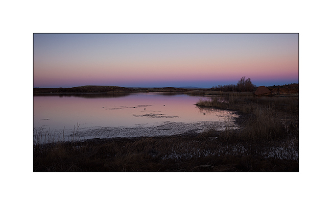
21. I got to a nice oasis at dusk…
22. Restful tranquility…
Other discoveries to follow soon. 😉
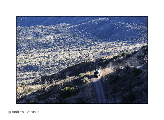
Winter in Arizona
I had a few days of Arizona winter with summer temperatures. Between 70 and 80 degrees, it changes with the -9 I had a few weeks ago in Utah!
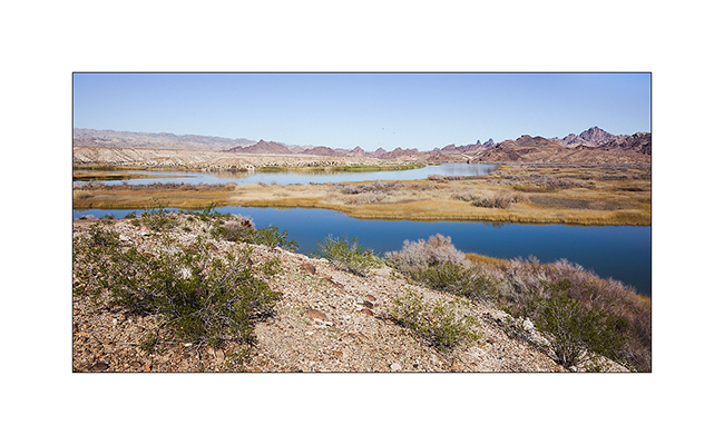
1. Wetland where the Colorado meander between the mountains.
2. Windy camp on the shore of Lake Pleasant (iPhone photo, sorry for the bad quality…)
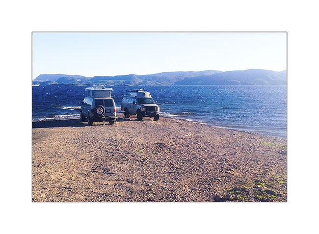
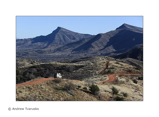
3. VivaLaVida on the road to the Verde River.
4. Mountain desert.
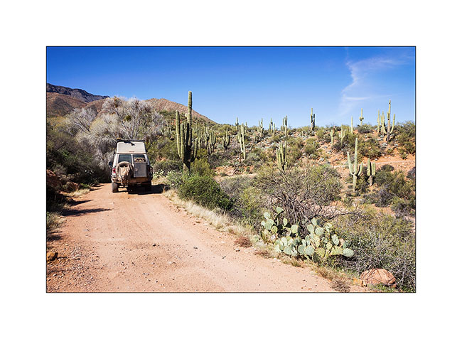
5. L’Arizona, it is also the saguaros, giant cactus which are the symbol of the State.
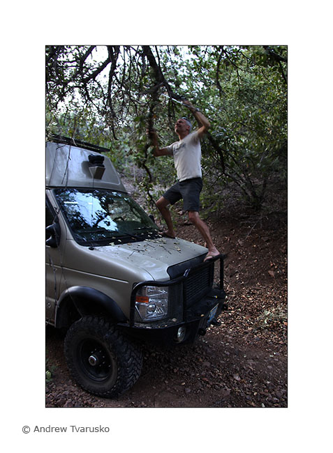
6. In some glens, trees sometimes hamper progress…
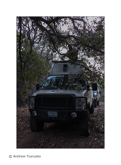
7. … forcing to play the saw or pruning shears…
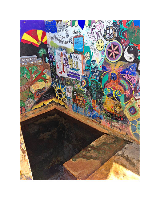
8. Rio Verde Hot Springs, a nice hot spring. There was a resort that burned in the 80ies. Remains the baths above the Verde River.
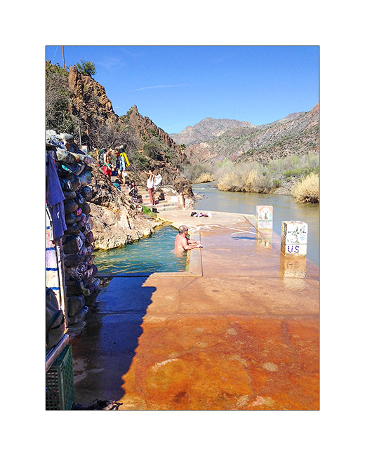
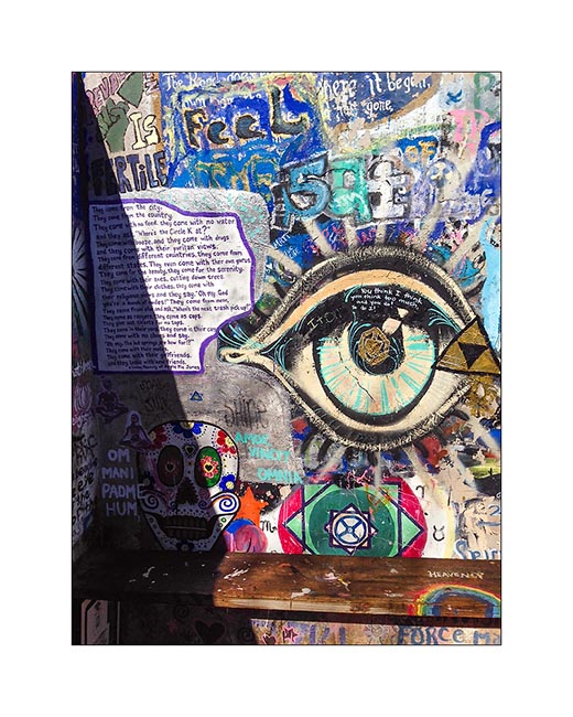
9. You will encounter a Hippies atmosphere, everything has been taged in a spirit of freedom and sharing. Swiming suits are “optional” and many are enjoy the hot water in their nude…
10. The “inner” basin whose water is warmer.
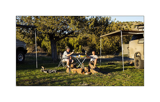
11. Last drink with Andrew who will continue his vacation in the South, well … if it doesn’t change his mind! 😀
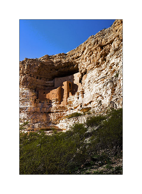
12. Short stop at the magnificent ruins of Montezuma Castle inhabited three centuries between 1,100 and 1,400.
13. Sunset over Red Rocks near Sedona.

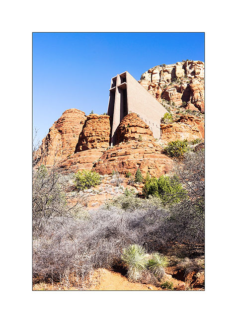
14. Chapel of the Holly Cross in Sedona. It was built in 1956, rather futuristic for its time..!
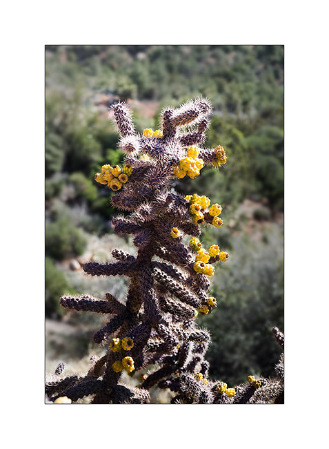
15. Cactus…
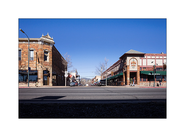
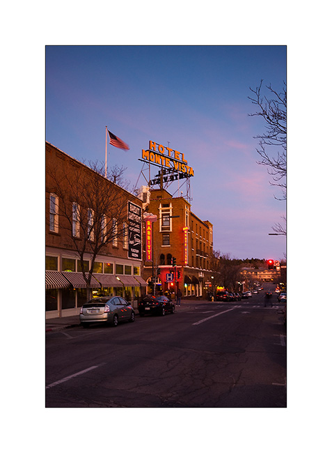
16. And here is a little serie of the small town of Flagstaff.
17. Hotel Monte Vista.
19. In Main Street.
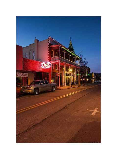
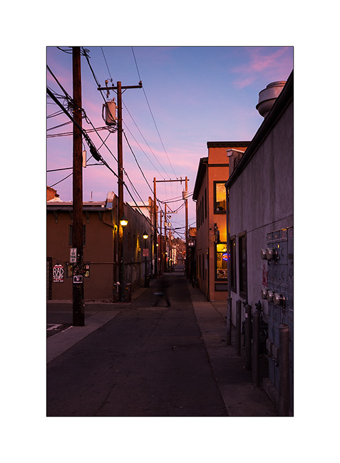
20. Back street.
So much for today. Vivalavida is currently heading East to reach North Carolina, where I’m gonna leave her in good hands during my stay in Switzerland. She will go through all the US toward East in ten days, nearly 2,200 miles.
Thus, updates will likely space themselves out before they stop in March, you will not hold it against me…
ay tuned for some pictures of this crossing coming soon… 😉
Californian varieties
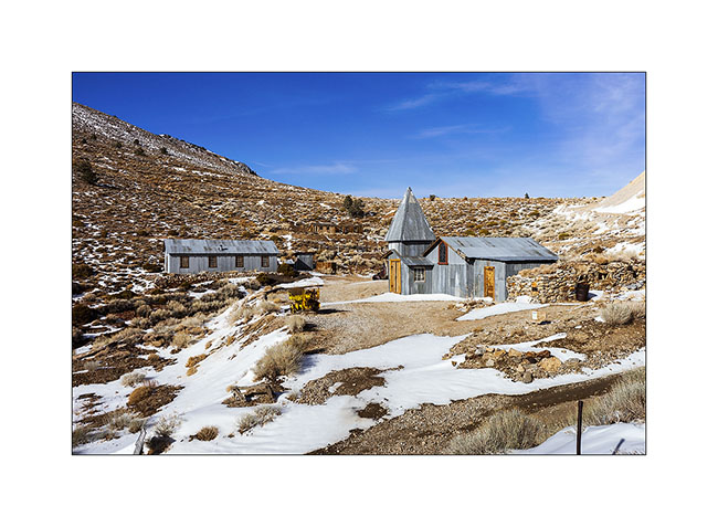
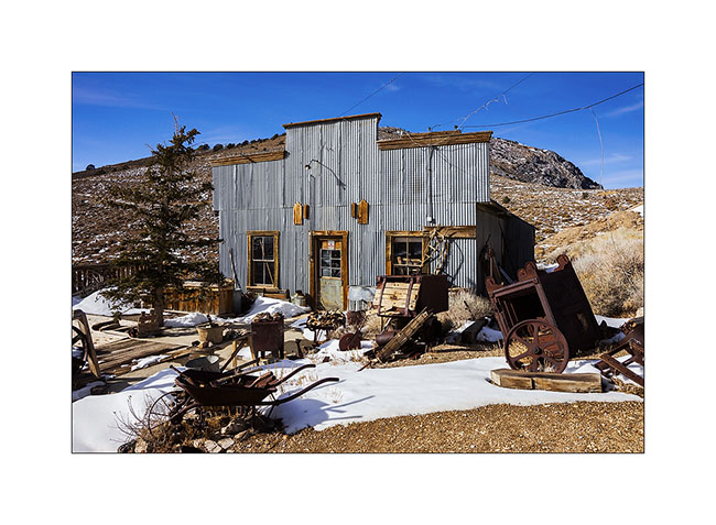
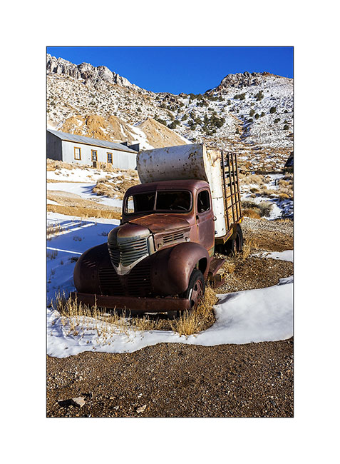
Having failed to reach Cerro Gordo through the ridge road blocked by snow, we drove up the classic route. This is an abandoned mining town that was home to 2,000 people between 1856 and 1930. It had up to 7 saloons and the basement is dug over 35 miles (55 km) of galleries. It generated the largest amounts of silver from all the American West at this time.
1. Some buildings of this mining Ghost Town are made of corrugated sheet.
2. General Store transformed in a museum.
3. A 1946 truck.
4. Splendid furnace in hotel.
5. A restroom…
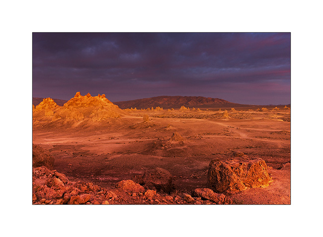
6. The next day, we stopped at Trona Pinnacles.
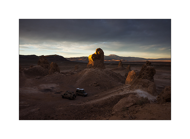
7. the sun is going Under the clouds.
8. This is tuff chimneys such as Mono Lake, which formed in a lake between 100,000 and 10,000 years before our area.
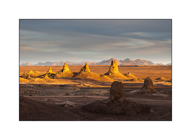
9. Some are 140 feet high.
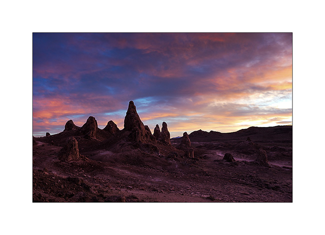
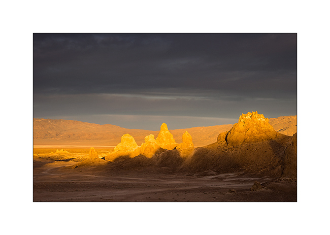
10. Flaming sunset.
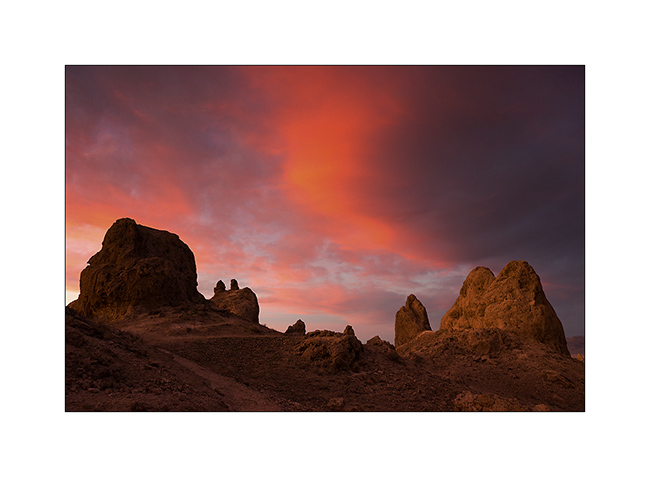
11. Unlikely colors…
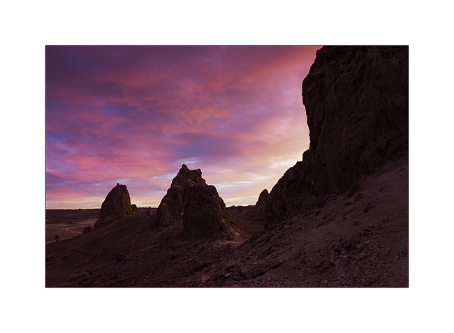
12. Light reflected by the purpled clouds…
13. Another discovery : Red Cliffs Canyon.

14. The errosion sculpted amazing forms, sometimes colored…
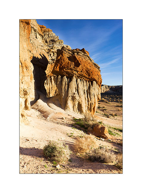
15. … sometimes gray.
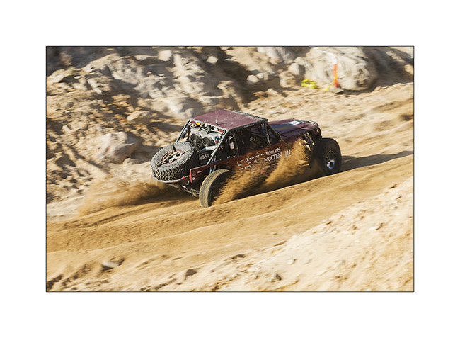
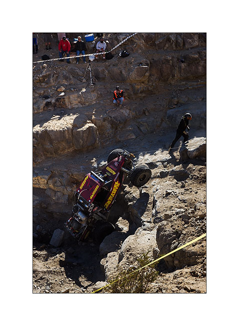
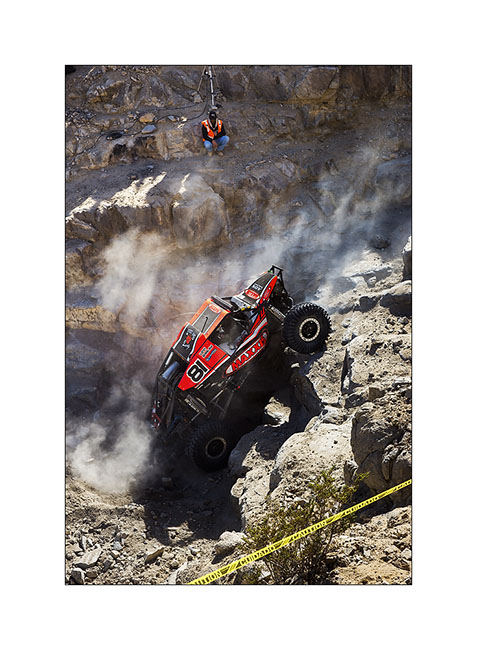
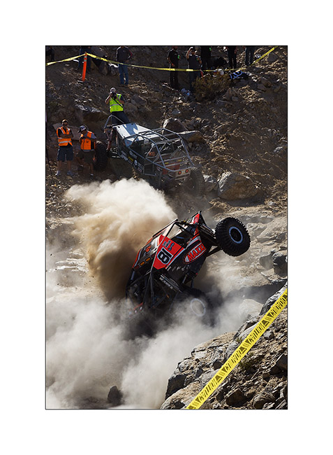
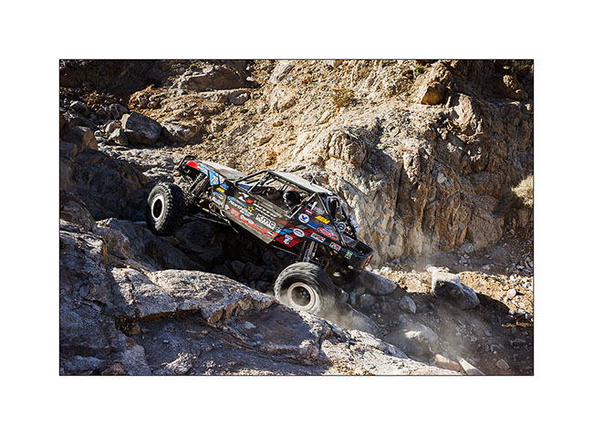
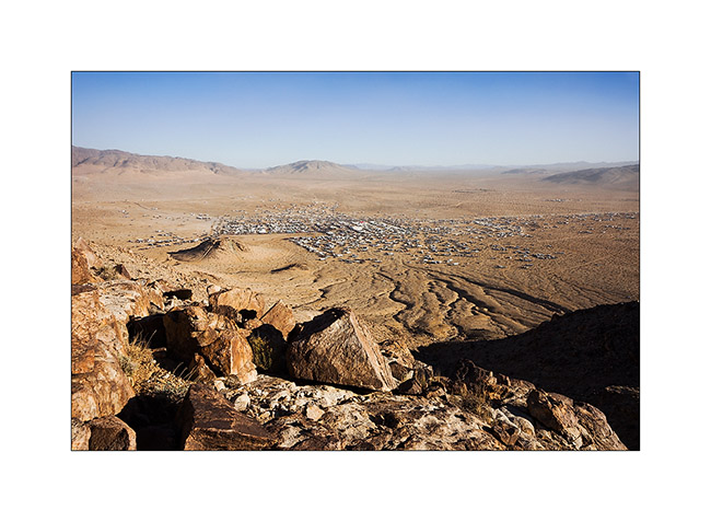
Change of scenery! We stayed for three days at the “King of the Hammers”, an off road race! The event takes place in the desert and alternates very fast sections on sandy tracks and pure rock crowling passages in canyons full of large blocks and obstacles. The winner took almost 9 hours to browse through three rounds of 45 miles.
16. Vehicles are buggies which most are between 800 and 1,000 hp!

17. This one has a distant silhouette of Jeep…
18. Back Door canyon entry.
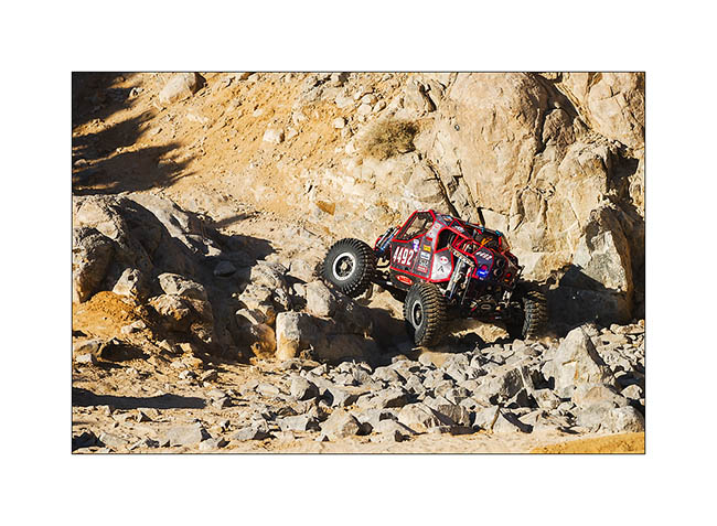
19. Winching an obstacle, here a more than 10 feet high step! The co-driver is also the one that will tie the winch.
20. Some buggies are single seater.
21. Power passing…
22. Up in Back Door canyon, more than 600 feet above the desert.
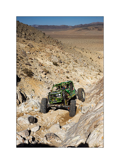
23. Another obstacle that seems less impressive than reality on this image.
24. It is a city of nearly 30,000 inhabitants that rises from the desert during the race week.
Here is a short video taken with my cell phone…
Once the race is over, dozens of private vehicles are trying to hit obstacles of the race with the encouragement of hundreds of spectators that beer makes quite noisy ..! Here are two more videos, just to give you an idea of the atmosphere. They were shot around midnight…
After this fun experience, VivaLaVida began his eastward migration toward East travelling back to Arizona for a few days, still followed by Baja Shaker… To come soon. 😉
Salt Tram…
I met Andrew with whom I went to Baja last year. He’s gonna make a little way with VivaLaVida before I hit the road toward East…
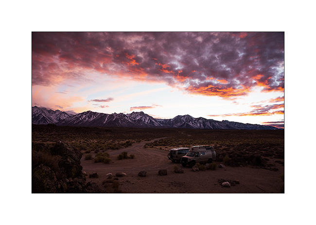
1. Beautiful colors to the first camp together near hot springs.
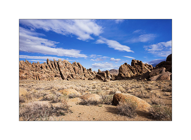
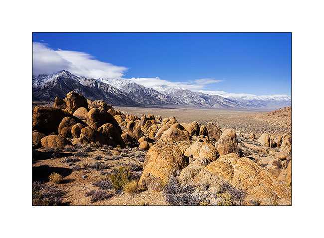
2. Stop at Alabama Hills that I discovered last spring with Jean-Luc.
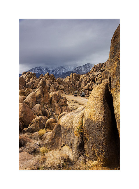
3. This place is really fun with these conglomerate concretions.
4. Withney Portal Arch.
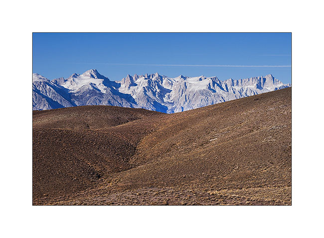
5. These hills are located at the foot of the Sierra Nevada.
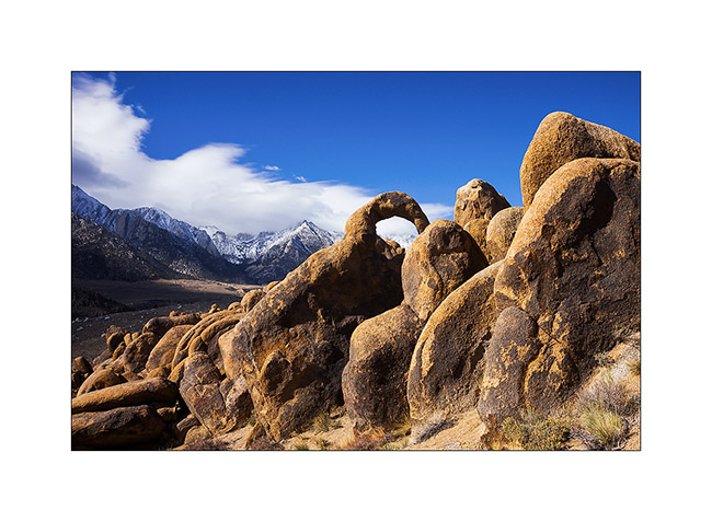
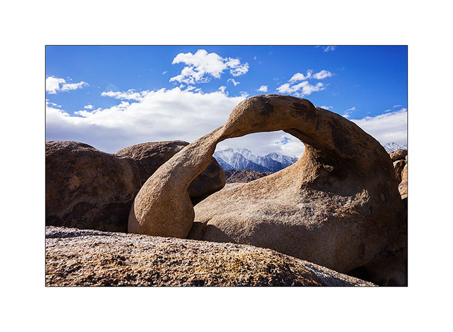
6. Visit of Mobius Arch I had already presented here.
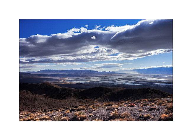
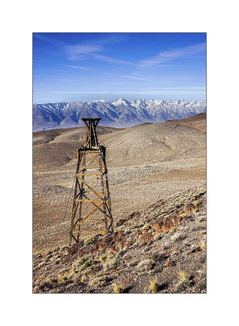
We then went to discover the Salt Tram, a construction that I wanted to explore. We had seen some pylons with Jean-Luc in the Saline Valley, thinking it was an elevator built for mining. In fact, it was a tram designed to exploit the salt deposit of the Saline Valley. Built between 1911 and 1913, the numbers are just amazing! It starts from 3,300 feet above sea level in Swansea, in the Owens Valley, rises more than 8,000 feet and goes down the other side of the mountain in the Saline Valley. The hauling cable was 27 miles long!
7. Up the Swansea Grade, above Owens Valley.
8. The Sierras received some snow three days ago.
9. Owens Valley with VLV and Baja Shaker camping at 5,500 feet elevation.

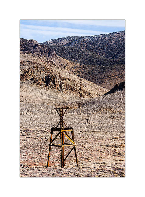
10. I approach a first pylon.
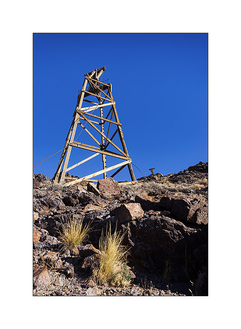
11. Assembly.
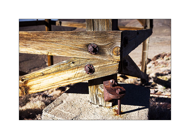
12. The dry climate has preserved the wood for over a hundred years.
13. Second pylon.
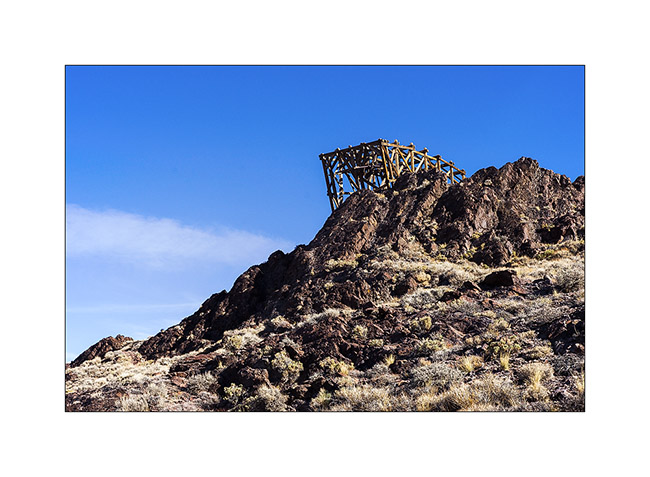
14. One of the intermediate stations to cross a ridge.
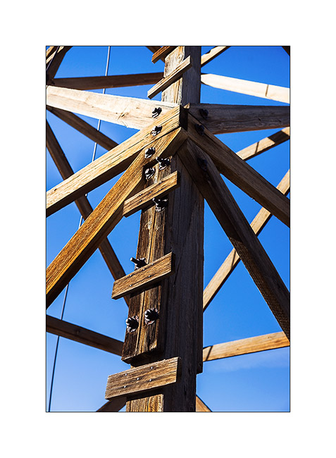
15. The construction is very similar to modern lifts excepted it’s made of wood.
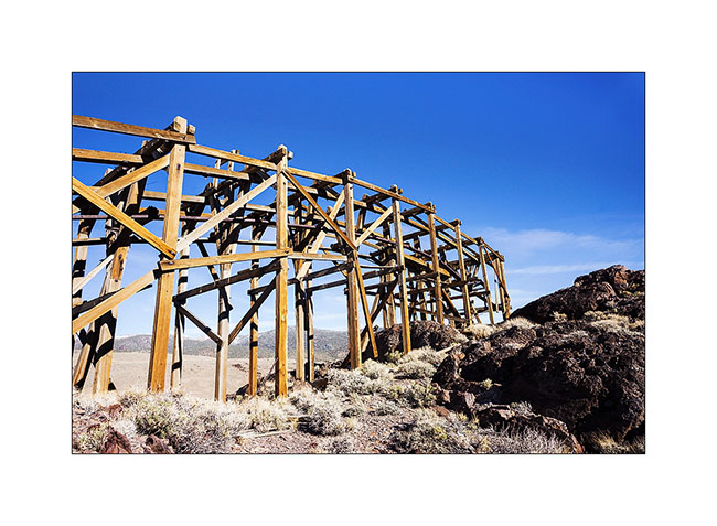
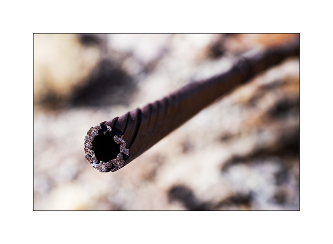
16. Hauling cable detail.
17. Framework.
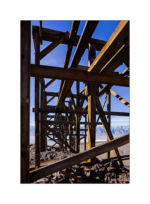
18. Pylons alignment with the top station at the bottom.
19. View of a lower intermediate station in front of the saline still in use today.
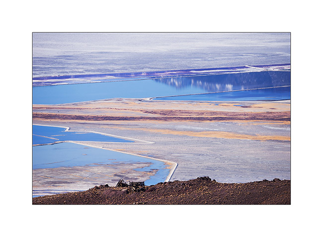
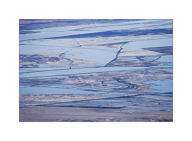
20. Graphics of saline.
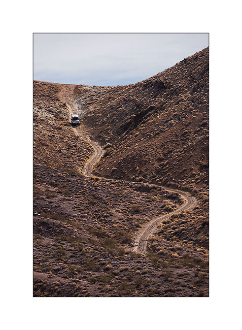
21. Baja Shacker going down the Swansea Grade quite steep and dissected in places.
To be followed in some days… 😀
Behind the Sierras…
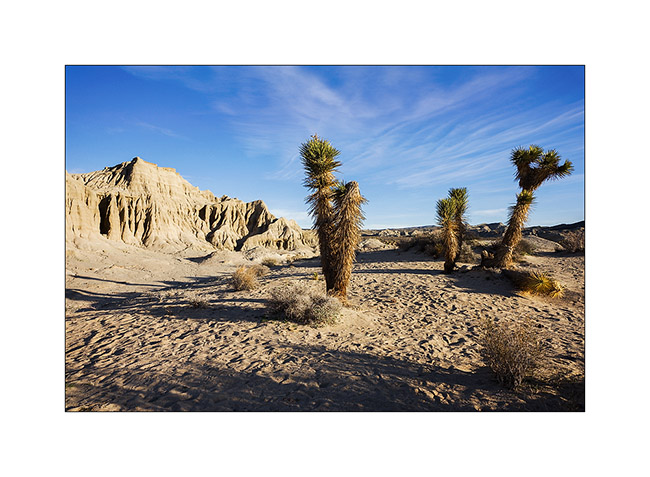
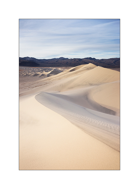
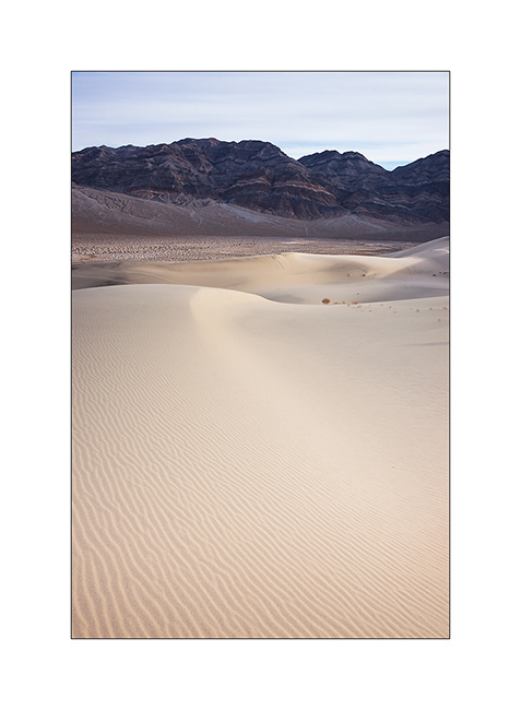
1. Sunrise over Eureka Dunes.
2. Contrasts between dark cliffs and clear dunes…
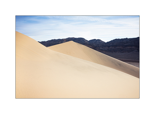
3. … and between the softness of the sand and the harshness of the rock.
I then went to explore volcanic craters near Mono Lake, the few snow this year allowing to access it easier than usually in this season.
4. On the road, I spent a night near Hot Creek, a river warmed by hot springs.

5. I’m over 6,000 feet elevation and there is no snow…

6. It’s cold at night however, 10F that night – and lakes freeze…
7. Boondocking behind Crater Mountain, at 7,900 feet elevation.
8. Mounted in steep scree of porous and rather light volcanic stones. Worse than the sand: making three steps up, you descend two! 😀
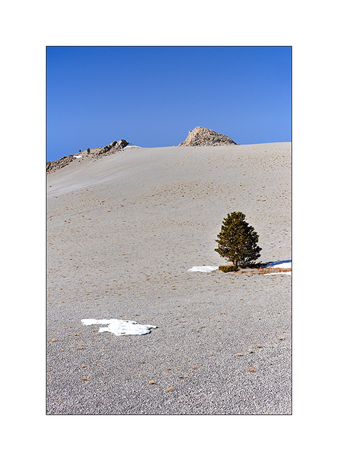
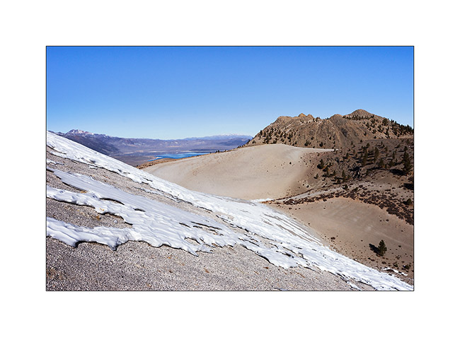
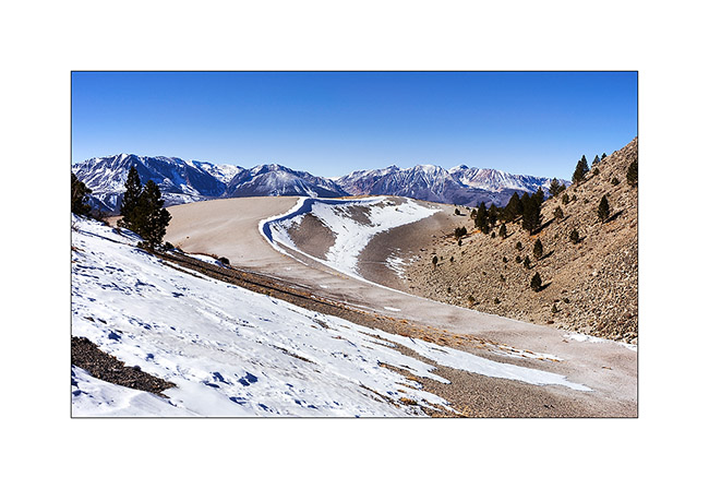
9. at about 8,500 feet, I see Mono Lake in the distance.
10. The north slopes keep some patches of snow.
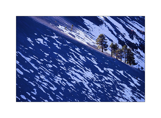
11. Patchwork…
12. Sierra Nevada is close toward West.
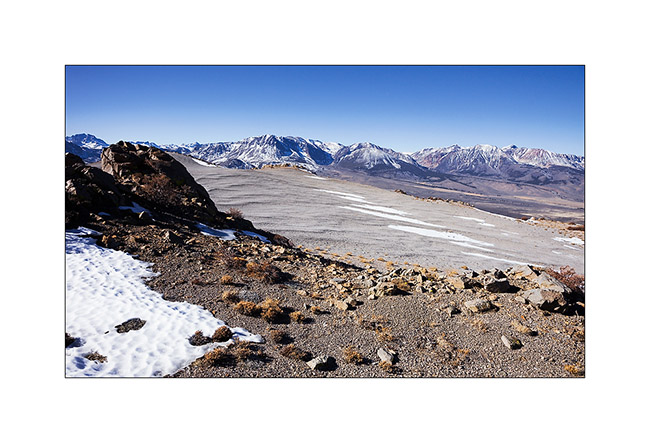
13. Scoria cone in front of Mono Lake.
14. Remnant cornice under the summit slope.
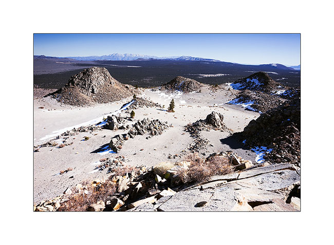
15. Arrival on the main crater or what remains.
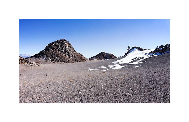
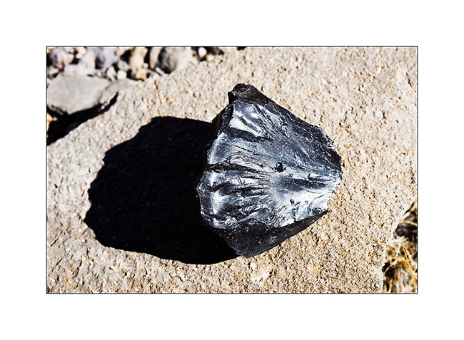
16. There were many of such black stones that looked like vitrified coal, rather light for their size with smooth and shiny texture.
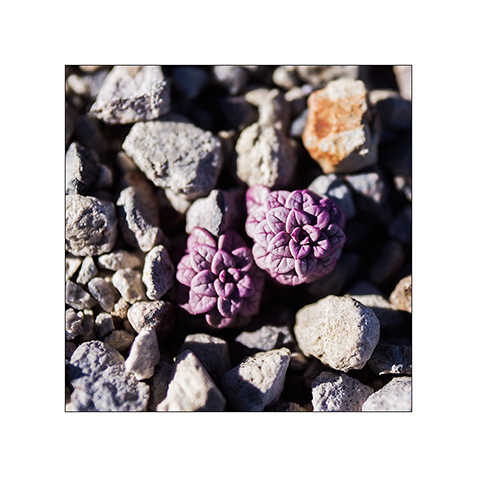
17. One of the only plants that manage to grow in this hostile environment. Tiny but pretty…
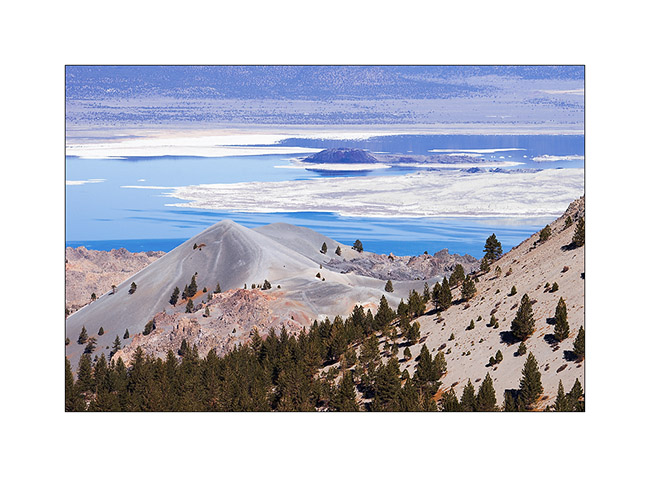
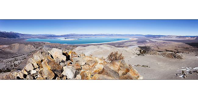
18. View of the crater from the highest point at 9,400 feet elevation.
19. The panoramic view of emerald color Mono Lake is impressive!
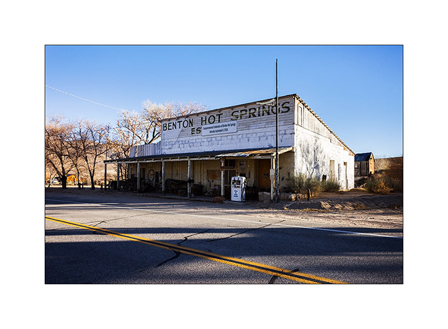
20. Going down on the way to some hot springs, VivaLaVida went through Benton Hot Springs, a historic place of passage.
After soaking in hot water two hours under the stars (what a joy!), I took a one day break to make an oïl change to VivaLaVida. Andrew (the guy with whom I had discovered the Baja California early last year) is being announced, I should meet him in the coming days to discover some new corners with Baja-Shacker.
To discover soon in a future update… 😀
 D5 Creation