August, 2014
now browsing by month
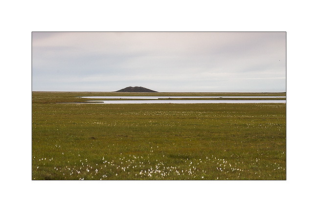
Denali National Park (2)
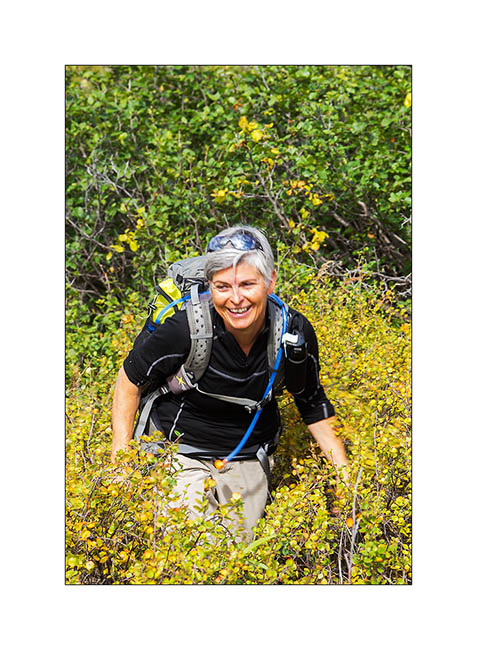
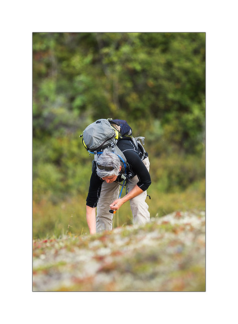
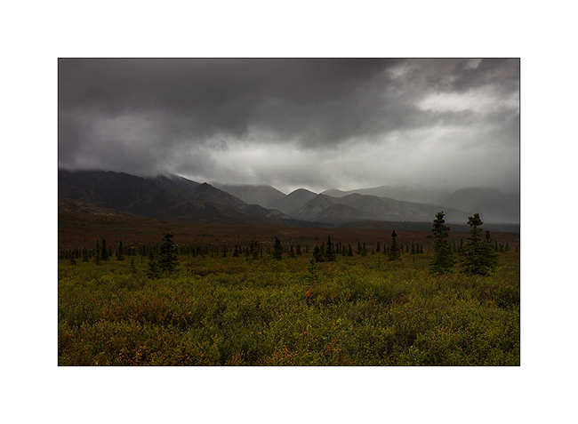
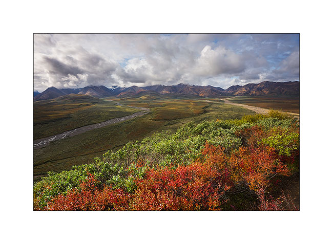
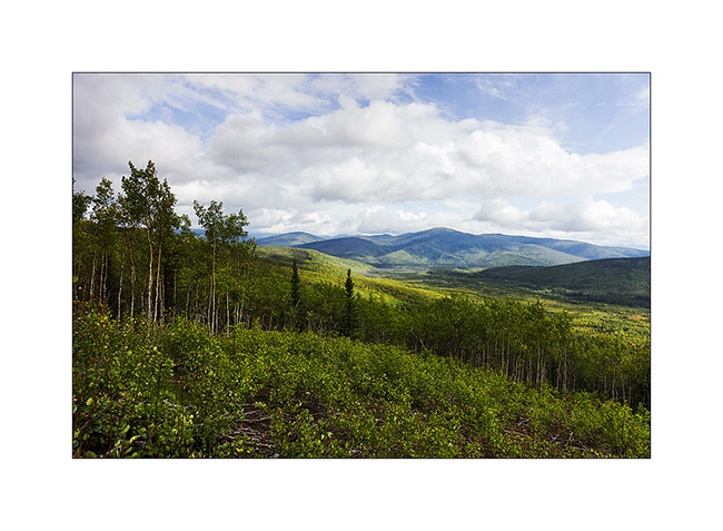
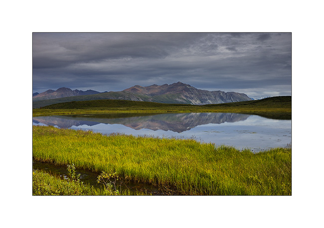
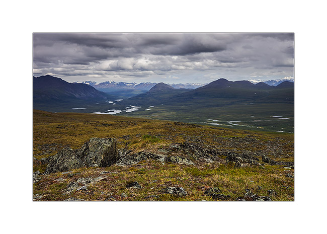
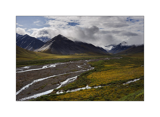
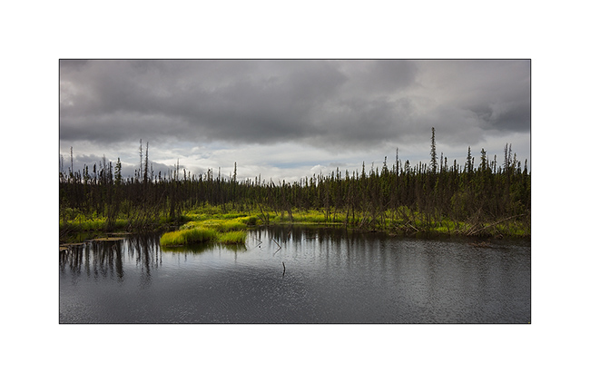
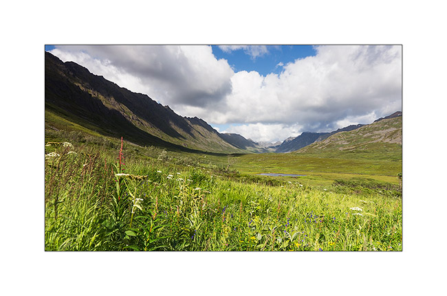
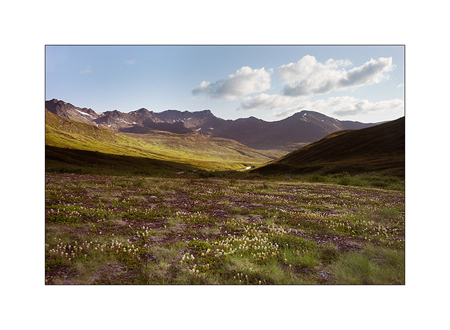
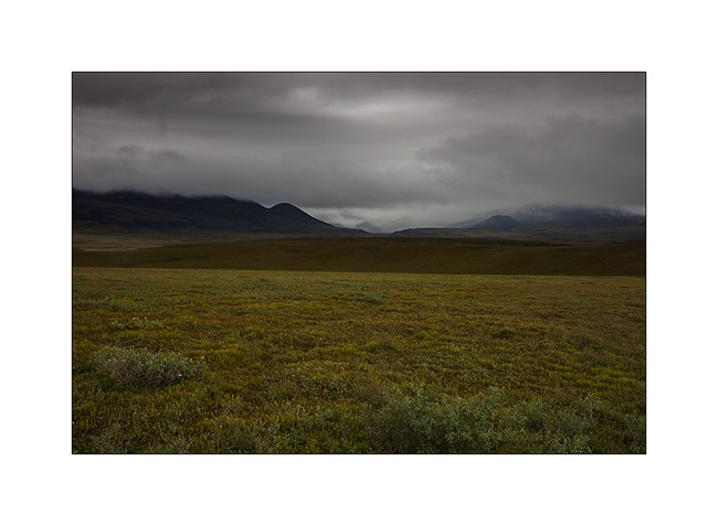
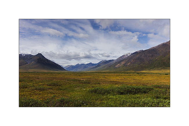
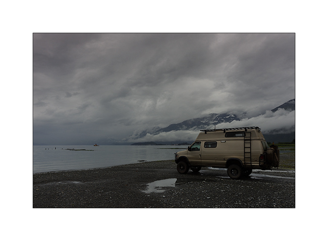
We took a bus the next morning that dropped us near Highpass, the highest point of the road. So we walked over seven hours in wildnature, first under the sun before rain in the afternoon. There are no trails, so we progress in the tundra and freely choose our way.
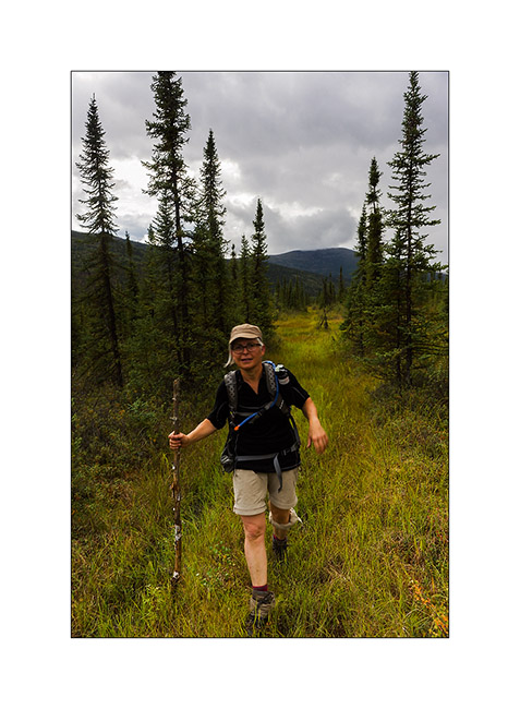
1. Sometimes, willows are several feet high. Progressing is not always easy but Mino keep smiling! 😀
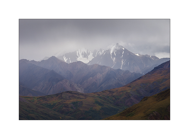
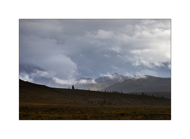
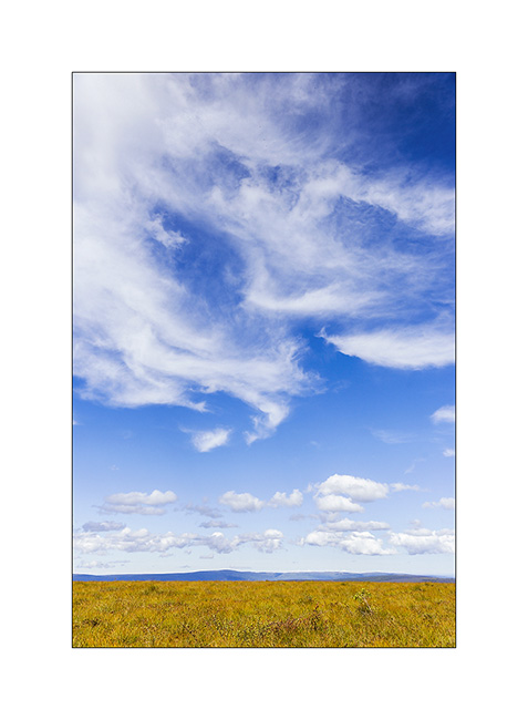
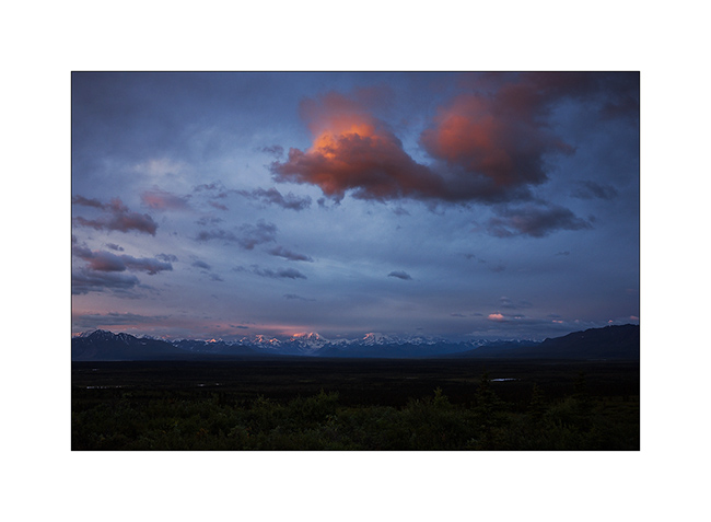
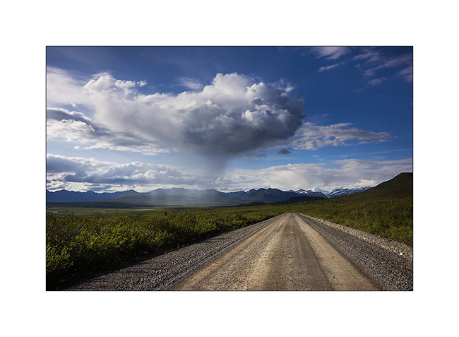
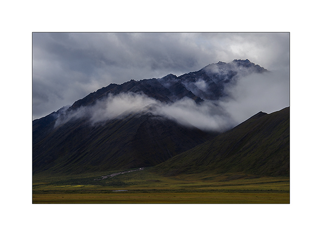
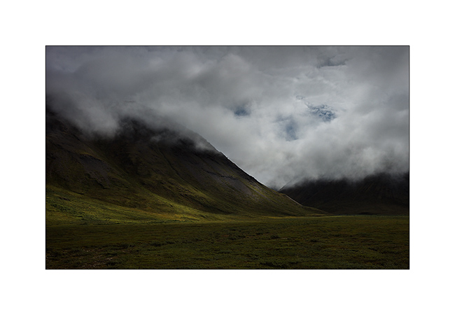
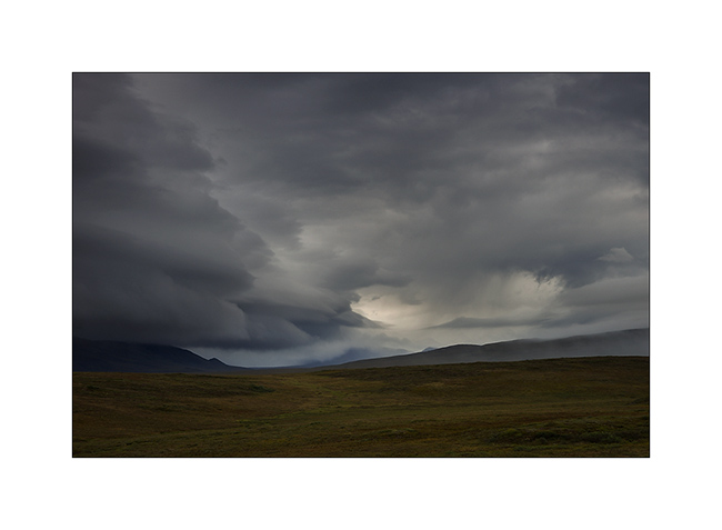
2. clouds growing rapidely…
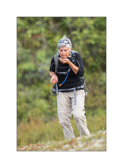
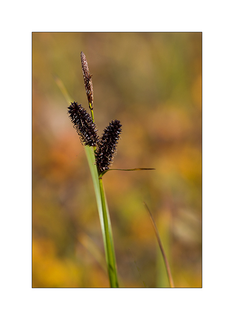
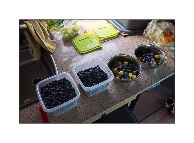
3. Berries are everywhere at that time of year, including blueberries that we gather throughout our journey.
4. Oh greedy!! 😉 (Well, I confess, me too! 😀 )
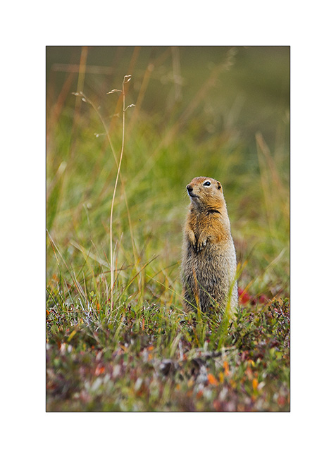
5. They are many ground squirrels that signal our arrival by their characteristic cry.
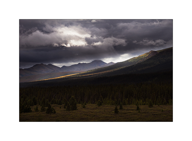
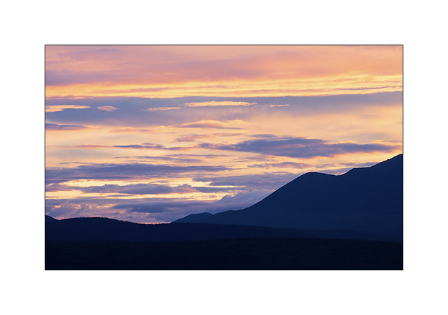
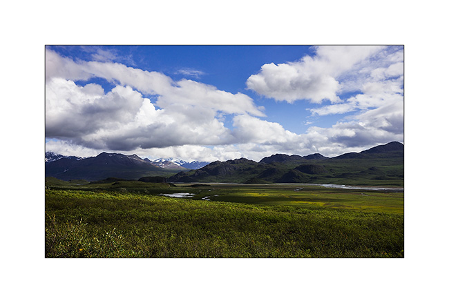
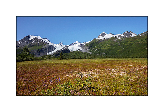
6. This powerful nature is just beautiful!
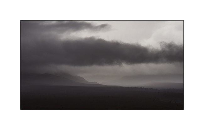
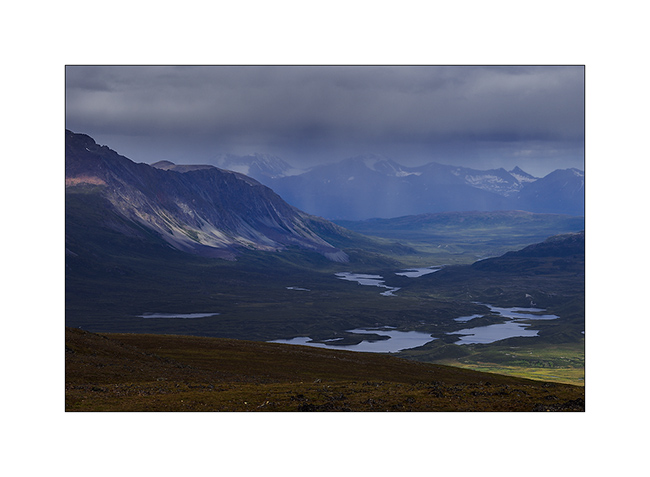
7. Atmospheres constantly change with the passing clouds…
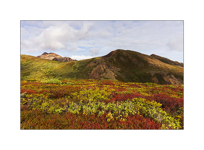
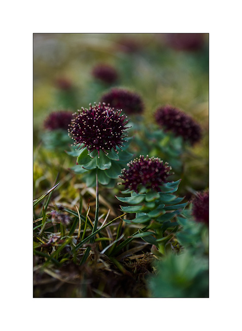
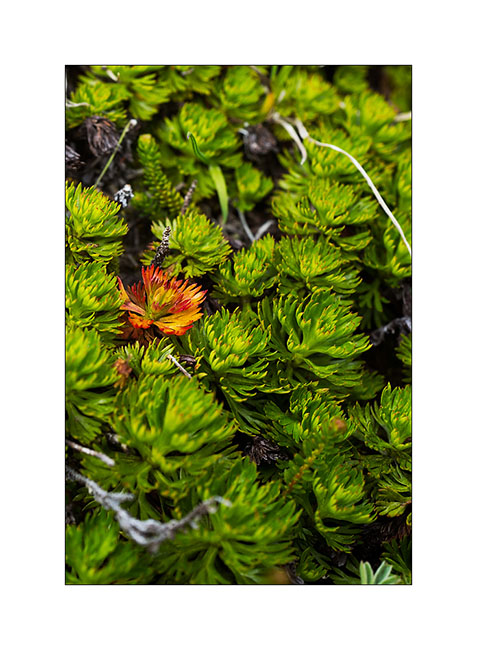
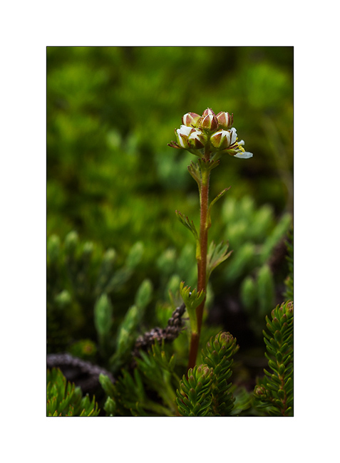
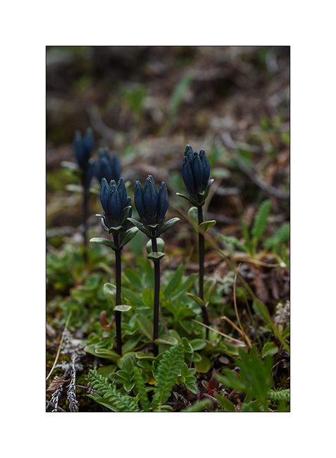
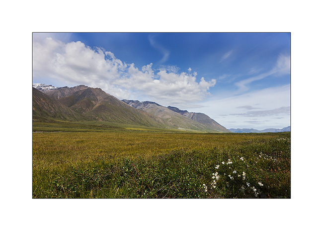
8. Some flowers remain on the tundra in the late summer.
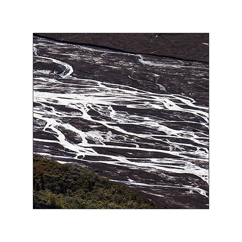
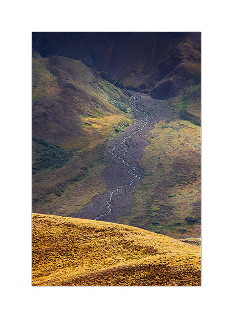
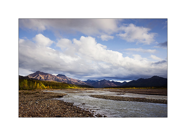
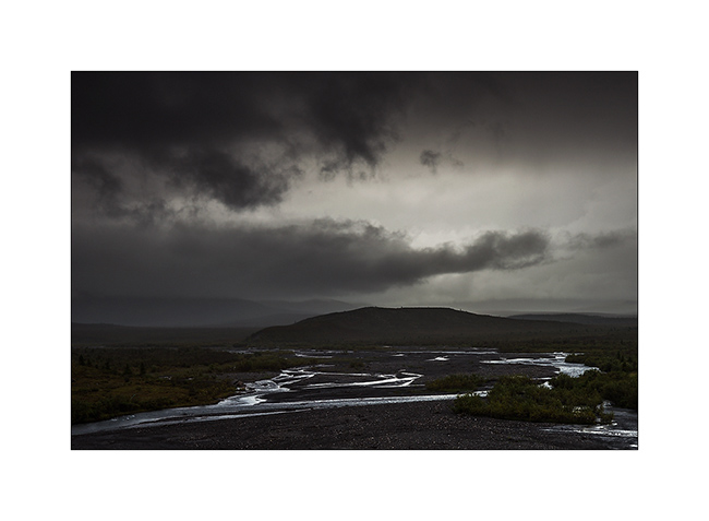
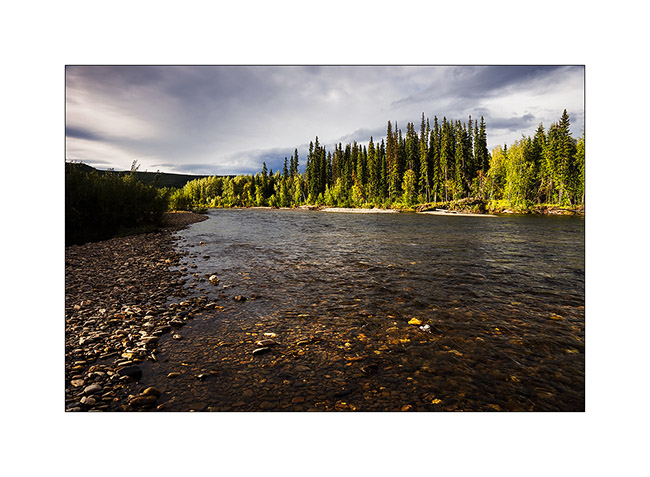
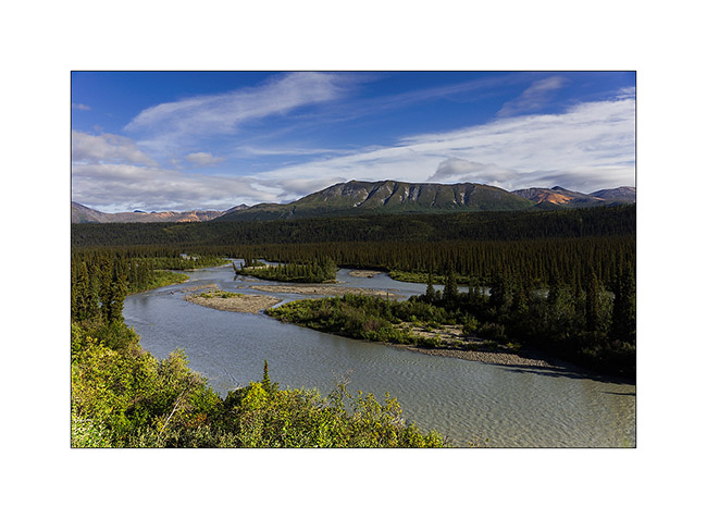
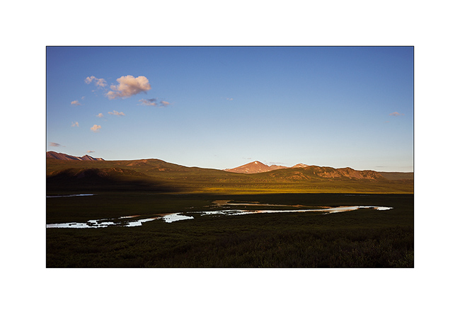
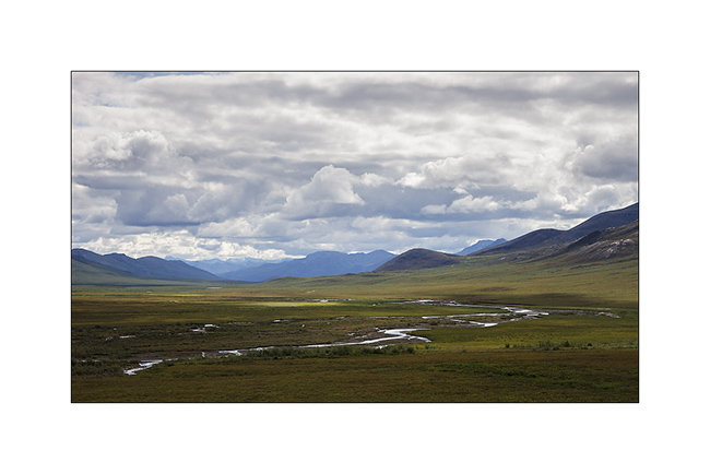
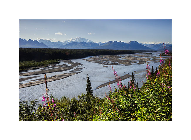
9. Rivers have formed large gravel bars by getting silt away from the glacier they flow from…
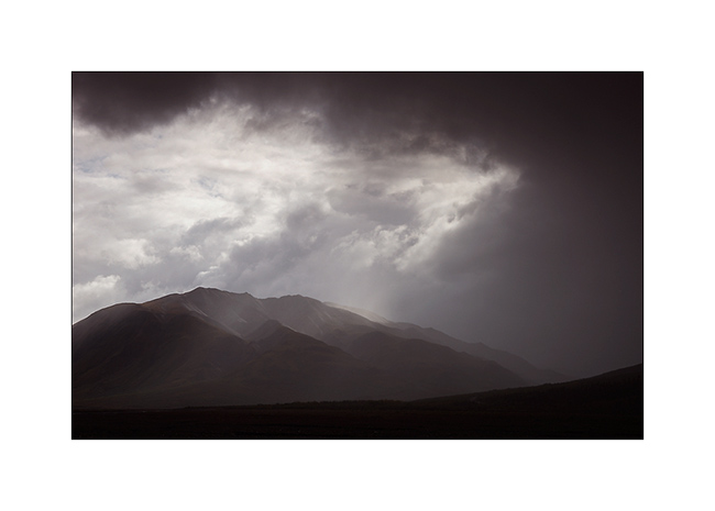
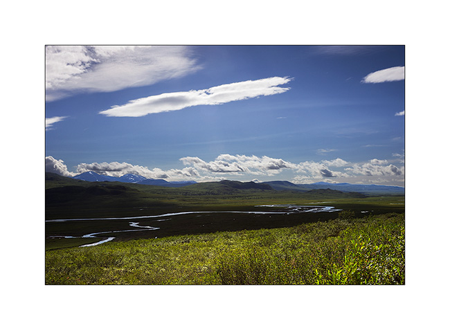
10. Meanders games…
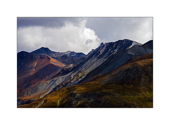
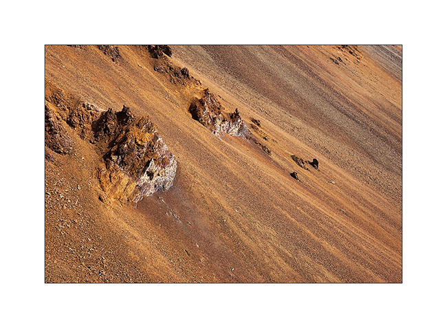
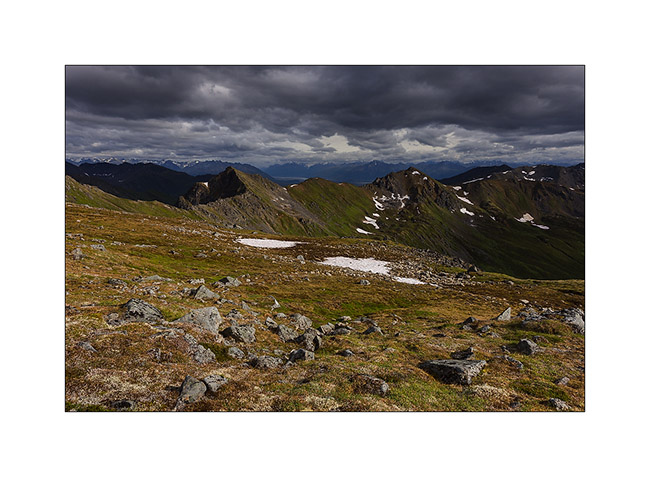
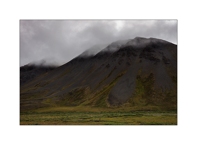
11. The top of the mountains is mostly made from large colorful screes.
12. Plunging perspective…
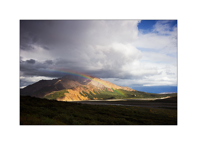
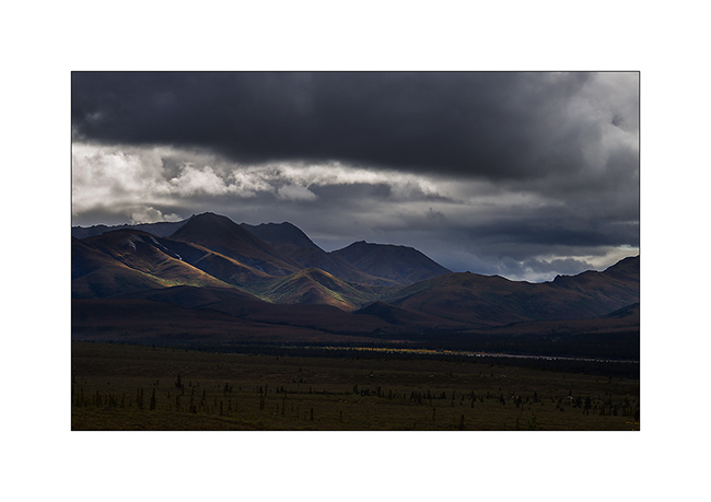
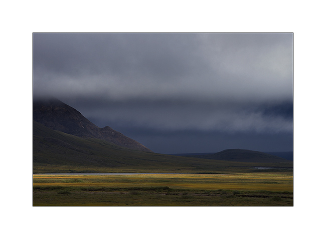
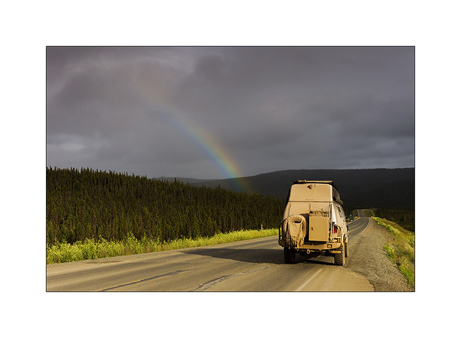
13. Afternoon showers start again…
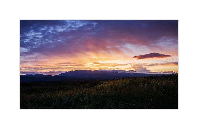
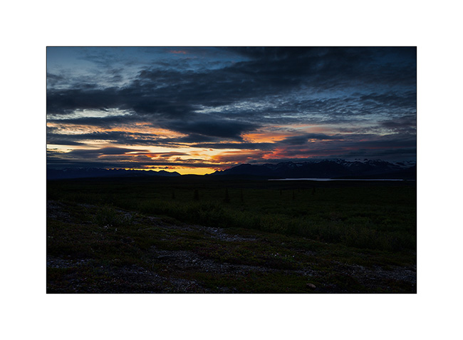
14. … and a beautiful rainbow emerges a few moments.
15. Fortunately, our rain suits protect us well!
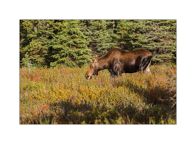
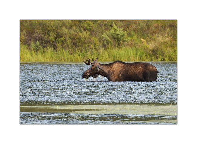
16. While we join Teklanika by bus, we see this female moose.
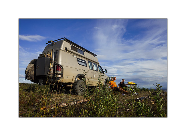
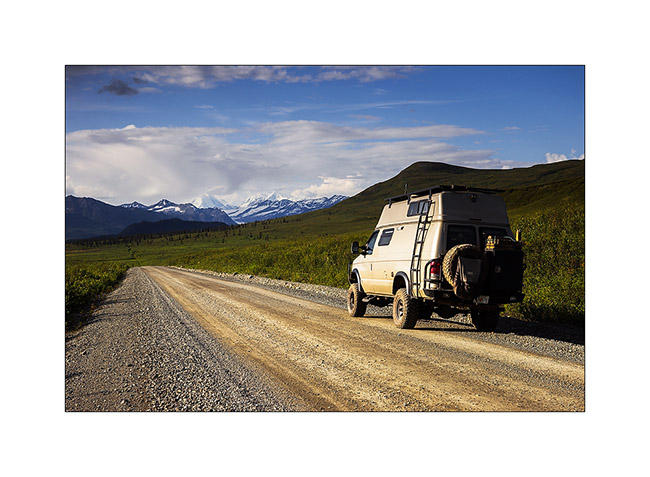
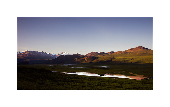
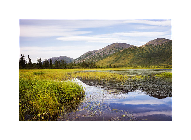
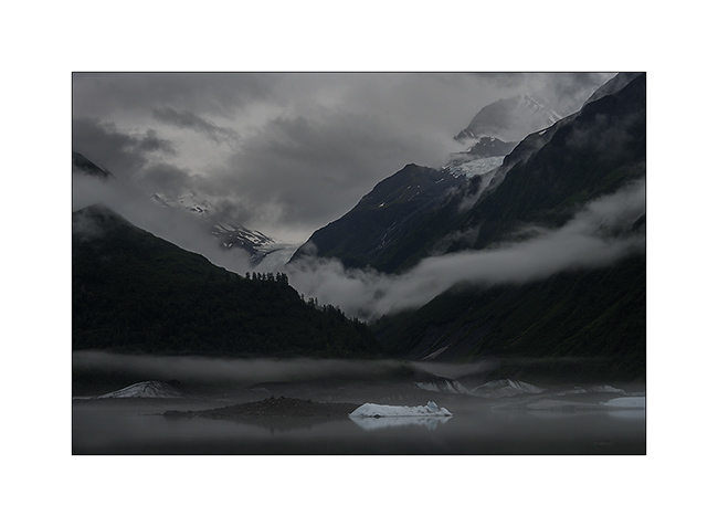
17. Off the bus a few miles before the campground, we enjoyed the last sun rays going down the bed of Teklanika River.
So much for the second day. To be followed soon.
Denali National Park (1)
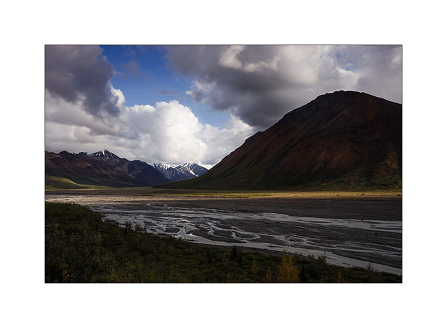
And here we arrived in Denali National Park, a large wilderness that includes Mount McKinley, the highest peak in North America, more than 20,000 feet elevation. This park was the first created in the United States in 1917 by Mr. Sheldon, who fell in love with this wilderness when studying dall sheeps for three years, then struggled for ten years to get this park created. In 1980, President Jimmy Carter has nearly tripled the size of the park.
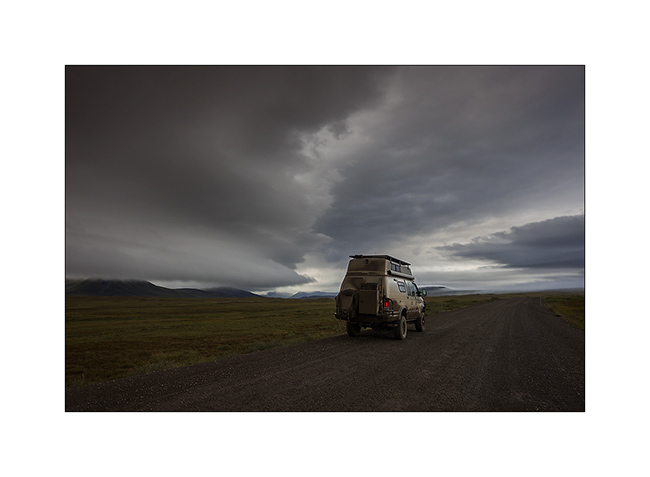
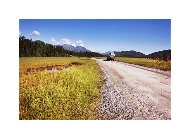
One road sinks into this wilderness, reserved for public buses to minimize traffic. Vivalavida has obtained a permit to only join and leave the Teklanika Campgroud. I booked four nights for a bit of time to explore this wonderful land. Lottery with the weather that smiled at us, rewarding some good sunny times between showers, with beautiful skies … The low traffic has developed abundant wildlife not to fear the always same vehicles using the road; the “encounters” are frequent and sometimes really close. We’ll see grizzlies on every trip…
1. It was gray and rainy when we took the road to reach Teklanika…
2. … but I still found some photogenic wet environments…
3. … sometimes with some light.
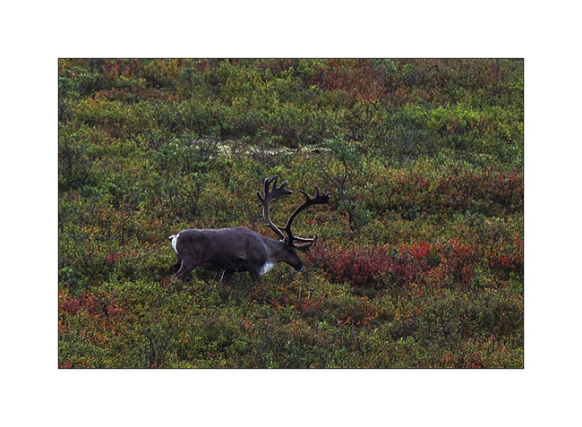
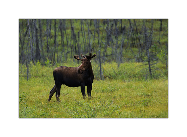
4. We see a bull caribou near the road.
5. The rain is going away…
6. … the stop while VivaLaVida is going deeper in the park.
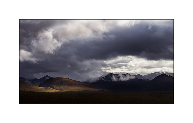
7. Sometimes a patch of light plays with reliefs.
8. Arriving in the Teklanika Valley, we are now close to the campground where VLV will remain quietly four days.
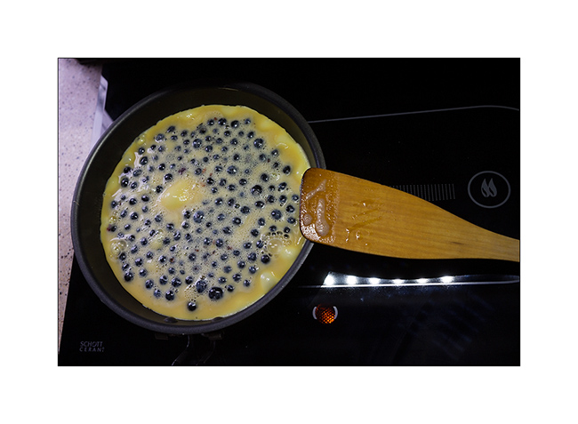
9. And to celebrate this arrival, we had a good sweet omelette with wild blueberries! 😉
10. The next morning, we only drove a few miles in the bus to meet a first grizzly!
11. Imposing Teddy, isn’t it?!! 😀
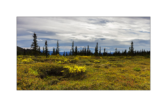
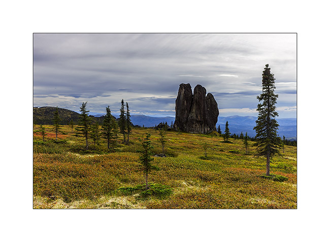
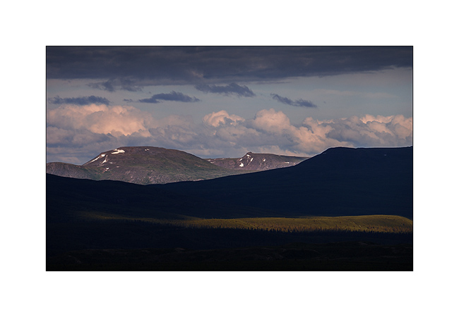
12.Tundra begins to change to fall colors. The “willows” are adorned with a beautiful dark red color.
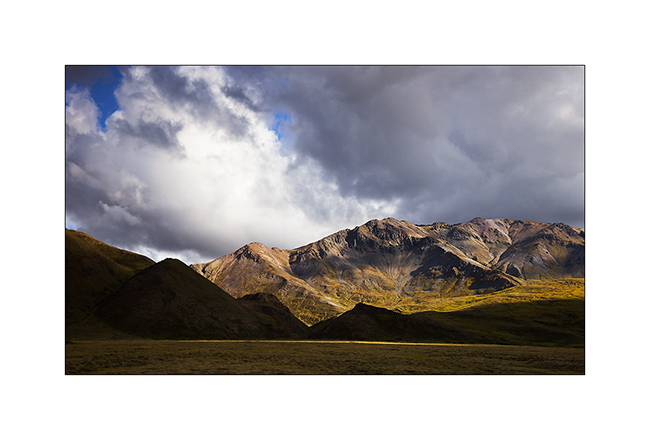
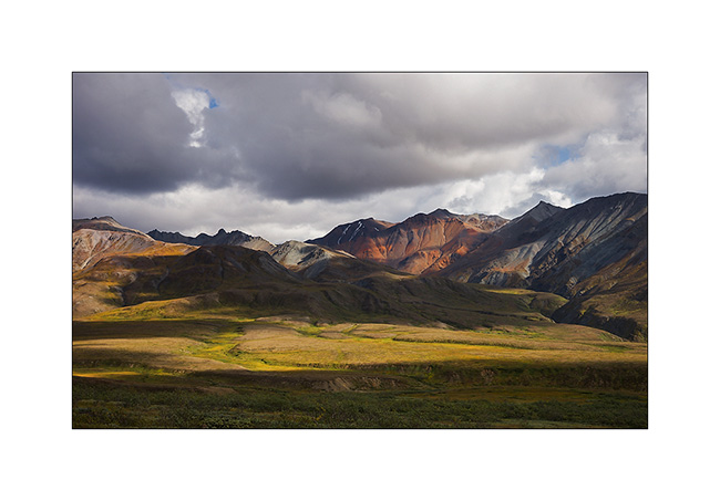
13. Polychrome Mountain.
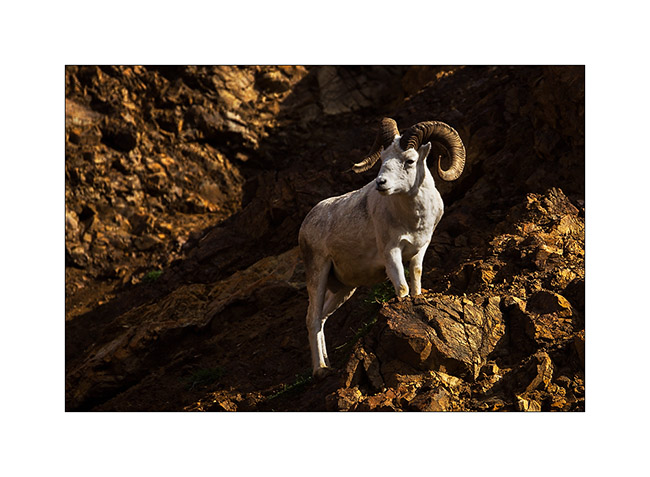
14. A little further, we see a nice “Dall Sheep”, the only white mouflon that exists on Earth. Superbly adapted to the rocky cliffs where he stands away from his predators.
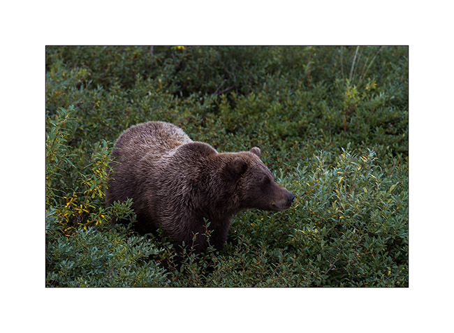
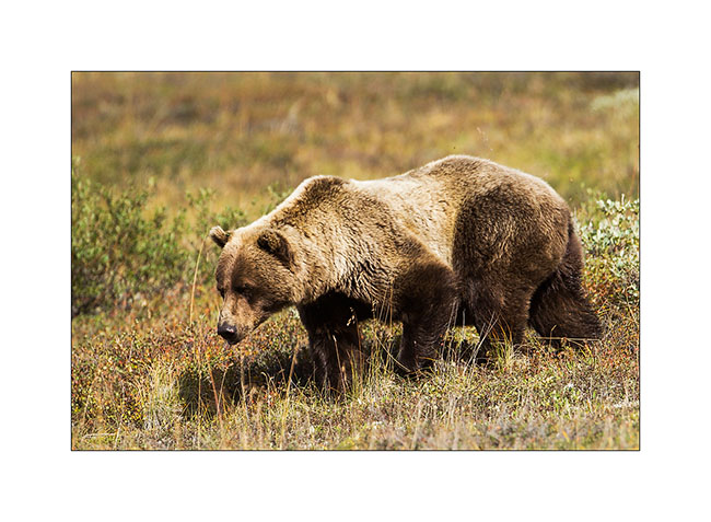
15. And here is a new encounter with an adult grizzly that crams berries on the tundra.
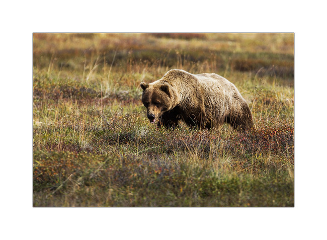
16. When a bush is finished, it moves to the next.
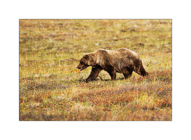
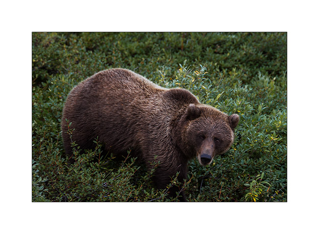
17. This one is almost ready for hibernation, with good fat reserves.
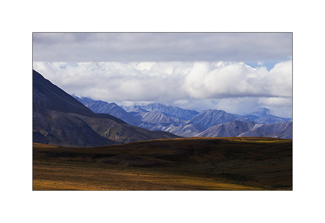
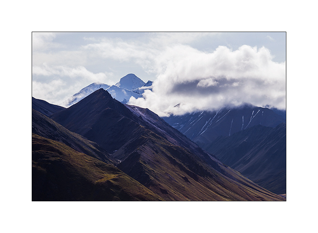
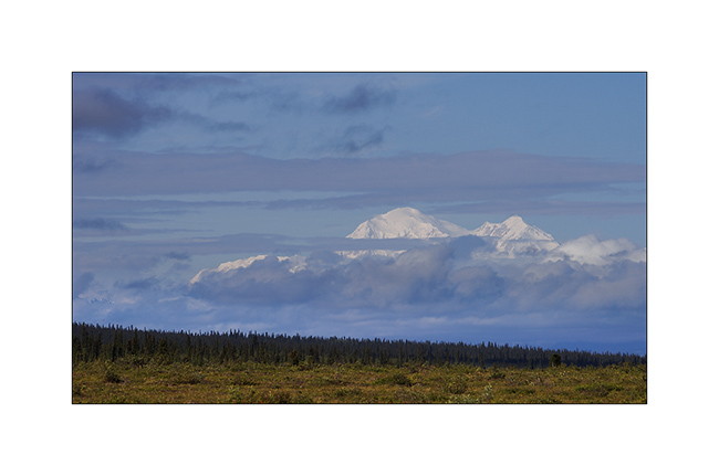
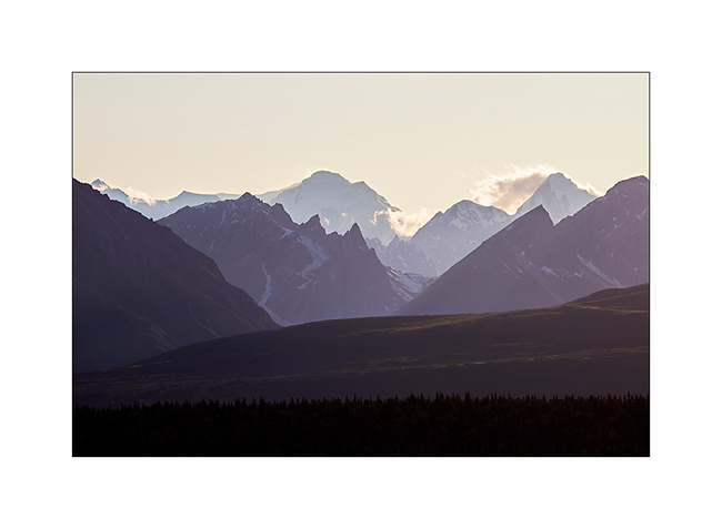
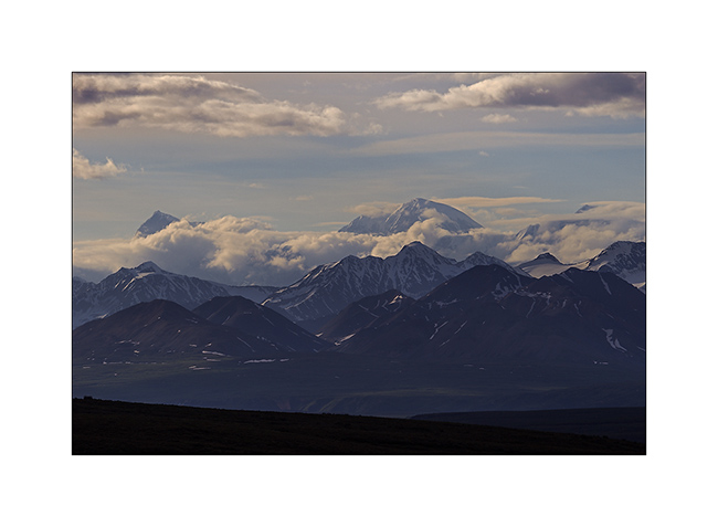
18. That first day, Mount McKinley is hidden in the clouds as over 80% of the year. Its mass is such huge that it creates a microclimate, creating clouds on its flanks even some clear days elsewhere.
19. A lot of moisture remains of yesterday rain but during the bus journey to the end of the road, more than 80 miles from the campground, we will identify several places to hike the next days. I must admit that I was quite frustrated not being able to stop where I wanted for a few tantalizing compositions…
I will relate you our second day in this beautiful park at the next update coming soon… 😉
Manley & Chena Valleys
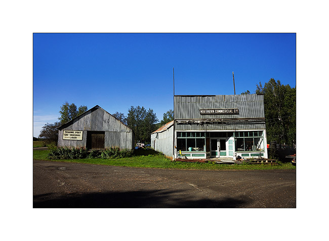
Since the announced weather being bad South, we took the road to the North where the forecast was better and went to visit Manley, a lost hamlet nestled down in a small valley.
1. The storefront of the junkstore, likely…
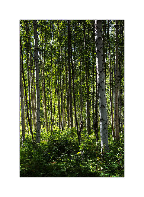
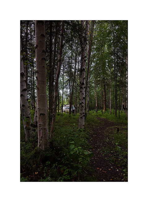
2. Birch and aspen forest are magnificent.
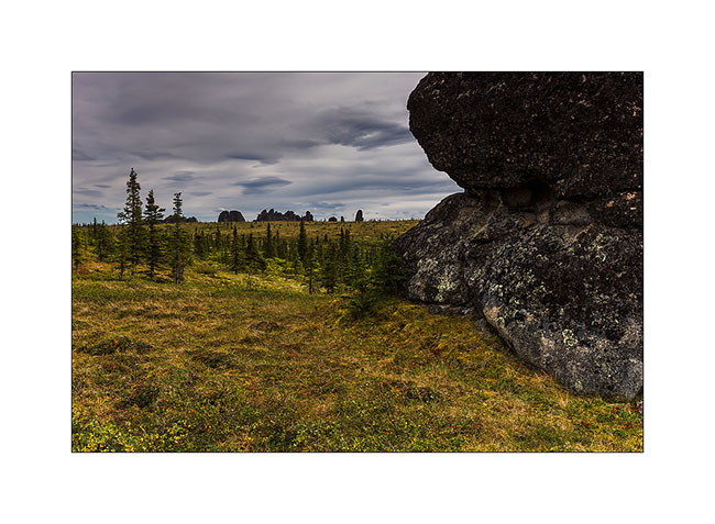
3. As soon as we reach about 2,300 feet elevation, the trees give way to tundra.
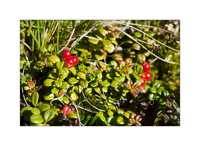
4. In this season, it is covered with berries of all kinds. Here, cranberries.
5. It’s aperitif time!
6. And that seems to please Mino! 😉
7. We will have a beautiful sunset!
8. Grazing light…
9. Game of sunset and rain showers…
10. Last gleams…
11. Humid conditions in the morning.

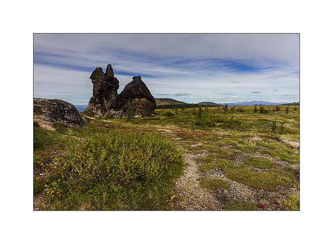
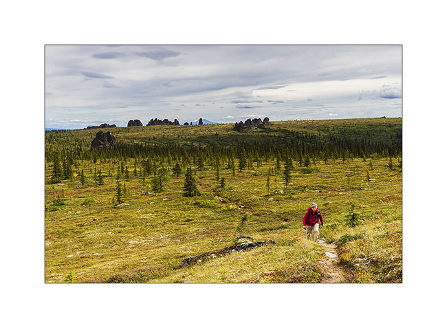
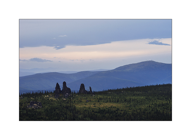
We then moved the Chena Valley there some nice hikes. The first to the Granite Tors, kind of granite towers that slender above the alpine tundra…
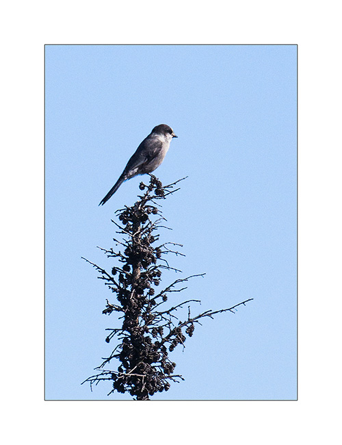
12. A gray jay intrigued by our presence.
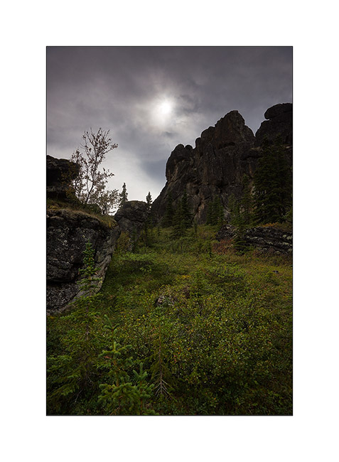
13. After 4 hours up, arrival at Tors.
14.Unfortunately, the light is not with me for pictures…
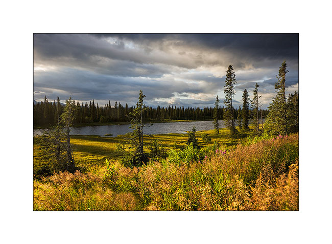
15. Tundra begins to change color, fall approaching.
16. This mountain plateau is beautiful.
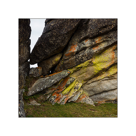
17. Lichens colore granite.
18. Soaring silhouettes…
19. Last look by starting the descent.
20. The sun plays hide and seek.
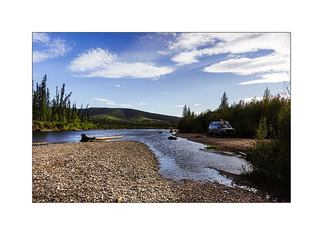
21. Pretty wild camp on the Chena River.
22. The next day, we make a loop in the still green Angel Valley.
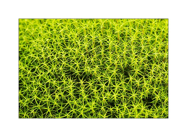
23. Mosses are omnipresent in undergrowth and in the tundra.
24. The way back through the bottom of the valley: 3.5 miles of marsh and a nice bit of fun with wet feet!
25. Just arrived, we leavd again to go picking blueberries. It takes us half an hour to fill two large boxes as there were so many everywhere!
26. Another wild camp near the Chena River.
27. Last rays before the sun hides behind the hills…
We then moved to the Denali National Park where I had booked a campsite for four days, the only way to get to this wild and unspoilt land. To comeng in the next update soon… 😀
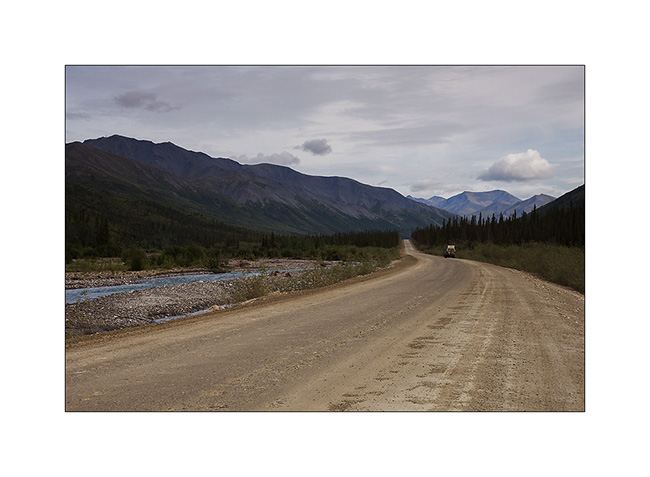
Maclaren Road & Denali Highway
Here is the continuation of our ramble along the Denali HWY.
1. Early light on the Maclaren River.
2. Meandering again…
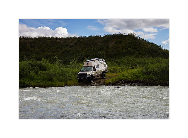
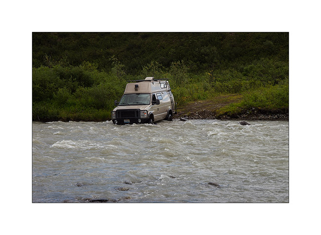
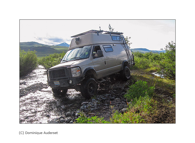
I previously told you that the Maclaren Road is virtually unused and that for good reason: there are some deep enough river crossing to stop many vehicles! But not VivaLaVida. Small sequence of a water crossing where the water reaches the top of the wheels of VLV.
3. Engagings the four-wheel drive because there are large hidden rocks under the turbulent water.
4. The nose in the water!

5. Then the rear. The bumper is quite wet!
6. Arrival on an island in midstream…
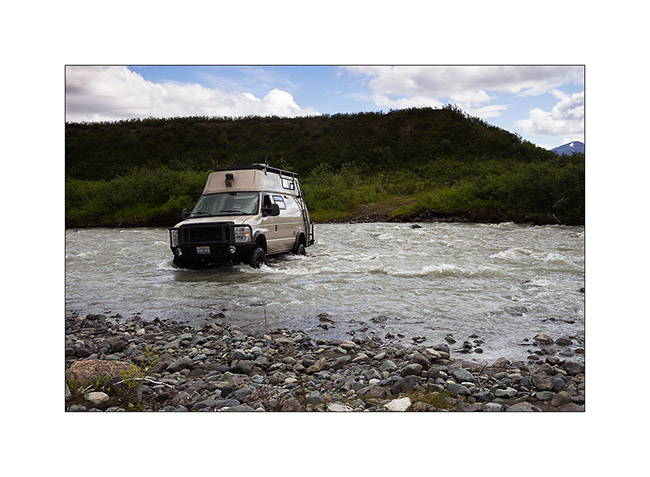
7. … and output. One done!
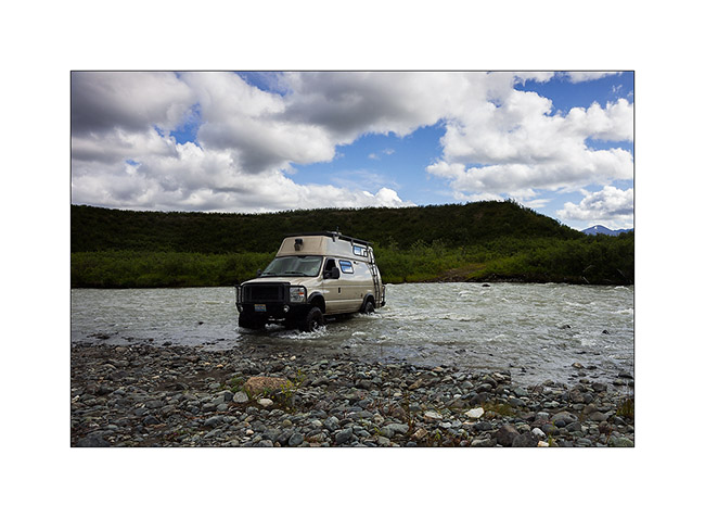
8. A little further, another beaver appropriated the road and turned it into a lake! After removing part of his dam to lower the level of two feet, VLV could cross it.

9. Still further, the road has been totally washed out by a stream.
Reached the end of the road, we had to turn back a little frustrated, shrubs having resumed their rights and destroyed the path leading to the Maclaren Glacier. So we continued to West Denali HWY.
10. The Sultina River, gorgeous in front of Clearwater Mountains.
11. Bonndocking away from the Denali HWY.
12. The sunset over the Alaska Range will be superb.
13. Late-rays on peaks.
14. Last light of sunset on Clearwater Mountains…
15. … and on the Alaska Range.
16. Dressed in red…
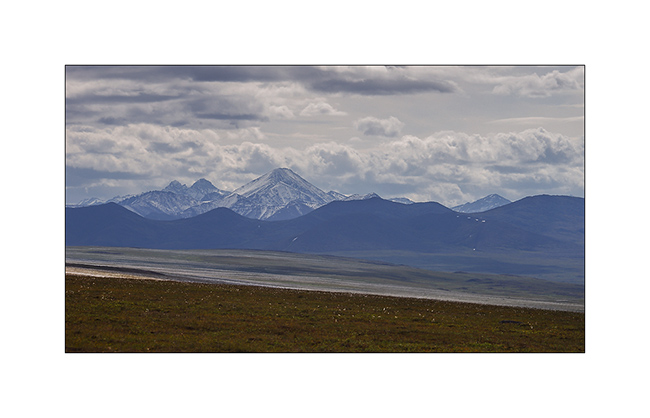
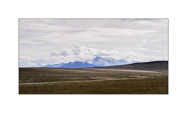
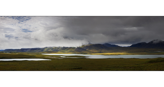
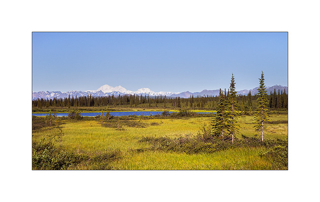
17. Overview of the vastness that surrounds our camp. The Alaska Range is more than 45 miles away…
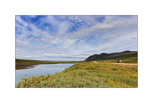
18. Back on the road the next day, discovering beautiful rivers…
19. … and still beautiful small lakes.
20. Cloud diagonal…
21. A hole in the clouds let us see Mount McKinley, over 100 miles away.
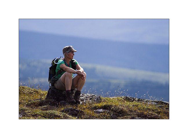
22. Short break during a hike on the Wickersham Dome.
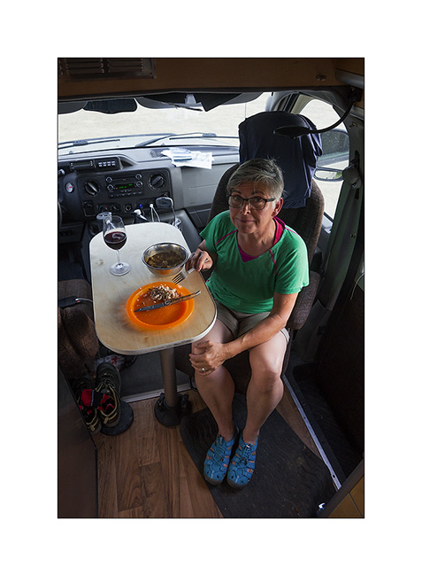
23. The evening is thai dinner: red curry chicken and quinoa, yum!
The weather continuing to be unpredictable, we will remain north a few more days, fingers crossed to have beautiful conditions when we’ll go visit Denali National Park, August 20th to 24th, reservation forces…
Stay tuned for more to come in our stroll in handsome Alaska!
Denali Highway again…
Mino arrivée sans encombre comme prévu le 6 août, je pensais que nous irions vers le sud découvrir la péninsule du Kenai. Les prévisions météos très pluvieuses pour cette région nous ont fait changer d’avis. Nous sommes ainsi retournés au Hatcher Pass d’abord, puis le long de la Denali Highway où le soleil devait être plus présent…
1. Jolies fleurs de la toundra alpine…
2. … où cohabitent quantité de plantes basses…
3. … parfois fleuries.
4. Belle vue depuis un sommet au dessus de notre campement au Hatcher Pass.
5. Le soir suivant, à l’extrémité est de la Denali HWY.
6. Petit lac avec une lumière matinale assez grise…

7. Miroir…
8. En marchant vers un sommet alentours, une jolie fleur bleu pétrole.
9. Depuis en haut, la vue vers le nord est splendide.
10. Quantité de petits lacs parsèment la toundra.
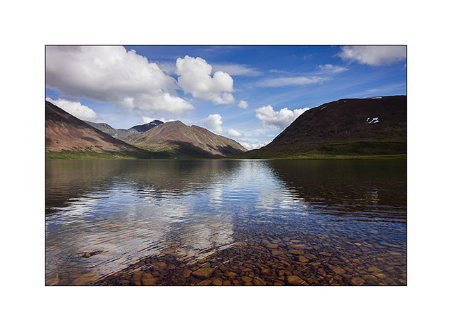
11. Le lendemain, nous marchons plus de trente kilomètres pour découvrir le Sevenmile Lake, retiré et sauvage.

12. Coincé entre deux plis montagneux, il s’étire sur une bonne dizaine de kilomètres.
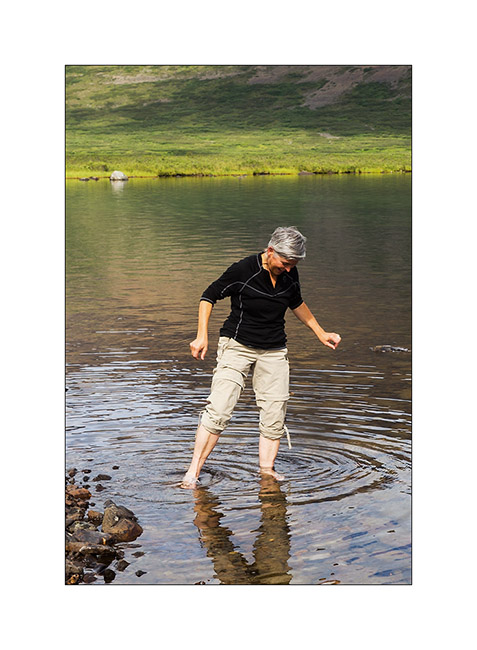
13. Rafraîchissement..! 😉
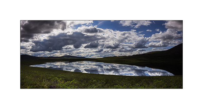
14. Sur le chemin du retour, petit panoramique du Glacier Lake qui joue le miroir à nuages.
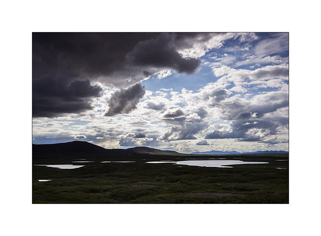
15. Plus loin, quelques autres gouilles sans nom sous un ciel d’averses.
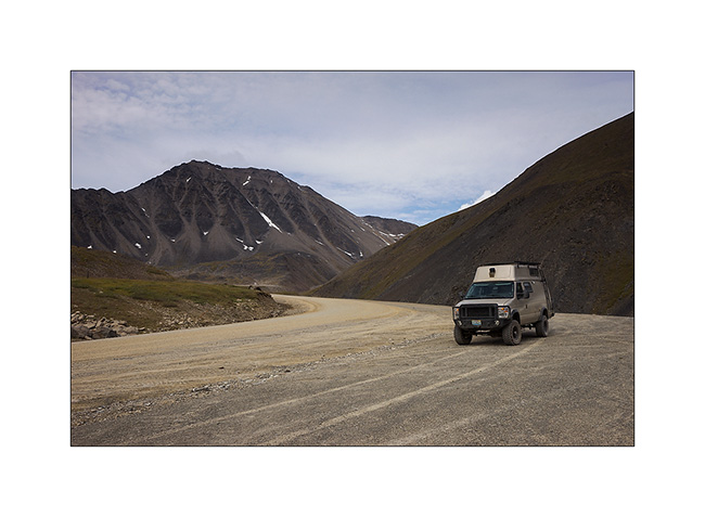
16. VivaLaVida sur la Denali HWY.
17. Une ondée passagère un peu plus loin…
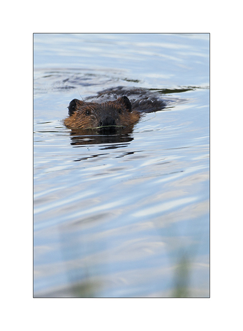
18. En empruntant la Maclaren Road, une piste latérale quasi inutilisée, nous apercevons Monsieur Castor.
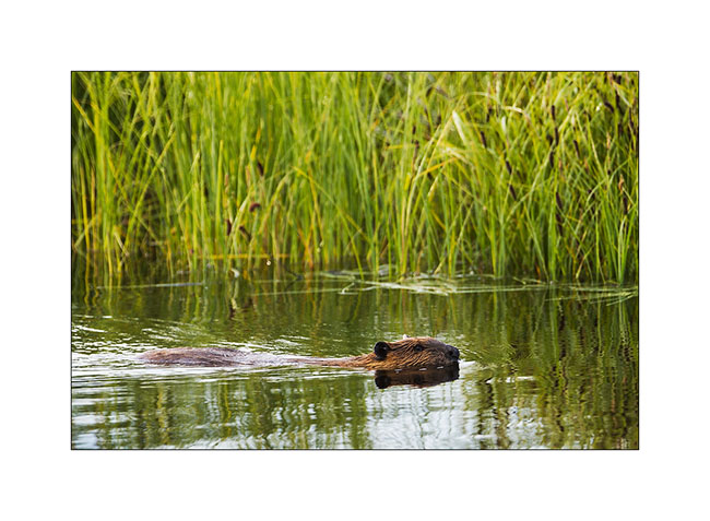
19. Intrigué par la présence de VivaLaVida, il s’approche pour voir si cet intrus en veut à son territoire. Il tapera quelques grands coups de queue pour nous faire comprendre qu’ici, c’est chez lui !
20. Nous trouvons un campement avec une vue plongeante sur la Maclaren River…
21. … qui méandre dans la plaine.
Suite à venir bientôt… 😉
Dalton Highway (3) & Hatcher Pass
I let you at the botom of the Brooke Range heading back South.
1. I’m half mesmerized by the scenes that follow one to the other…
2. … sometimes low “heavy” skies…
3. … sometimes cottony openings…

4. … or larger…
5. … but which close again almost immediately…
6. Where slopes are to steep, there are only screes…
7. High plateau of the Brooke Range, just north of Antigun Pass.
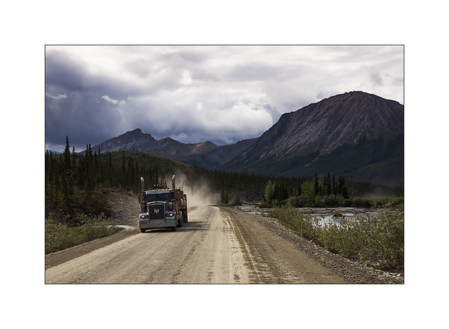
8. Going down the Brooke Range to the south, trucks roll again. They were stoped during the rain, too slippery for them. It must be said that here, hills have impressive percentages! Some also have evocative names: Beaver Slide for example, a 22% slope. VLV drove it down with 4WD 4×4 and not faster than 10 mph in the rain, in six inches of mud… Trucks then stop to wait for the road to dry.
9. The trees gradually reappear on the south side of the Brooke Range…
10. … However, not many yet.
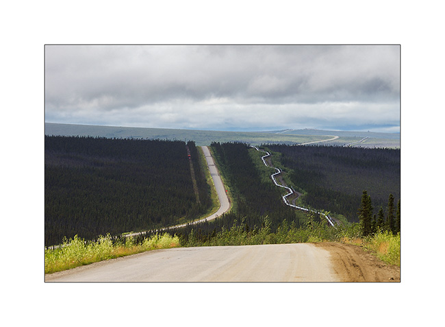
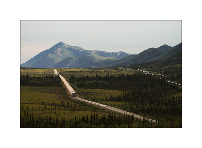
11. The pipeline sometimes accompanies me.
12. Marsh in the taiga.
13. A beautiful rainbow welcomes Vivalavida! 😀
14. But the rain starts soon again.
that’s it for my fast south-north-south through Alaska via the Dalton. A barely arrived that I already want to go back..! 😉 I hope I managed to transcribe some scenes of these beautiful northern landscapes that fascinate me…
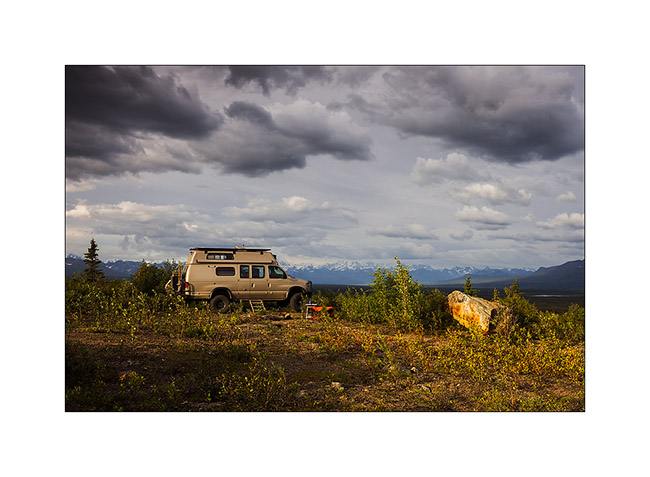
15. On the road to Anchorage, I made a detour to the beautiful Hatcher Pass.
16. Late afternoon from my bivouac.
Starting next update, Mino will keep me company… Updates will be more spaced again further apat, my delay is now caught! 😀
One more time, thank you for your loyalty to read this little blog. 😉
Dalton Highway (2)
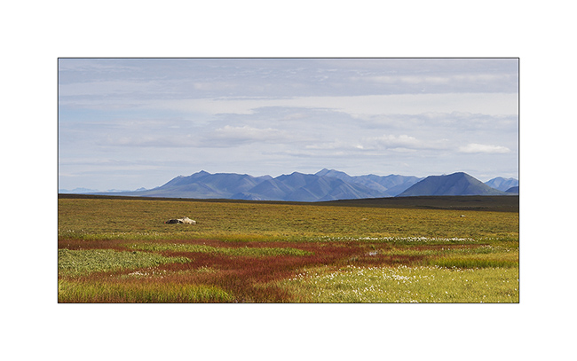
One continued ascent of Vivalavida to “far North” … The Brooke Range crossed, there is only a great plain that slopes gently toward the north to the Beaufort Sea. The more I go North and the more I can feel that winter isn’t gone since long ago…
1. Tundra flowers…
2. … out of sight…
3. Although it doesn’t look on the picture, the road is really rough. Despite its large Wheel traval, VLV didn’t drove a high speed average.
4. I meet from time to time a truck. The windshield ofVLV remembers it with a new large stone impact. It’s gonna be time to replace it once back from Alaska…
5. Colors of the tundra are constantly changing.
6. Water is everywhere, everything is marsh … I imagine how difficult it was for explorers of these regions to progress on such land.
7. This tundra is summer areas for caribous that migrate South during the winter, looking for less snowed areas to find lichens which are their menu.
8. A long time before seeing it, the dust announces the arrival of a vehicle!

9. Far North, a pingo. This hill is created by a “ice bubble” that has developed in the tundra, pushing it upwards.
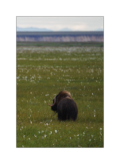
10. I have the chance to see the biggest herbivore of the tundra: a group of muskoxen.
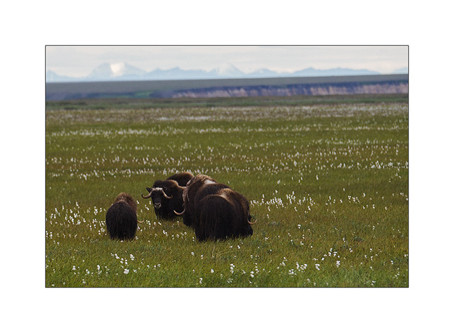
11. What a big animal! I’m not going to scratch his ear… 😉
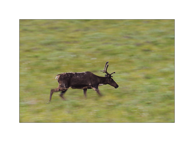
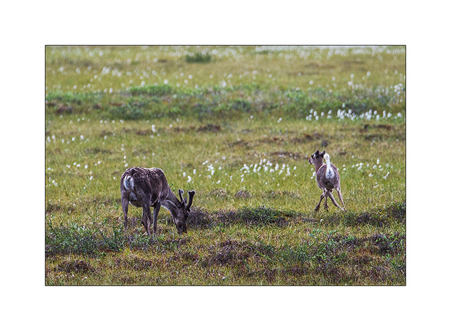
12. A caribou mother and is calf of the year.
Quizz : que veut dire faire la cleupette ? Indice : ça vient du Jura neuchâtelois… Et Pum-Tac, t’as pas le droit de jouer !! 😀
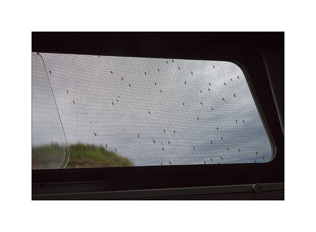
13. My bivouac announces the return of the rain. To try to show you the invasion of mosquitoes in this area: I opened this window for less than 15 seconds! Here, there are five species of these bloodsuckers, with the big tiger mosquito…
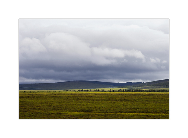
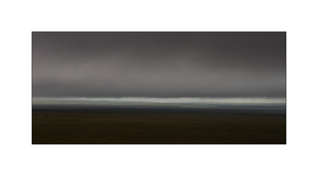
14. Low clouds in the morning, in the rain.
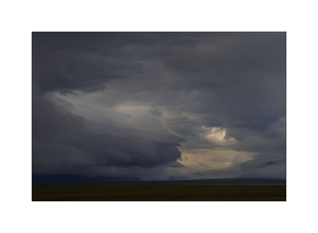
15. While VLV took the road heading South again, clouds are gorgious and impressive.
16. What an ambiance!
17. I think I’m in love with this tundra! 😀
18. VLV is already quite muddy!
19. Rain starts again…
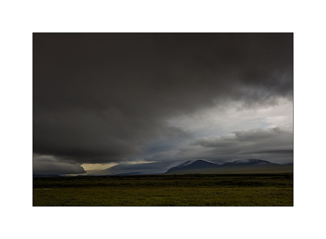
20. Higher in the Brooke Range, the sun makes short appearances.
21. Difficult to show you how VLV was dirty!
To be continued soon… 😉
Fjords, McKinley & Dalton Highway 1…
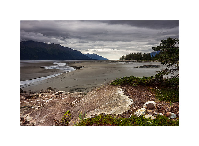
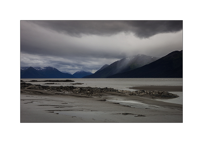
Pending favorable weather conditions to head to the far north, I took advantage of a brief lull to explore a fjord South of Anchorage. Large glacier valley, it was filled with sediment by the surrounding glaciers to the sea level or nearly. At low tide only remains a narrow channel of water in the middle. Each tide begins with a tidal wave. Not very spectacular the day I was there because the moon was in first quarter…
1. Turnagain fjord at almost low tide.
2. The channel that remains at low tide.
3. More than 150 miles away, the mountains of Kodiak.
4. After crossing swamps to seek a new composition… 😉
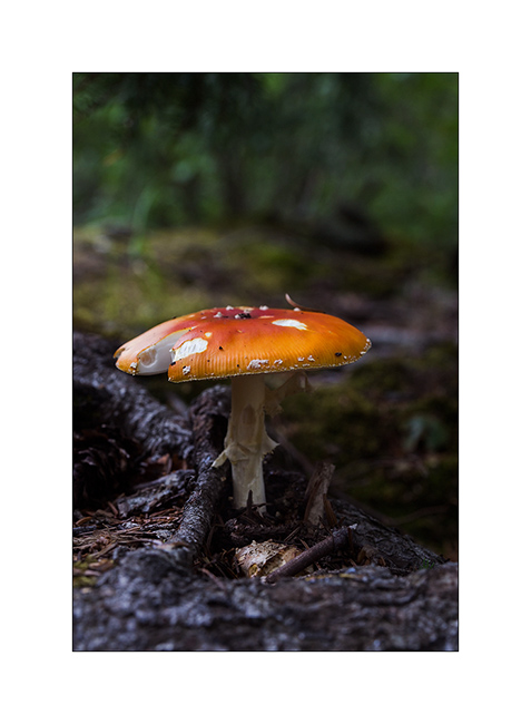
5. A non-edible touch of color in the undergrowth.
6. The lull was short-term…
And finally, after more than three weeks of waiting, thinnings were announced on the far north. Vivalavida hit the road for a 1,800 miles way before the arrival of my friend Mino.
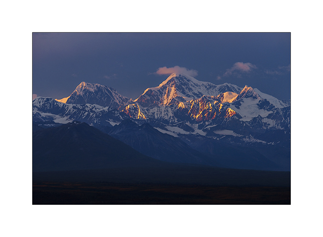
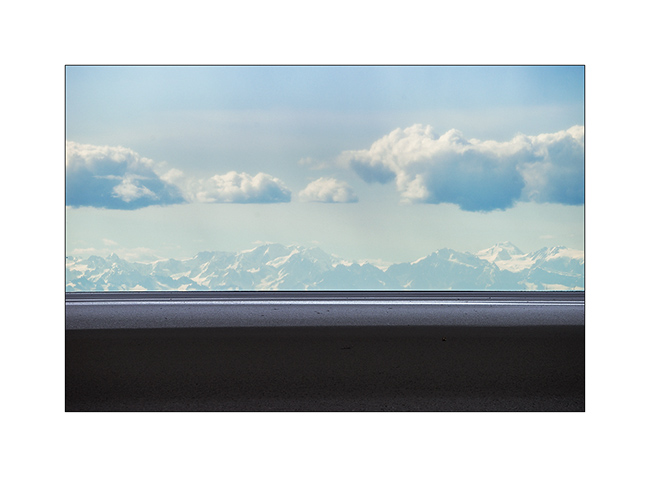
An unexpected opportunity: the beautiful weather allows me to see Mount McKinley, a rare opportunity as it is hidden in the clouds more than 80% of the year. It is the highest peak in North America, more than 20,000 feet elevation. A real giant!
7. I’m unable to transmit how big it is through my pictures but I was there still more than 120 miles away…
8. Here, still more than 50 miles away…
9. End of day on the surrounding mountains…
10. Camp next to a small lake.
11. The next morning, the giant is still visible while I’m more than 70 miles North!
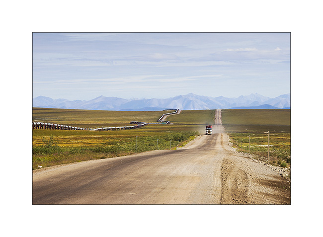
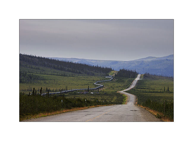
To go to the far north, there is only one path: the Dalton Highway, a 500 miles long road serving Prudhoe Bay and its oil fields. It was built along the Alaskan Pipeline and along almost its entire length. It took only five months and a half in 1976 to 15 teams working in parallel to build it, a performance driven by the short northern summer. It’s a road really committed, thin strip of dirt that goes up and down every hill in impressive percentages, then through the Brooke Range with a top at Antigun Pass, at about 3,400 feet. Only one service at mile 249, about midway. Traveled almost exclusively by large trucks that supply the oil workers, it turns into a quagmire when it rains; Vivalavida will find it out… It stays open all year round since the build of the bridge over the Yukon River.
12. at mile 96, “Finger Mountain” points to the sky in the middle of the tundra.
13. The sky is beautiful but cirrus clouds are already announcing the arrival of the next perturbation.
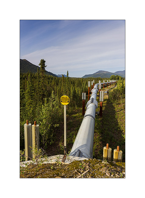
14. The Alaskan Pipeline, also completed in 1976. This is a strategic corridor for the exploitation of northern Alaska oil resources.
15. Its build shows great ingenuity. Each pillar is “free”, only laying on bidirectional Teflon pads. To overcome the expansion created by the magnitude of extreme temperature between winter (-60°F are common and every winter the temperature drops below that!) and summer, each tube is “sleeved free” to the next. Estimation of total theoretical expansion over the entire length would be more than 8 miles from Prudhoe Bay to Valdez terminal, 800 miles south..!
16. An moose grazing aquatic weeds that grow at the bottom of this small lake. They love it!
17. Small lake besides really aesthetic…
18. Everything passes through the Dalton; here, an about 25 feet wide house on this oversize convoy..!
19. Another moose seen from my camp in the morning.
20. Mirror…
21. VivaLaVida on the northern foothills of the Brooke Range.
22. Antigun Pass.
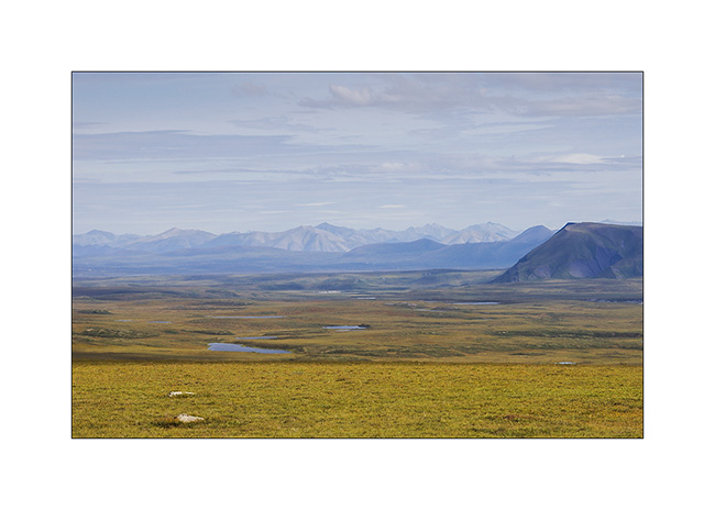
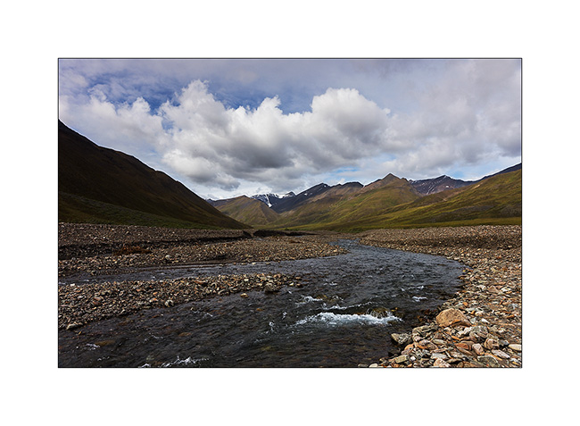
23. The Brooke Range is superb, with beautiful streams that dig valleys.
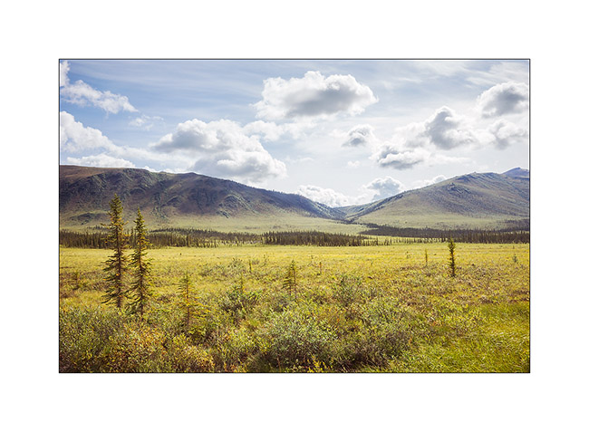
24. No more tree since mile 215. It’s to far North, the climate is too harsh. Only the tundra remains.
25. I take the opportunity of this thinning to “strafe” these moorland landscapes that are probably the ones that attract me the most…
26. VLV looks really small in these landscapes…
27. … dotted with small lakes.

Following of the thinning and return of bad weather in the next update… 😀
Glaciers & McCarthy Road
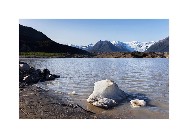
Better weather announced for two days, I drove the McCarthy Road, which sinks for about hundred miles between large ice areas. But on the road from Valdez to get there, I made a stop to walk to the bottom of the Worthington Glacier, easily accessible.
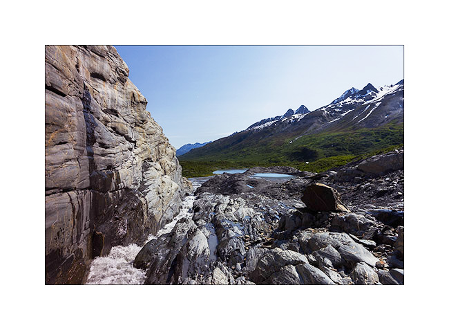
1. Glacial river near Thompson Pass.
2. The glacier tongue is divided in two by a lock of granite.
3. Hiking along the granite.
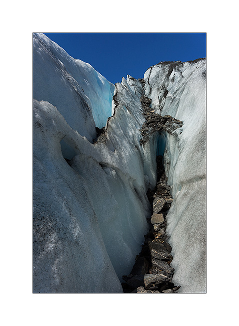
4. The ice also recedes every year here… In 1950, she was almost half a mile below.

5. Ice carved by melting…
6. Going up the McCarthy road, near the confluence of two beautiful rivers…
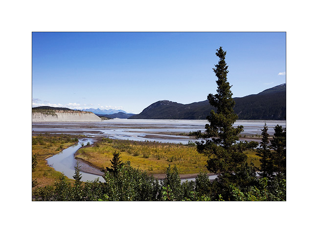
7. The road passes through beautiful landscapes of taiga alternating spruce forests and swamps…
8. … and numerous small lakes.

9. Arrived in McCarthy – on the other side of the river that crosses a footbridge to reach this little city – I slept at the foot of the gigantic Roos Glacier, near the small lake which ended his over 30 miles long tongue.
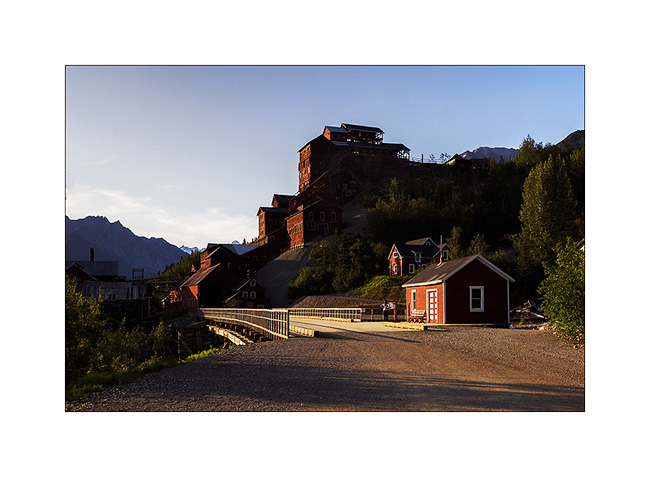
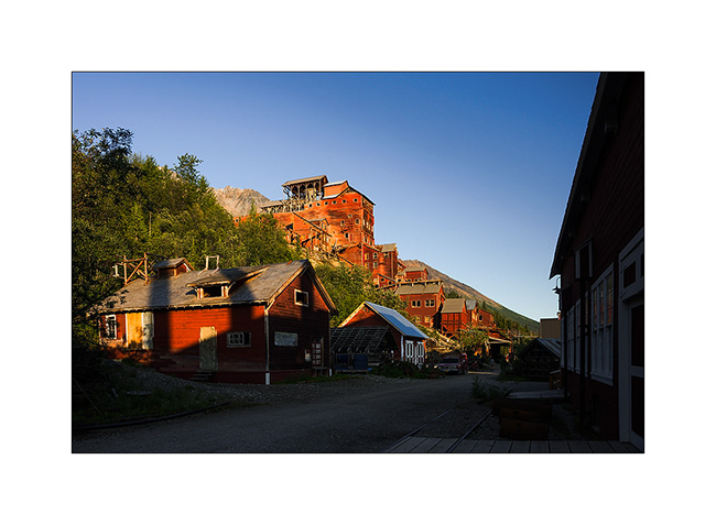
Enjoying the light of late afternoon, I took my Mountain Bike to for explore the Kennicott Mine, one of Alaska’s largest mines operated at the beginning of the last century.
10. This historical heritage is being renovated.
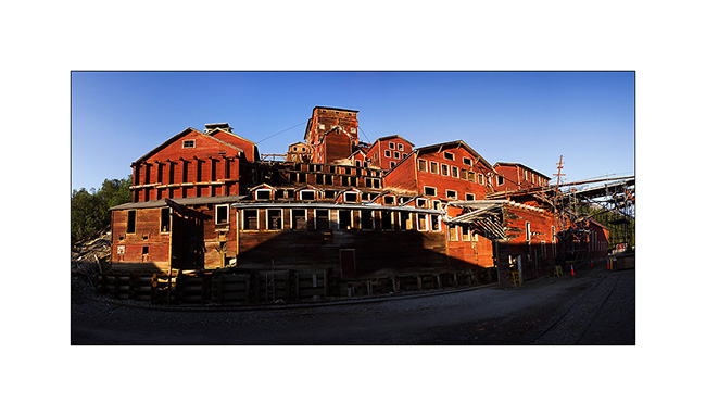
11. The construction of the mill itself is really huge. Even this panoramic of 6 stiiched images don’t manage to show you how large it is.
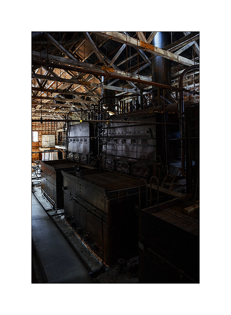
12. Several outbuildings surround it…
13. … whose thermal plant that produced the electricity needed in a real coal power plant.

14. The four huge boilers are impressive!
15. This mine is built on the lateral moraine of Roos Glacier which descends more than 5 miles downstream.
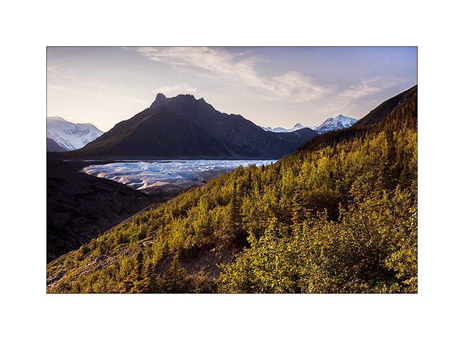
The next day will be a hard day: I decided to go up the glacier as far as I could. I made more than 30 miles, mountain biking first, then hiking. I arrive much only as half of the glacier…
16. A panoramic shot of 8 images in an attempt to show you that immensity. By itself, this glacier is larger than Rhode Island!

17. Back by the McCarthy Road and even there, I founnd a swiss cow!! 😀
18. VivaLaVida would almoast fly..! 😉
19. This is actually a high and narrow bridge over a deep gorge. It was built in 1905 for the railway route which allowed to bring coal to Kennicott Mine and transport gold mined.

20. Beaver lodge in a pond near the road.
21. VivaLaVida approaches his camp of the day…
22. … along a beautiful river… The large icy dome in the background is Mount Wrangell, a dome volcano.
23. … where salmon fishing is going well. There were a dozen of these catch-machine driven by the current.
24. I still see the large dome that gives rise to Roos Glacier, more than 60 miles as the crow flies.

25. The Sunset was beautiful, the bad weather coming again and bringing some clouds…
The rain will follow me again during several days. So I headed to Anchorage for some maintenance work on VLV and to prepare the last updates before the arrival of Mino who’ll have landed when you’ll discover these lines. 😉
East Denali HighWay & Valdez (AK)
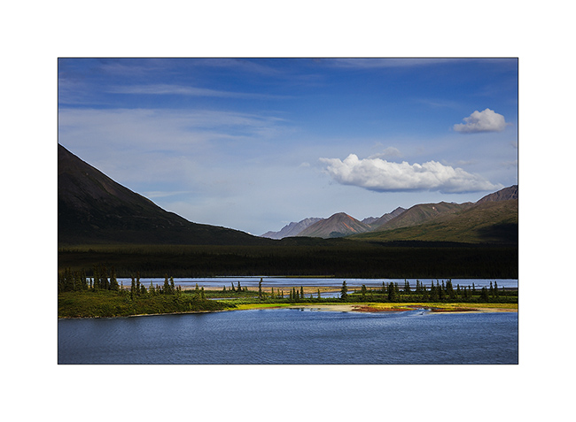
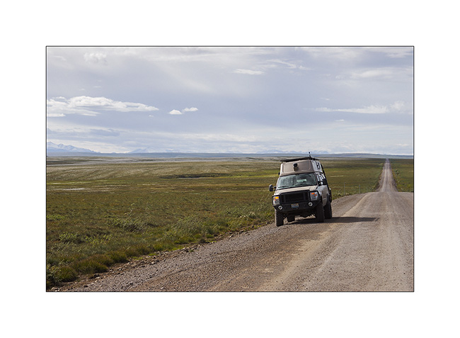
The Denali Highway is definitely not a highway, it was in poor condition and it took me almost the full day to drive the seventy remaining miles of dirt.
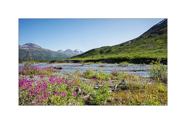
1. Glacial plains make the rivers meander.
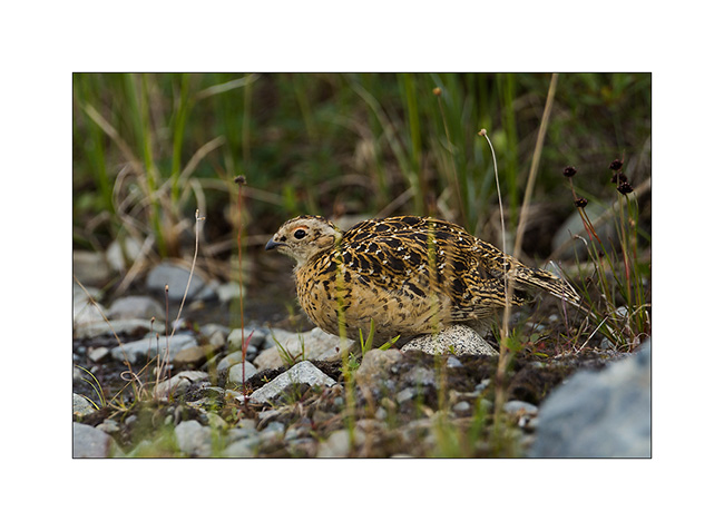
2. During my lunch stop, I first saw the mother ptarmigan…
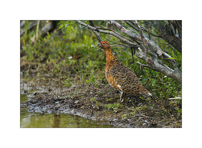
3. … then some of its progeny. Two months after birth, they have grown and are about half their adult size.
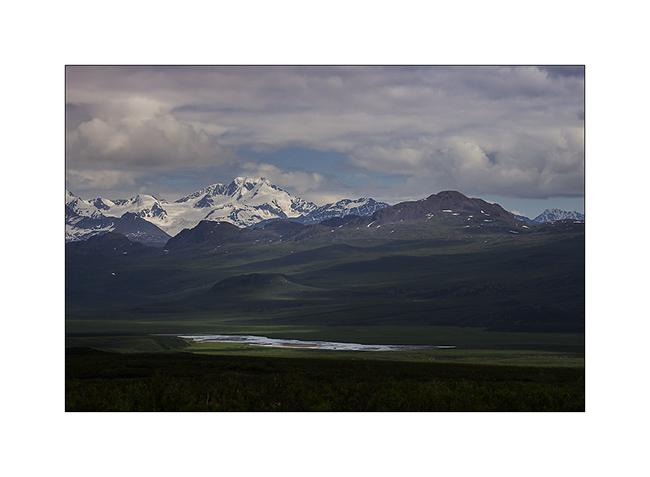
4. Wide glacial valleys offer great views.
5. Getaway on a side track.
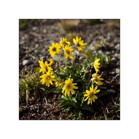
6. There to, there is nice flowers.
7. Near the East Junction, the view opens on the Alaska Range.

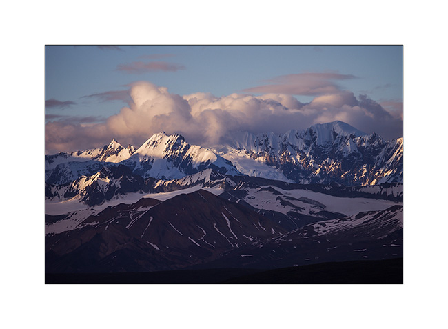
8. A weather opening allows me to see off one of the highest mountains in that range, Mount Hayes, which rises to over 13,800 feet above sea level.
9. Light patch…
10. Clouds arrive…
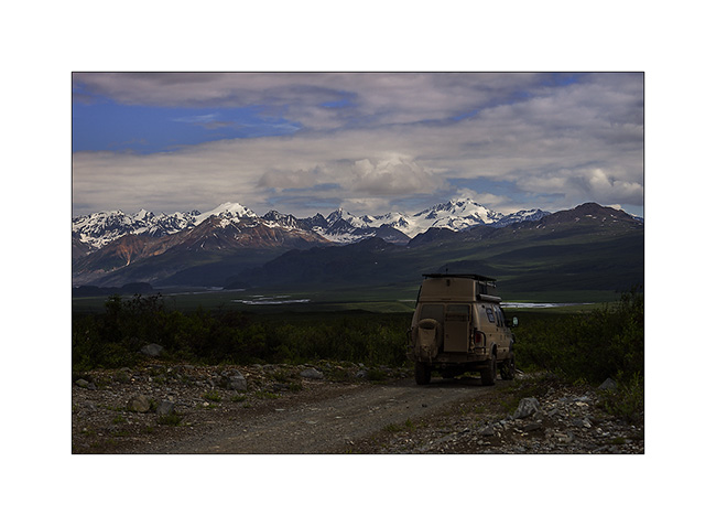
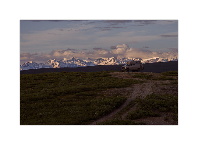
11. Boondocking on a hill in the tundra.
12. Given the bad weather announced, I continued the road to Valdez. The road ends here!
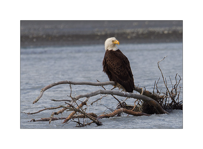
13. The mouth of Valdez Glacier Stream is a real birdhouse for bald eagles! I observed more than thirty of those, awesome! Here is one that comes…
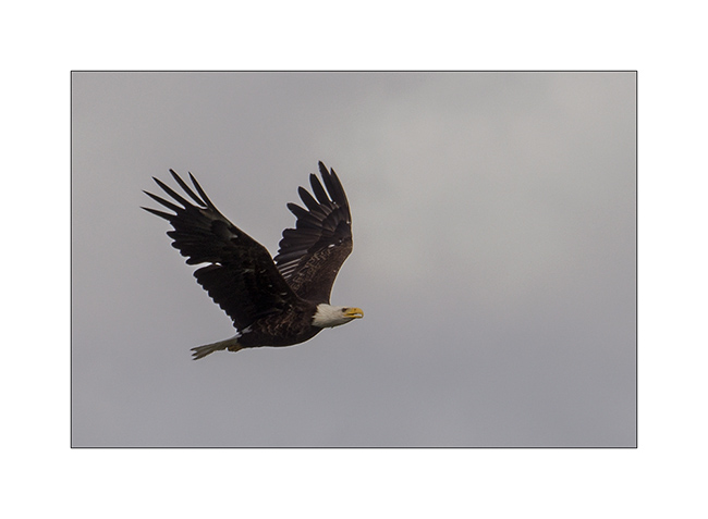
14. … and lands not too far on a hunting spot. I crawled 300 yards in the mud to get closer… 😀
15. Returning, I see fresh grizzly tracks.
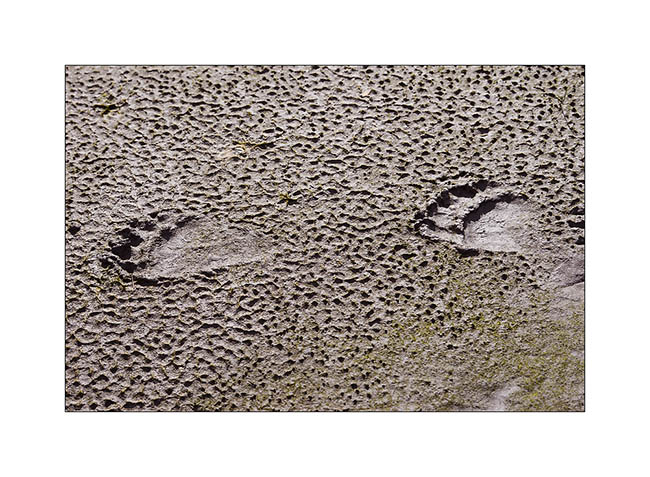
I talked to a local who stopped to see VivaLaVida and he tells me that this place is frequented by many grizzlies, especially late in the day for a good reason. This place is close to a salmon hatchery. And as you probably know, after a 4-year cycle, to reproduce, salmons return to their birthplace. Here, they try to go upstream in a nearby river but are blocked by a waterfall and remains between the bay and the waterfall. While this is only the beginning of the breeding season, there were already thousands of salmons crowded into this little river and bears have understood that it’s easy to catch food up here to make their required reserves for hibernation.
So I decided to wait a moment and I was lucky… 😉
16. A male probably 4-5 years old arrived on the scene and catched a first salmon without waiting!
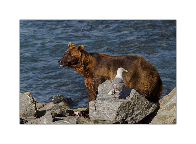
17. He repeated the operation 6-7 times, not leaving much to the seagulls quickly ready to steal the remains. It was funny to see the bear trying to scare thoses when they came to close. 😀
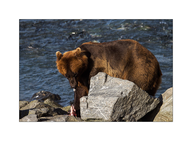
18. I’m only about 12 yards away and enjoy the spectacle!

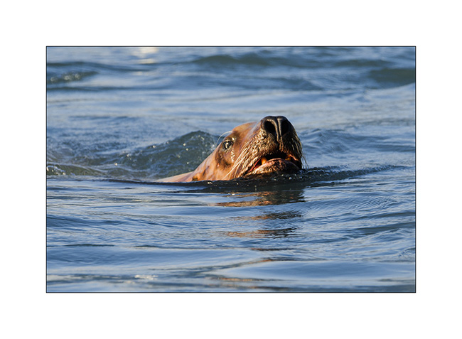
19.
The grizzly is not the only one to take advantage of the opportunity; This sea lion is also hunting. He catched about 12 salmons in about half an hour!
20. Eyes still dazzled by this show, I went to sleep at the bottom of the glacier.
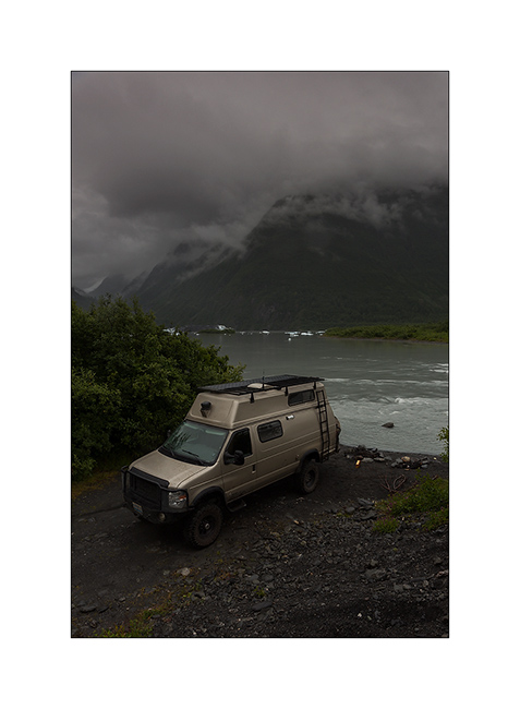
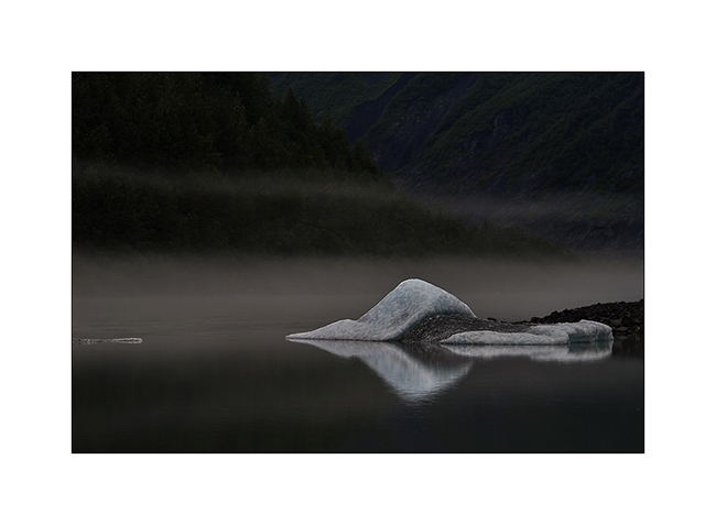
21. The rain fell again, moisture was probably at 100%, giving an atmosphere of rainforest…
22. To complete this update, a small iceberg rather aesthetic in layers of mist…
Way back from Valdez and McCarthy Road to come in a few days.
Thank you again to follow us with as much fidelity! 😉
 D5 Creation