Tennessee @en
now browsing by category
The crossing to the east continues…
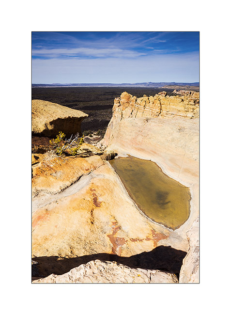
Still in New Mexico, I crossed the El Malpais area – “the bad country” – a volcanic site that spread a large lava flow approx. 3,000 years ago…
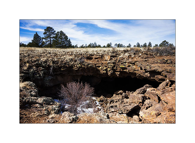
1. A lava tunnel revealed by the partial collapse of its vault. Its access was closed to protect bats that overwinter there.
2. View the gigantic lava flow from El Malpais, an Hawaiian type volcano. It covers nearly 35 miles.
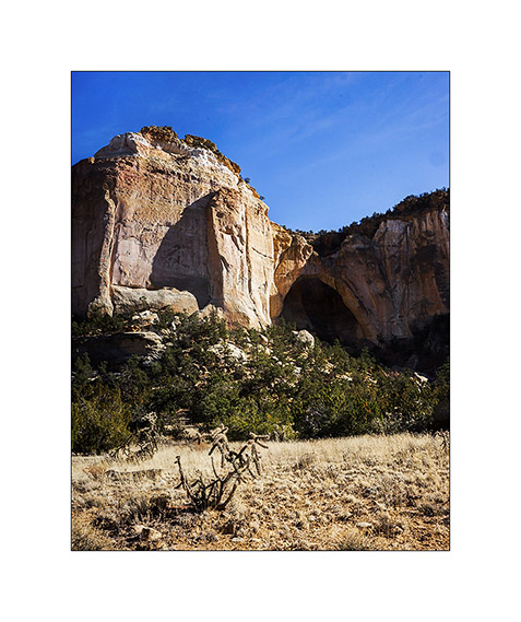
3. La Ventana Arch, one of the largest natural arch in New Mexico.
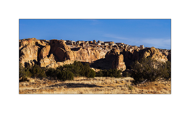
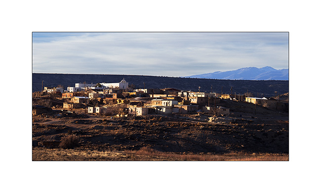
4. The Pueblo Acoma on a hill of sandstone. I have not been allowed to visit it, the access being restricted, paying and … suspended for the winter!
5. Further, the Pueblo Laguna Library and its Hispanic-style church.
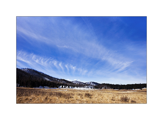
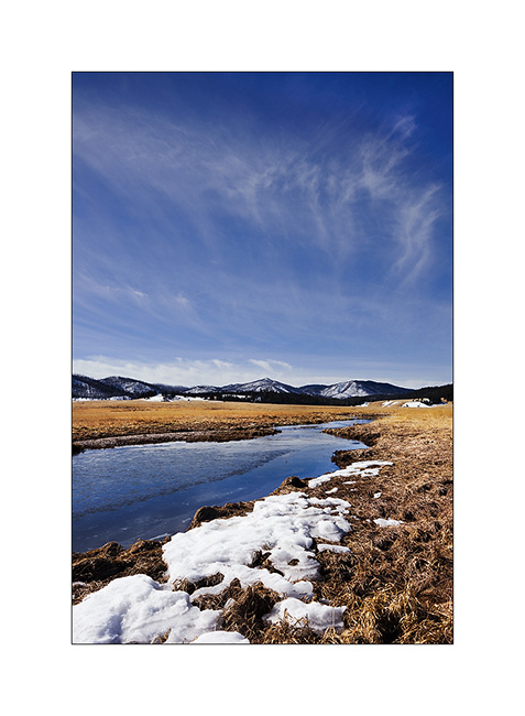
6. The next morning I woke up on the Valdez Caldera, remains of a giant volcano that collapsed on itself. This caldera is 14 miles in diameter!
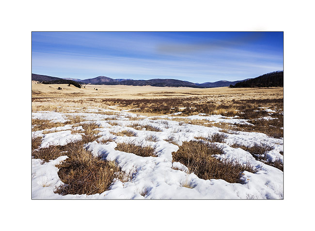
7. Beautiful sky while there is still a few snow at over 7,000 feet. Yet, for 5-6 years, the place doesn’t receive the usual 6-10 feet snow…
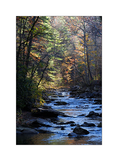
8. East Fork River.
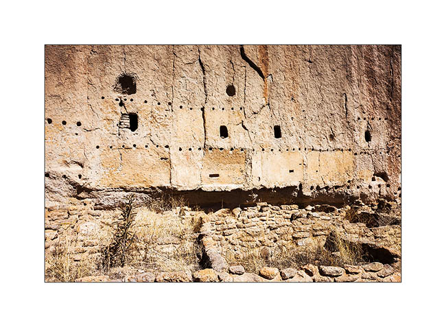
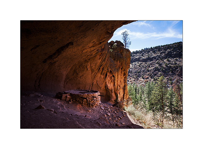
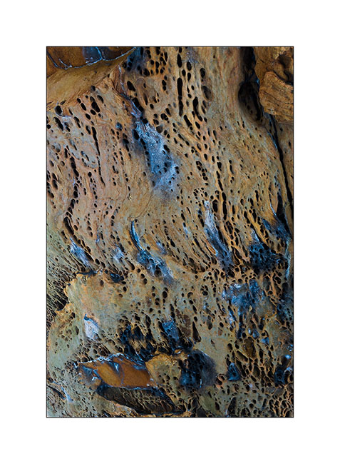
9. By collapsing, the volcano has poured an incredible amount of tuff nearly 55 miles around, sometimes more than 600 feet thick. It’s in a canyon carved in the tuff that are the Bandelier Dwellings. In addition to the cavities in the tuff, the Indian built houses at the foot of the walls. Note the horizontal rows of holes that allowed to fix the frames on the wall.
10. Natural cavities.
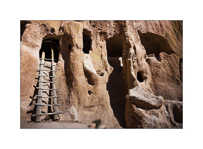
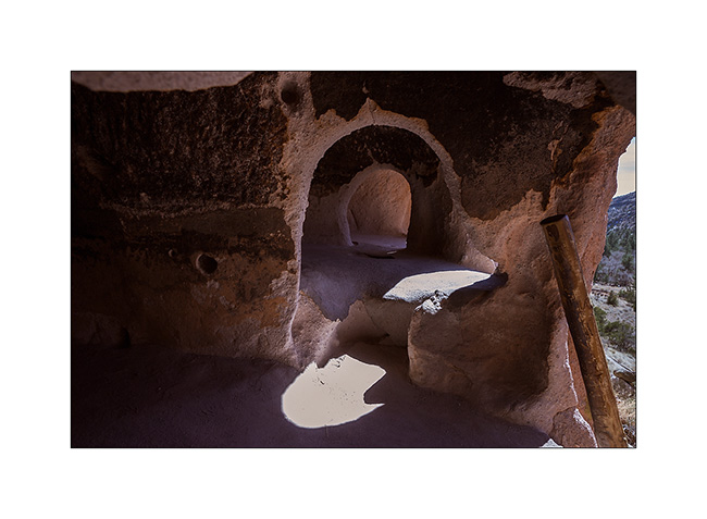
11. They were connected by passages duged into the tuff. Note soot that still covers the vaults.
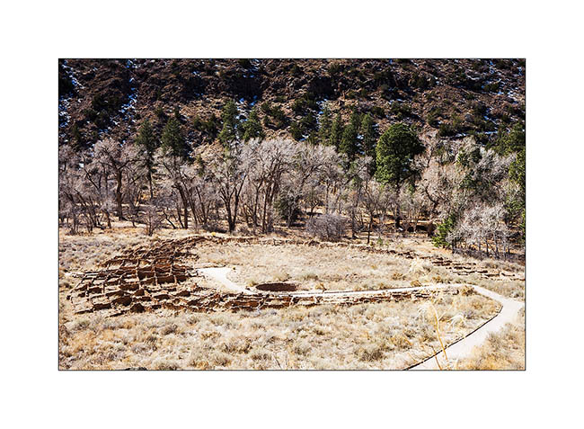
12. At the bottom of the canyon, the ruins of an impressive semi-circular pueblo.
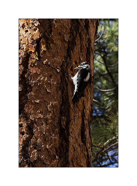
13. A local resident who allowed me to approach, which is rare for a woodpecker.
Further upstream, there is a kiva – a room for rituals and ceremonies – found almost intact under a large overhang; only the roof was rebuilt there sixty years ago. It is 140 feet above the canyon and you have to climb on long ladders to get there.
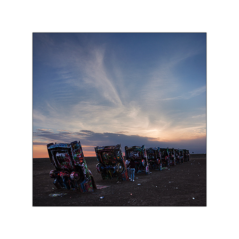
15. Detour in Oklahoma to discover the original work of an artistic collective: 10 old cars planted in the ground from the front…
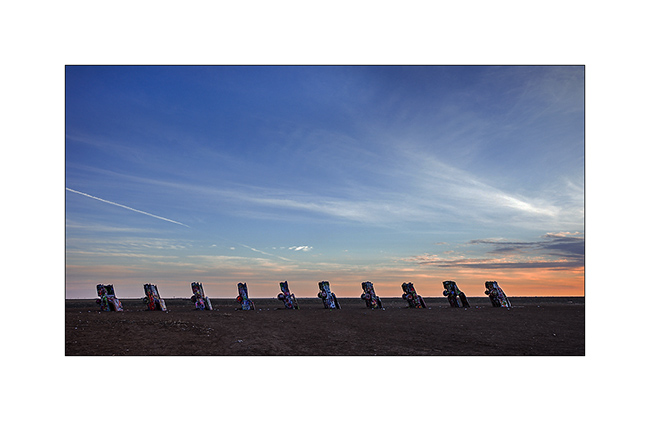
16. Quite original, it must be said. Too bad, I arrived a little late, the light wasn’t great…
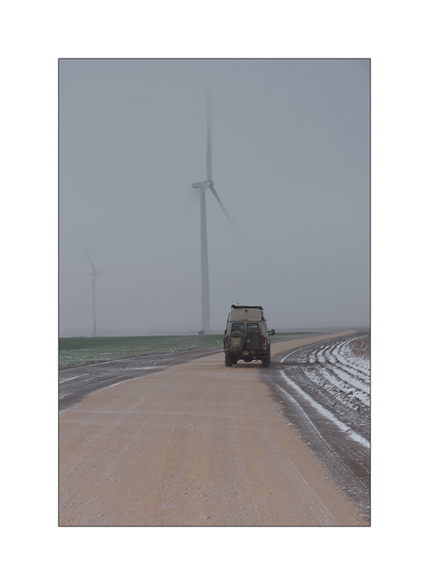
17. Winter wake up in the middle of a Wind mill field in which I spent the night. It was blowing a strong blizzard (announced between 50 and 60 mph!) and actual temperature was 15F…
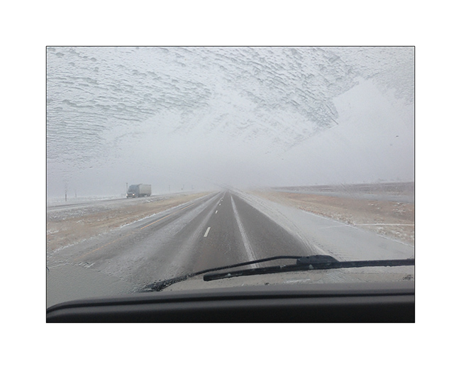
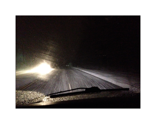
18. Hellish road conditions! Freeway was just a carpet of ice, the few inches of snow fell during the night was packed with trucks before freezing. VivaLaVida traveled almost 450 miles in these conditions, a little tiring for her driver…
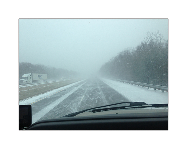
19. The next day in Arkansas, it was not much better: snowed all day to more than 400 miles. I stopped counting the vehicles out of the road at 50…
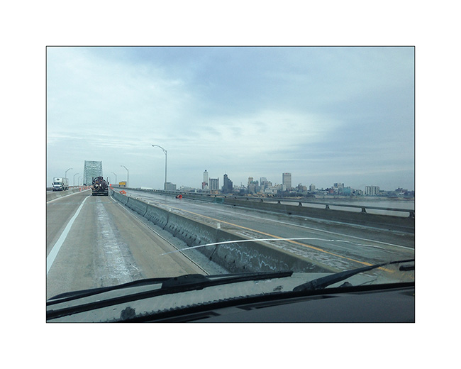
20. It improved a bit as I crossed the Mississippi River in Memphis TN.
Without showing it that much, this update relates to a three-day trip and more than 1,300 miles in very difficult conditions. After a stop at Maryville TN to eat with a couple of friends, I found the snow back on the road to cross the Appalachians but arrived in the region of Asheville safely.
I’ll be on the departure to Switzerland when you’ll discover these lines…
This blog will then be quiet for a few weeks … but will continue to relate VivaLaVida’s journey from early May no doubt!
Thank you for following this journey, I’m always very pleased to read your comments. 😉
Tennessee (4 and end)
Here it is, the new Title of Vivalavida arrived! So I’m back to Fletcher to pass technical inspection by the seller – Chris in this case – necessary for subsequent registration. I will then be able to go to Georgia where the following steps are still to be done: get proof of residence, a certificate stating that I am not “eligible” for social security, obtain my Georgian driving lisence (it will be easier since I already have a US driver license) and finally register VLV Under my name. Still many steps, hoping they will not be as long as the previous…
I take this opportunity to update the blog with some of the last images brought from Tennessee. I left you at the Big South Fork …
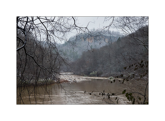
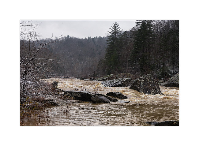
The next morning, the snow had whited the country and the clouds were very low. I went to see the Angel Falls on the Big South Fork River, flooded after two days of almost uninterrupted heavy rains. A beautiful wild atmosphere …
I saw two pileated woodpecker, too fearful that I could photograph without a tent.
1) Flooded Big South Fork River

3) driftwood…
4) Angel Falls transformed in powerful rapids…
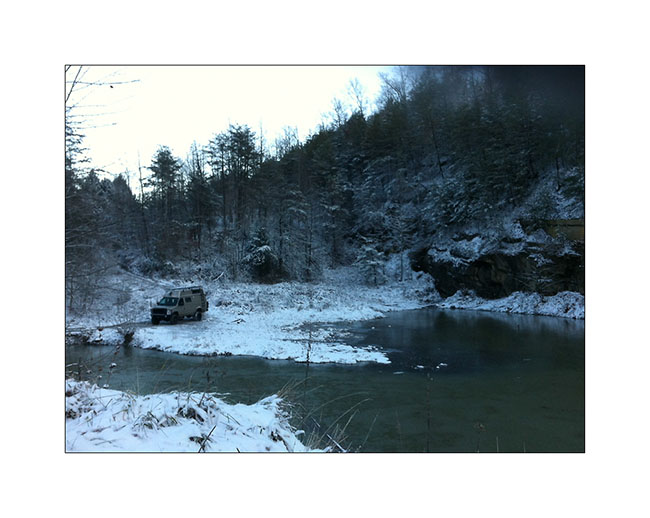
I then did a bit of road eastward to explore two beautiful natural arches the next day. Arrived when the night was well fallen, I declined to pursue the trail marked on the map which was washed out and completely frozen by the ambient 16°. I stopped near a small lake to spend a night.
The next day, I was somehow baptized by that winter! 😉
First by a really frosty morning: 7° to the outside thermometer, 27° to Vivalavida’s dash thermometer, behind the front curtain. First night that the heater, set to 40° to protect the bowels from freezing, has started at 3.30 am.
5) Morning at my campsite with 7°: cold! (taken with my iPhone…)
In the daylight, I was able to continue the snowy trail and I stopped at the hiking trailhead. After having equipped myself for “cold” weather, with my waterproof pants, my jacket on three polar layers, I started the trail. After a little more than a mile, I discovered a river to cross! Not very big, probably 20-25 feets wide, but deep enough for the water to enter in my shoes, which was excluded given the temperature. So, no other choice than taking my shoes off and cross barefoot! believe me, it was an exhilarating experience! 😀 A beautiful baptism, isn’t it?
After walking a few feets in the snow to dry my feet, I puted socks and shoes again and had good warm feet for the whole hike! A little more than one hour later, I discovered Primroy Arch, beautiful in that snowy day. I don’t know if it’s because of its name but it is unfortunately widely tagged with lovers names … A shame for such a great natural monument even if the symbol is pretty…
6) Primeroy Arch
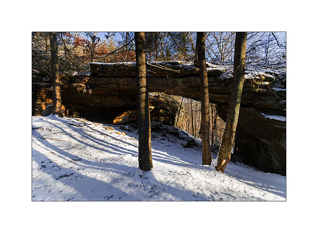
7) Primeroy Arch (2)
8) Thanksgiving decoration..! 😉
9) Pretty colors under the arch, portion that taggers didn’t reach…
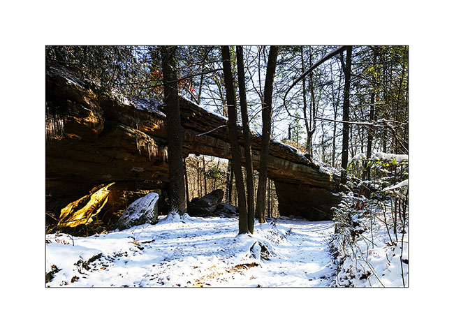
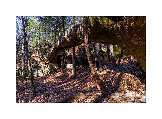
I continued the hike to the beautiful “Drive’in Triple Arch”, rather sought my way through the forest, which was a little difficult to find with the recently fallen snow…
10) do you see the trail..?
11) end there..? 🙂
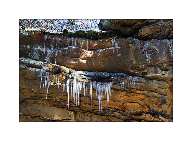
In fact, it was more a GPS navigation than anything else .. I also had some trouble finding the arch nestled at the bottom of a long cliff, or more exactly to access it. I made several attempts to down the cliff of about hundred feet, finding me every time over a impassable sheer. In the end, I made a detour of nearly an hour to reach the end of this long cliff, then walk down of it the other way. I discovered this beautiful arch which is actually a double arch. It is a good example of how these arches appear: water seeps into cracks of the cliff and the frost breaks the rock above, the keystone of the arch preventing it from breaking below. Ice present that day highlight water infiltration.
12) Dirve’in triple Arch
13) ice stalagmites under the arch…
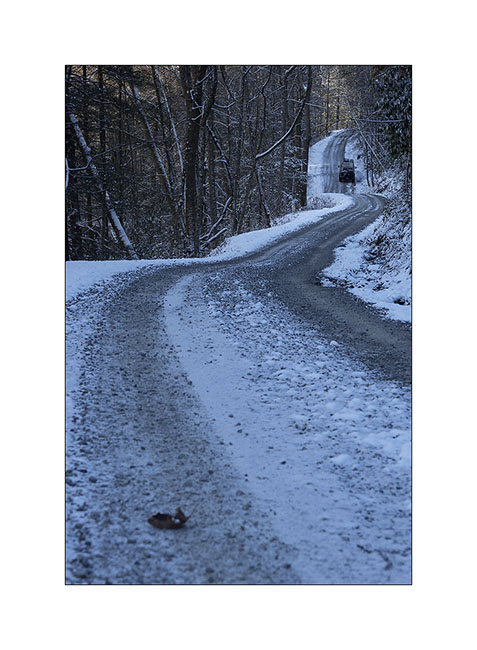
The return went without particular problem – in recrossing the river of course – and when I found Vivalavida at about 3PM back, the roads were still frozen by 26° ambiance…
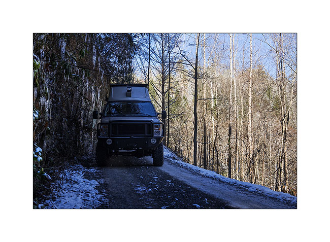
14) winter on the raos…
15) narrow passage…
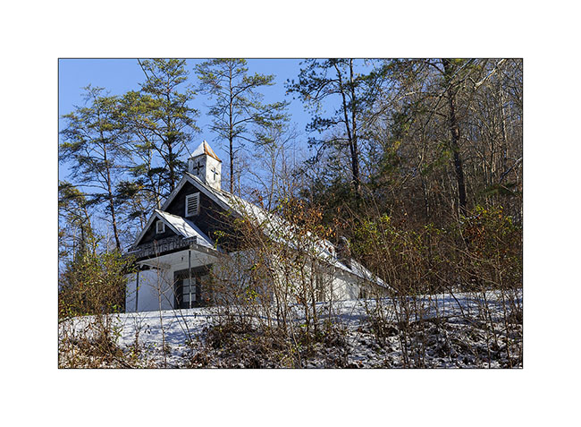
16) small Church on the road
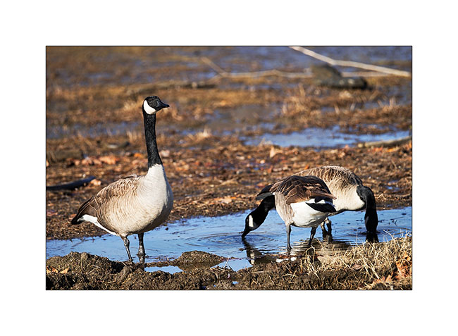
I then spent two days next to an artificial lake, enjoying watching the birds. First, a large group of Canadian Geese, about 80 individuals. What a noise they make! 😀
17) Canadian Goose
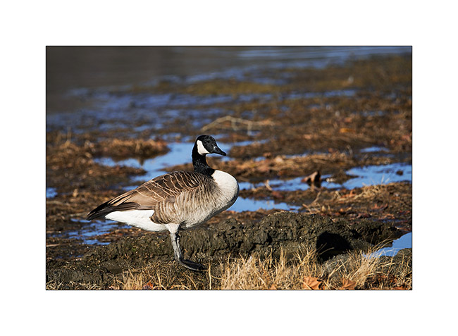
18) this was a little worried about my presence…
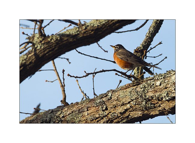
19) an American robin
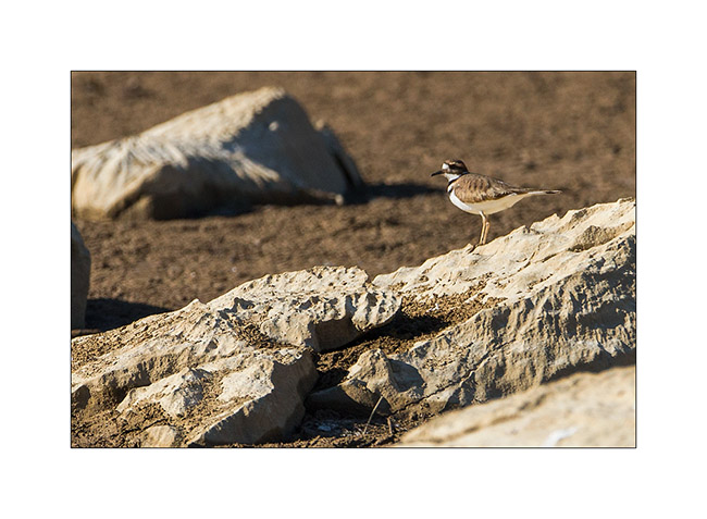
20) a plower killdeer, quite difficult to approach…
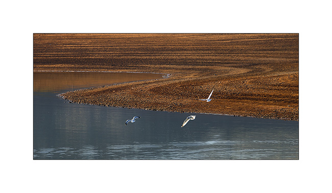
21) seagulls..
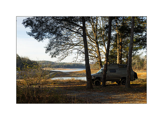
22) my campsite thèses two days. Nice, isn’t it?
At the announcement of the arrival of the Title, I took the road back to North Carolina, stopping to visit some relics of the past…
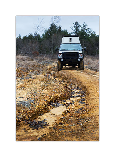
23) muddy road…
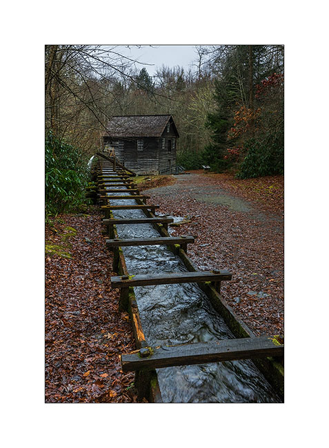
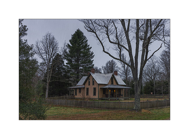
24) One of the first l’un des premiers weight-mill, a column of water driving a turbine. This one was built in late 19th century.
25) old preserved house, a relic of the 19th century (1860 for it)
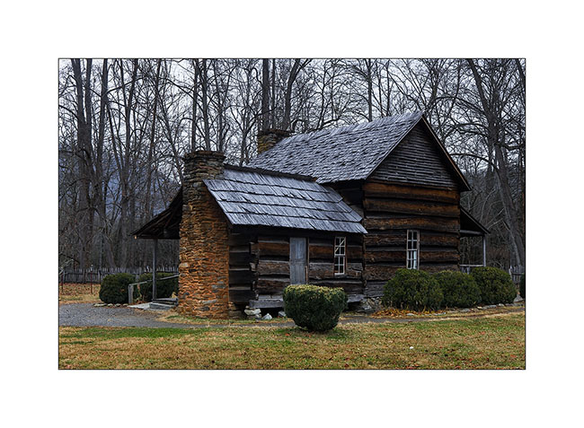
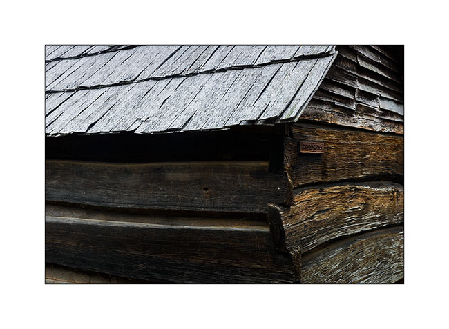
26) construction details…
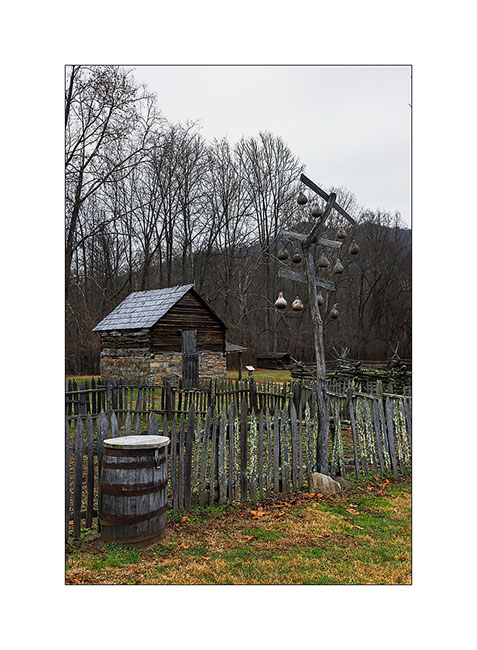
27) traditional barriers; durable and which don’t need nails to build..!

28) traditional birdhouses made in calabashes and an apples house in the background.
29) And finally, a photo taken by Eric during our meeting in Maryville. It was he who advised me to visit the Big South Fork, many thanks to him!
Still in Tennessee
Here is the following of my Tennesse trip., with a poor light because of the not very pleasant weather.
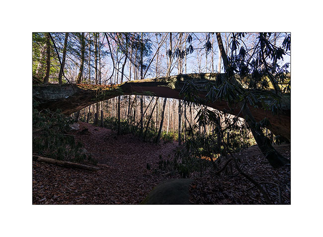
I went to Kentucky to visit a natural Bridge, just North of the Big South Fork area.
1) Natural Bridge
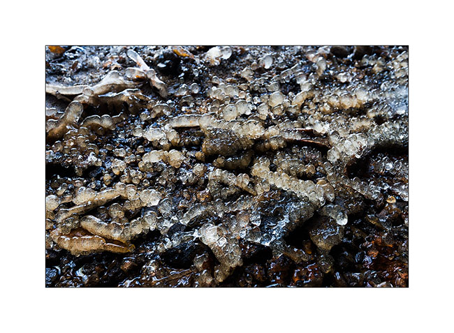
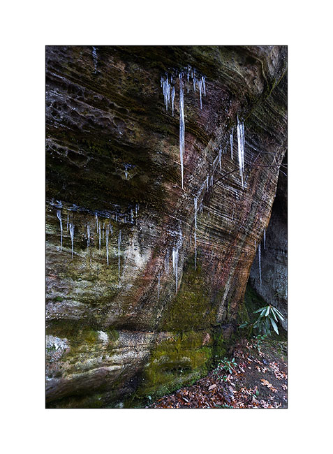
2) Temp was about 16°, difficult to show without these icy formations!
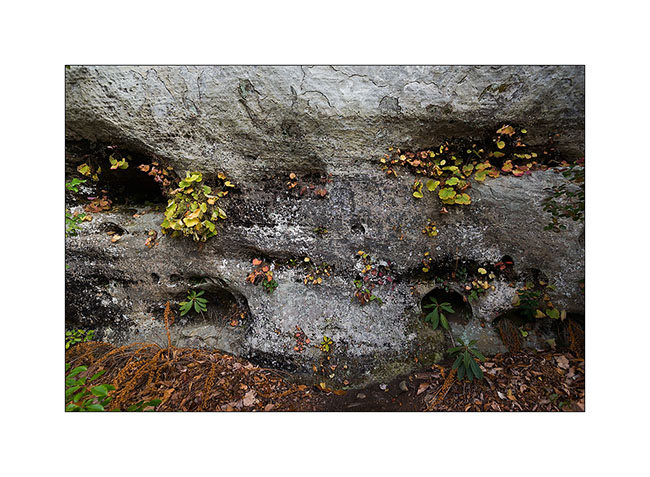
3) Natural hanging gardens…
4) Along the road, I sometime see nice traces of the past…
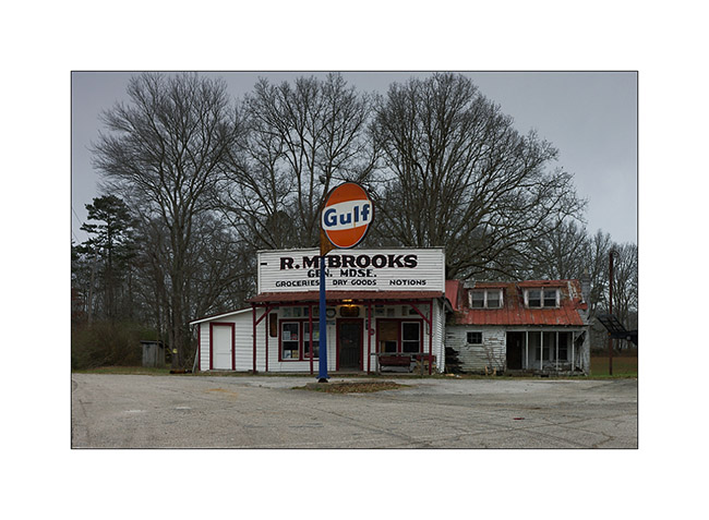
5) Small house rebuilt as it was in 1850…
The next night, Vivalavida was entitled to his snow baptism. I woke up Under the rain by 29° and went to discover Northrup Falls, probably one of the falls that are my favorite so far.
6) Freezing rain…
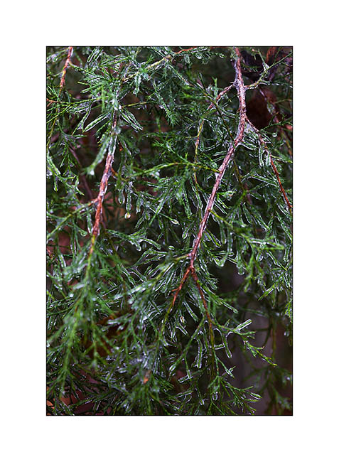
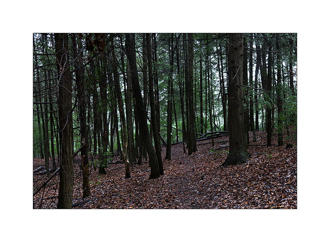
7) Pine forest Under the rain…
The fall jumps a high oberhanging cliff about 200 yards long. Athmosphere was really wild, with rain and fog, and a deafening noise, reinforced by the echo of the cliff as I approached the falls.
8) The overhanging cliff…
9) Discover of these amaising falls
10) Details…
11) Northrup Falls
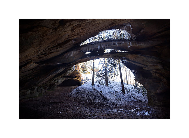
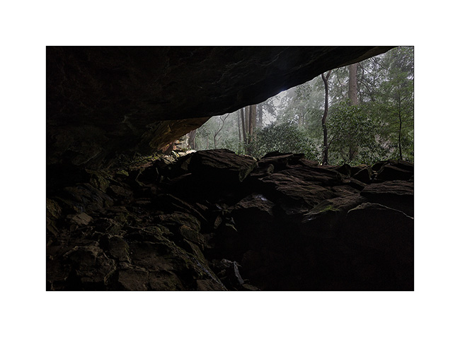
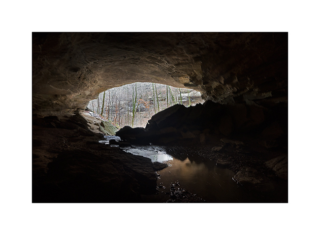
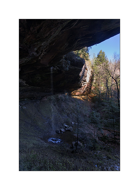
The rain still heavy, I went to visit the Bunkum Cave, not very far away.
12) Nice last fall colors in this wet forest
13) Entry of the cave, with the surprise to discover that a small river is coming out of it…
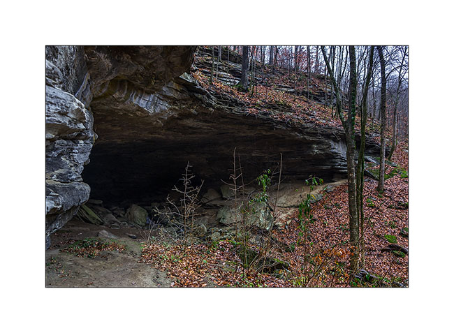
14) Exploring the cave is forbidden to protect endemic bats from a parasite killing them. So I couldn’t venture beyond daylight…
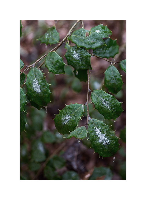
15) Holly…
There are still some pictures of my discovery of the North Tennessee to come soon…
Great week to all! 😀
Tennesse again (2)
Still waiting for VivaLaVida’s new title, I get to Tennesse again since last Saturday. I found there the winter with low temps and some snow, the first one for VivaLaVida! 🙂
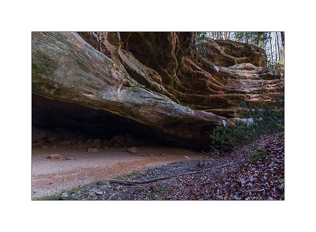
this time, I’m visiting the Big South Fork, North-East of the state. they are several natural arches and bridges I wanted to discover…
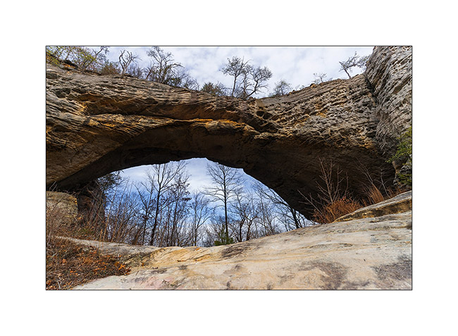
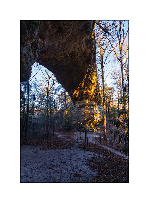
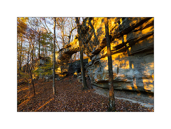
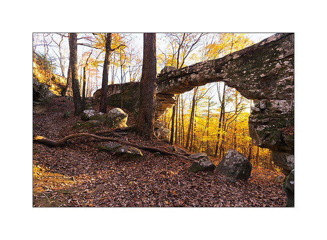
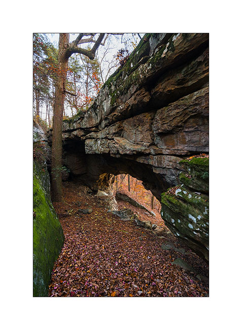
the first I visited were Twin Arches, two arches only about hundred yards one from the other on the same ridge, easy to access by a nice forest road. the morining I was there and even it doesn’t seem on the pictures, temp was 16°..!
1) The South arch, the largest one : about 95 feets high and 135 wide.
2) The North arch is smaller but thiner.
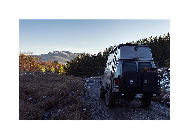
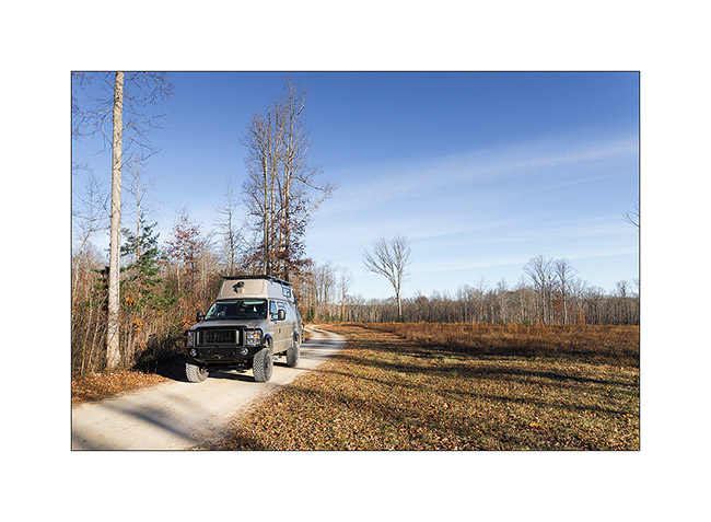
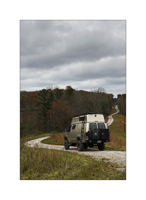
3) VivaLaVida on nice forest roads…
then I followed the trail to the Slave Falls, thin waterfall jumbing from a overhanging cliff.
4) Slave Falls
5) Further on the same trail, the very elegant Needle Arch.
On the way back, I discussed with a ranger – the only person I saw during three days- and he adviced me two other arches in the area, one over. The first one is just called Natural Bridge and is very thin in the middle. I had to climb a little to go down to it.
6) Natural Bridge
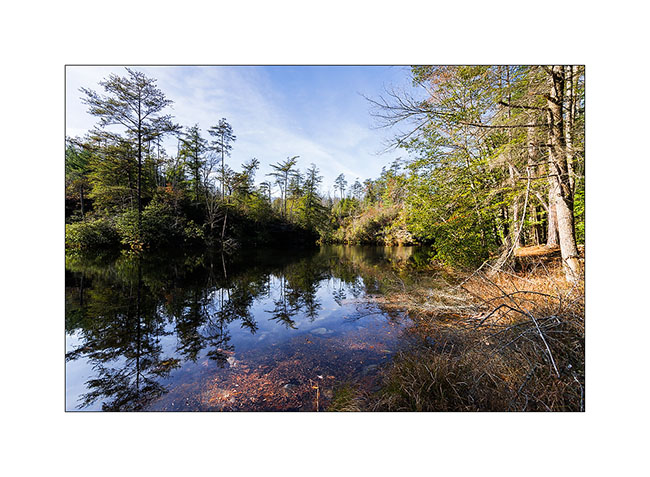
The seconde one is over the Picket Lake. Not easy to find a nice spot to shoot it without walking in the watter, what I refused to do since the cold temp, 26° at that time. 😉
6) Picket Arch
7) Nice Picket Lake…
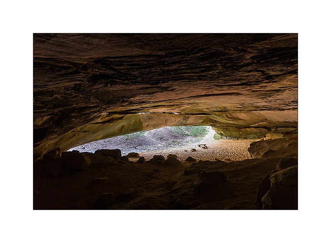
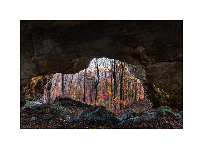
8) The next morning, I drove another nice forest road, about 28 miles long, to visit a cave used long time ago par Indians Cherokee.
9) Entry of the cave
10) New arch in formation over the entry
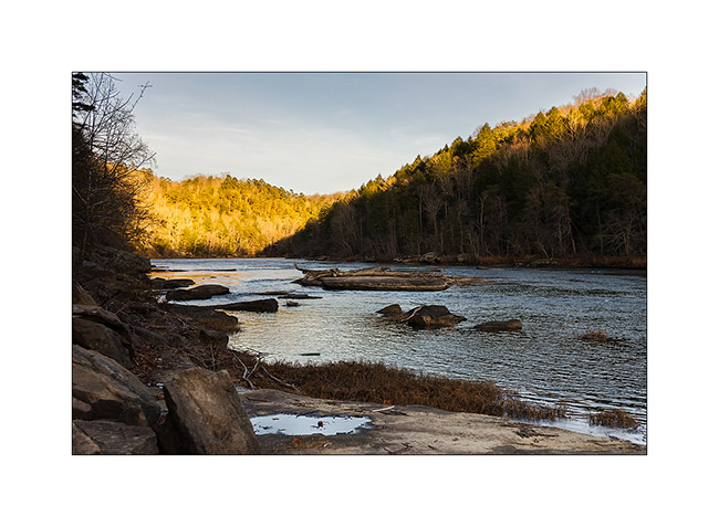
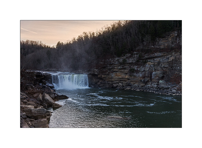
Some road again to the Knetucky to visite the Cumberland Falls, known as the most powerful waterfalls of North-East America excepted Niagara .
11) Arrival at Sunset, a little too late for the right light…
12) The Cumberland River jumps 120 feets , making a permanent water cloud…
13) Grass…
14) Sunset on the Cumberland River
Following of these Tennessee discovery soon… 😉
Happy Thanks Giving to all ! 😀
Tennesse (2)
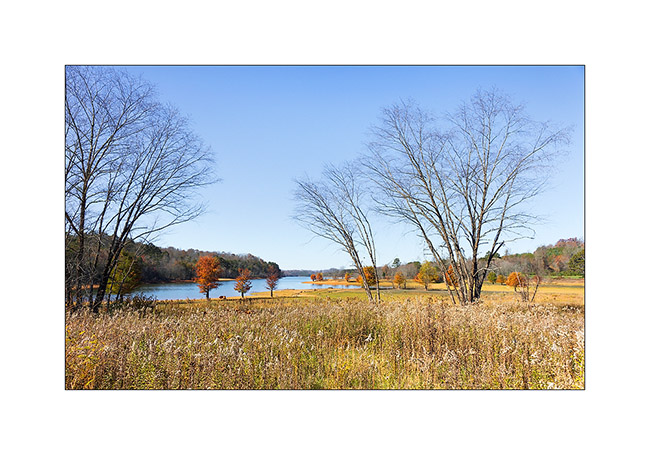
Here is the continuation of my first visit to Tennessee. On the way back, I made a quick stop to meet Eric, the owner of a van and member of the Sportsmobile forum. We ate together at Maryville and he told me about a few places worth to visit. So I went to sleep in the wetlands of the Little Tennessee River, meadows and swamps in which the small Tennessee River meander…
1) Twilight…
2) Going up the Citico River…
3) Morning atmosphere…
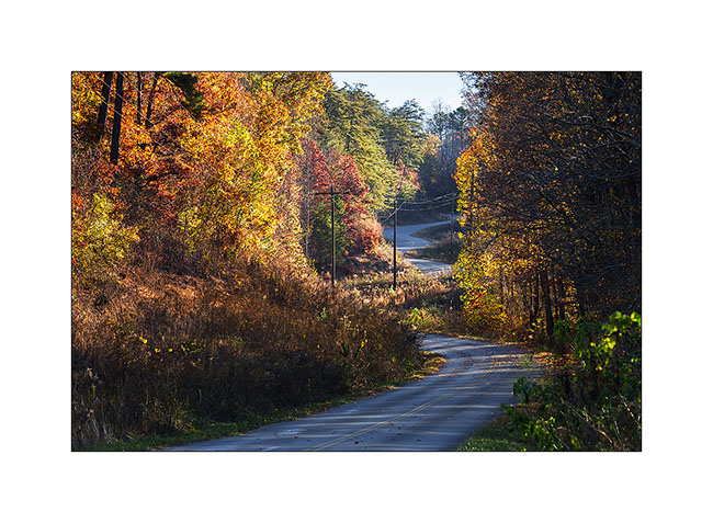
4) Small country road…
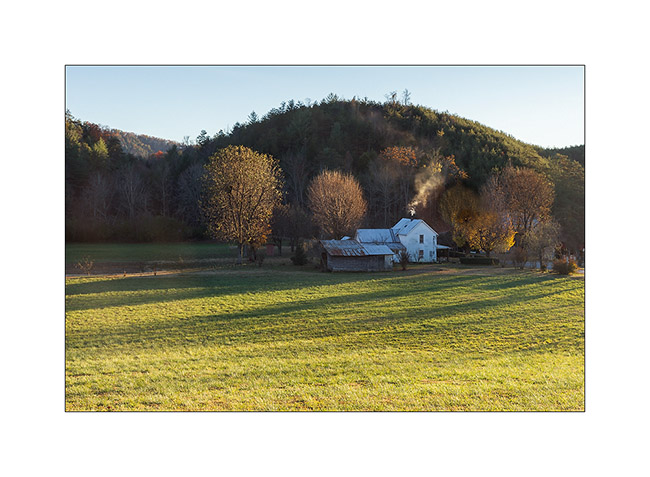
5) Typical house…
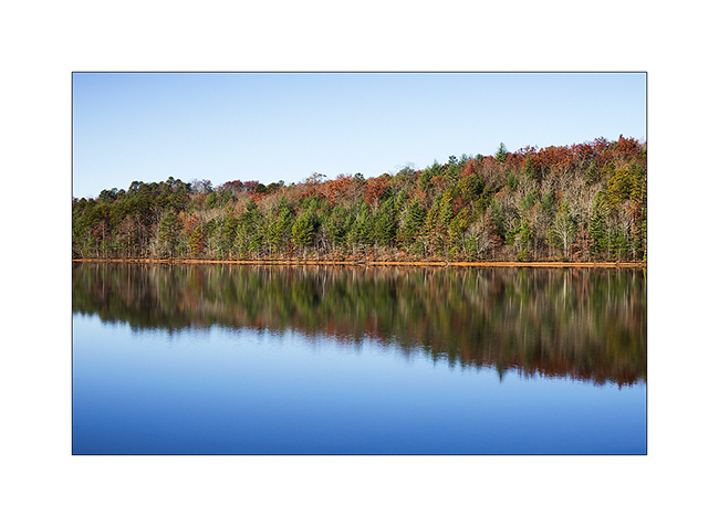
6) Reflections…
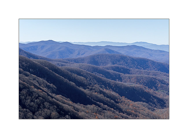
7) Approaching the Skyway…

The Skyway is a kind of Blue Ridge Parkway, a scenic route traced on the ridges, connecting Tennessee to North Carolina. Better than Highway 40 to return to Fletcher! 😉
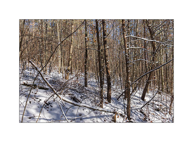
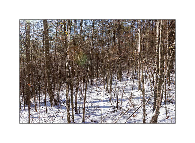
Tree leaves are now almost fell, the atmosphere is different, more austere…
8) Last colors…
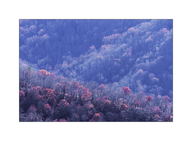
9) Vegetal waves…
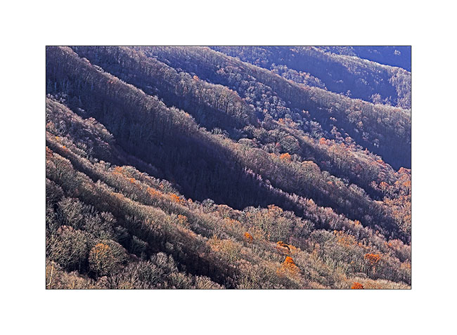
10) This gorgious forest, everywhere…

11) South Appalachian
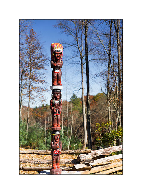
12) In this Cherokee territory, I saw several totems…
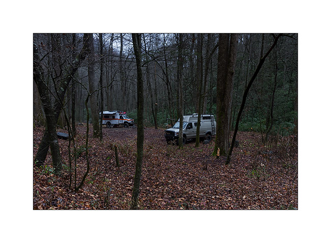
Back to North Carolina, Justin and Heather met me in the forest for a rainy camping week-end…
13) Forest camp…
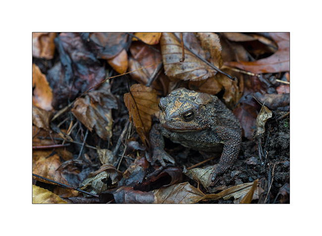
14) In the morning, looking for wood, I saw him looking at me…
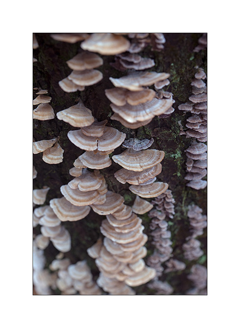
15) Fungus (1)

16) Fungus (2)
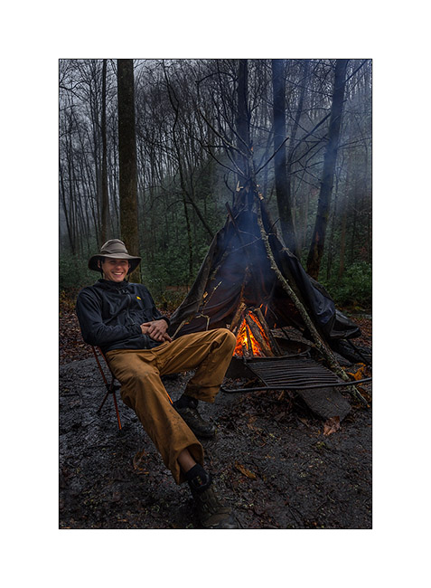
And finally, Justin posing in front of our protective fire teepee (it was raining so much!). Done with a few branches and an old air mattress found in the river … On this last image for today, Justin poses casual while raining verses! 😀
17) Justin and the fire teepee!
That’s it for today. To be followed with a new trip to Tennessee in a few days… 😉
Hello Tennessee!
As anounced, here is a short return about my last week in Tennessee. I went there to discover two nice natural bridges and two spectacular waterfalls, quite different from the preceding ones, you will see…
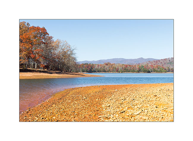
To go there, I drove through extreme western North Carolina and stopped at Catochee Lake, so nice with the last fall colors…
1. Arrival at Catochee Lake…
2. … Nobody there in this season…
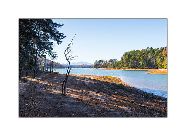
3. … and nice fall colors.
I drove further and arrived late in the night at my camp to be on site for the sunrise on the Sewanee Natural Bridge.
4. To go under the bridge, no other way than crossing it. I say hello, can you see me..?! 😉
5. Sewanee Natural Bridge (1)
6. Sewanee Natural Bridge (2) : what a wonderful natural bridge!
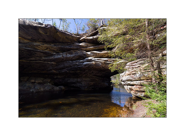
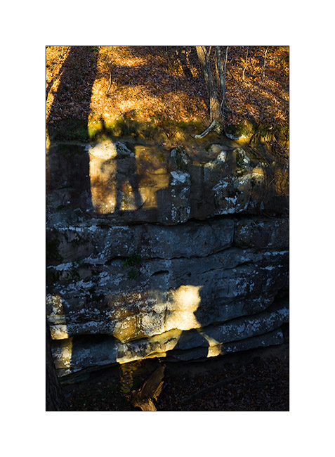
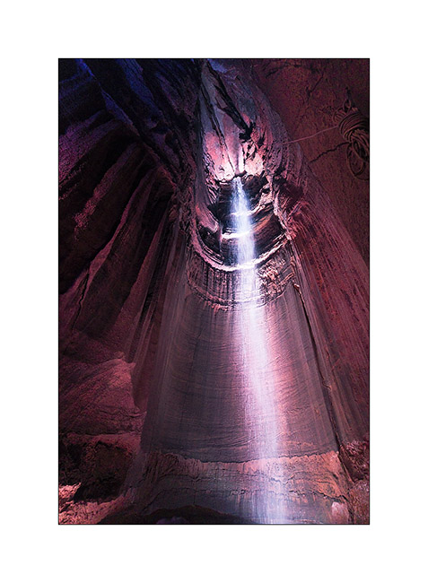
Then on the way to the second natural bridge, I made the tourist and stopped at the Ruby Falls. This waterfall is in a cave and is 145 feets high! Rare and spectacular at about 1’000 feets under the mountain. It was discovered in 1926 and open to the public in 1936 after a 29 stages elevator was built.
7. Ruby Falls
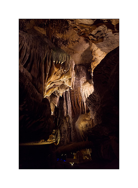
8. The cave we go through tout access to the falls have nice formations.
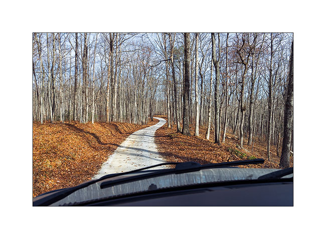
Then I drove again to go discover the Craw Creek Natural Bridge. It wasn’t easy to find an access, the forest road I noticed on my map was closed by a gate. The 10 miles forest road I drove was washed out by thunderstorms in some places but it’s not a problem with VivaLaVida.
9. Forest roads…
I finally started late for the 2:30 hours hike to go to the bridge. I arrived there as the sun was just disapearing. Light was then difficult…
10. Arrival under the bridge in a steep slope… Rather impressive like that, isn’t it?!
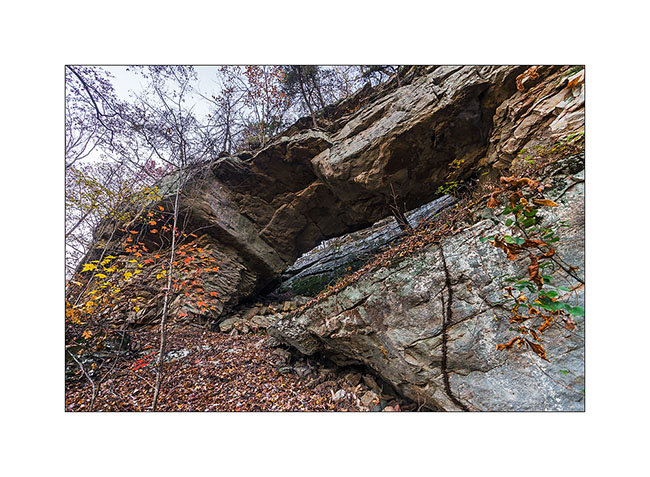
11. Just under tons of rock…
12. A more standard picture taken in very low light.
The hike back was quite unusual, in the night with the only light of my flashlight, in a roaring forest by the strong wind and a temperature of about 40 degrees. I saw my first rattlesnake, dark brown and about three feets long, which desappear when I walked. I was surprised to see one with such low temp.
Another funny story, I saw pairs of small bright spots in the beam of my flashlight, sometimes ten at a time. As I approached to see what it was, I found that it was reflection of my light in the eyes of small spiders that live in dead leaves. I had the impression of being watched from all sides! 😉
But I found back VivaLaVida safely at around 20:30, not without having to use my GPS to find two directions not so easy to find in the dark forest at night ..! I slept there with the feeling of being away from all…
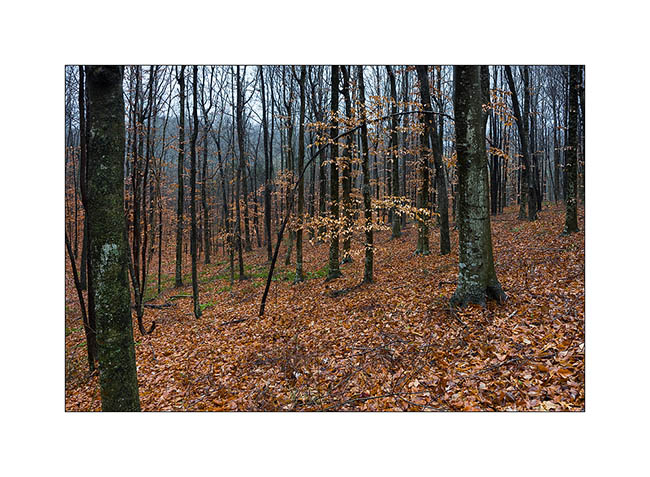
Wake up in the rain and cold with a very low ceiling of clouds … But VivalaVida doesn’t care of that, it led me to a beautiful waterfall by small “dirt roads” found on great topographical maps that the GAIA apps allows me to download (I’m not doing advertising but it is really great!).
13. Dirt roads…
And guess why I went to see the waterfall in particular? … Can you not find it? 😀
It is called “Pinot Falls”! Yeah Caro, I do not know if you have ancestors in Tennessee … 😉
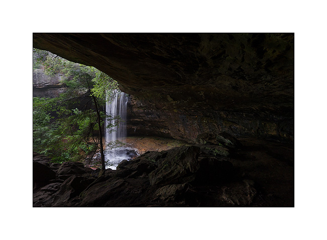
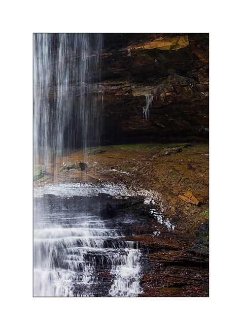
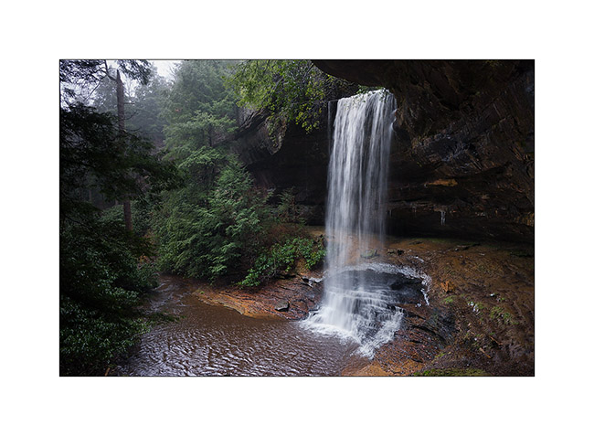
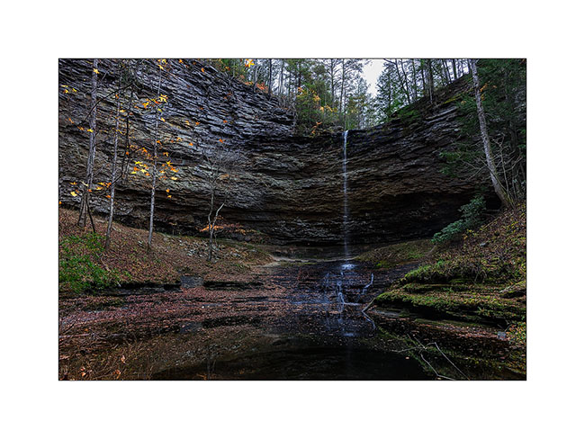
This waterfall is beautiful, nestled at the bottom of a deep ravine, at the end of a steep and really wild trail, jumping off a semicircle cliff. The rain hadn’t left me, so the light was really not optimal but it’s the vagaries of traveling photographer …
14. Arrival at “Pinot Falls”
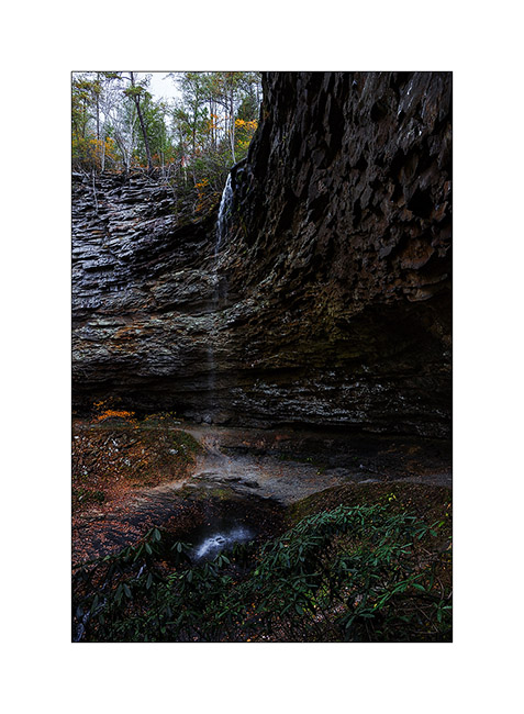
15. Semicircle view…
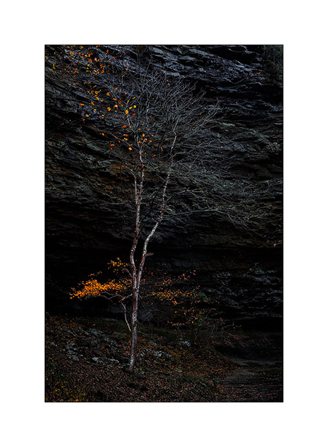
16. Last fall leaves against the cliff…
I will present the second part of that Tennessee trip in my next article… 😀
 D5 Creation